MyTopo
Willow Creek Dam SW Montana US Topo Map
Couldn't load pickup availability
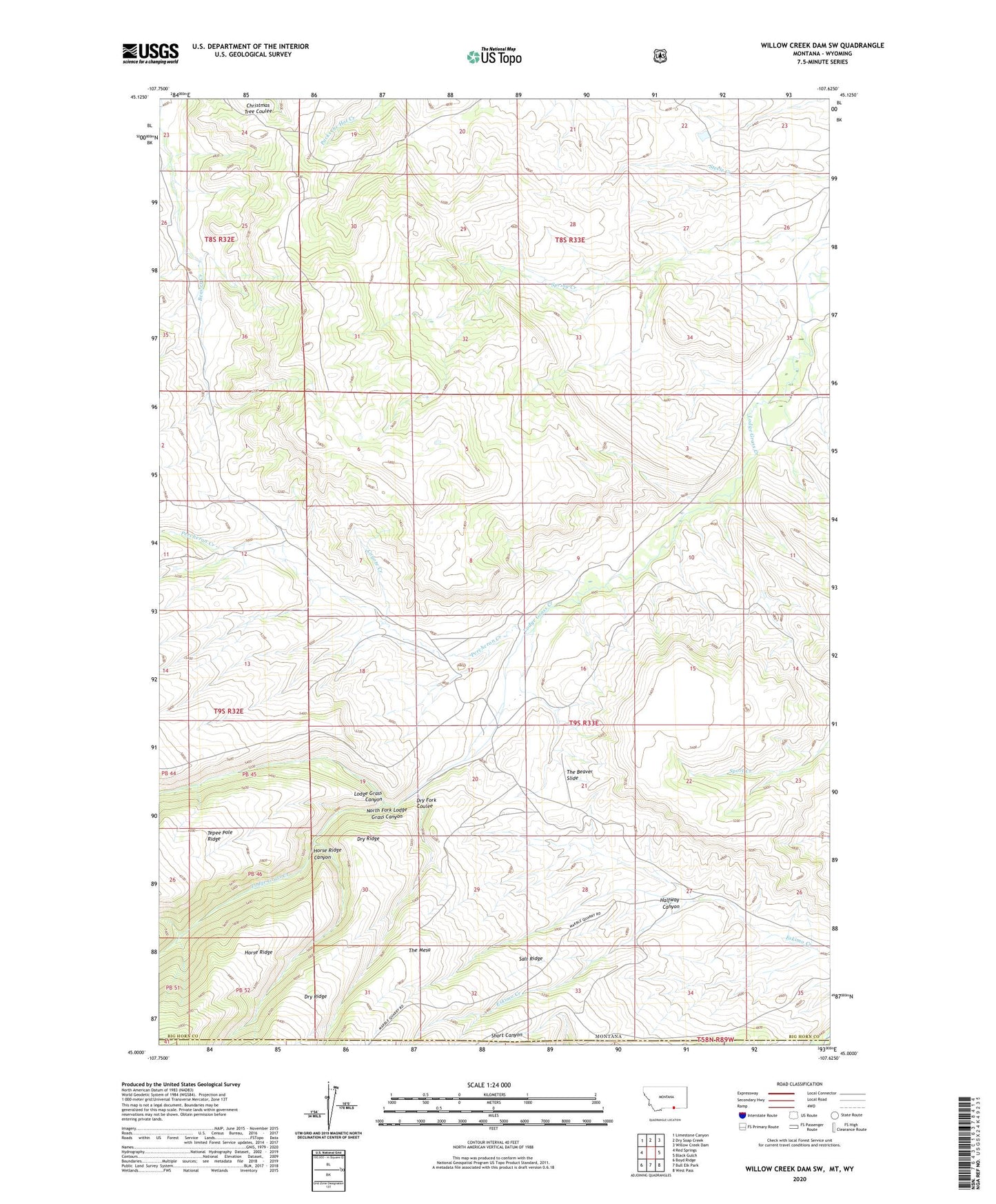
2020 topographic map quadrangle Willow Creek Dam SW in the state of Montana. Scale: 1:24000. Based on the newly updated USGS 7.5' US Topo map series, this map is in the following counties: Big Horn, Sheridan. The map contains contour data, water features, and other items you are used to seeing on USGS maps, but also has updated roads and other features. This is the next generation of topographic maps. Printed on high-quality waterproof paper with UV fade-resistant inks.
Quads adjacent to this one:
West: Red Springs
Northwest: Limestone Canyon
North: Dry Soap Creek
Northeast: Willow Creek Dam
East: Black Gulch
Southeast: West Pass
South: Bull Elk Park
Southwest: Boyd Ridge
Contains the following named places: Buck Creek, Coyote Creek, Dry Fork Coulee, Halfway Canyon, Horse Ridge Canyon, Lodge Grass Canyon, North Fork Lodge Grass Canyon, Percheron Creek, Rim Rock School, Salt Ridge, The Beaver Slide, The Mesa, West Fork Little Bighorn River