MyTopo
Black Gulch Montana US Topo Map
Couldn't load pickup availability
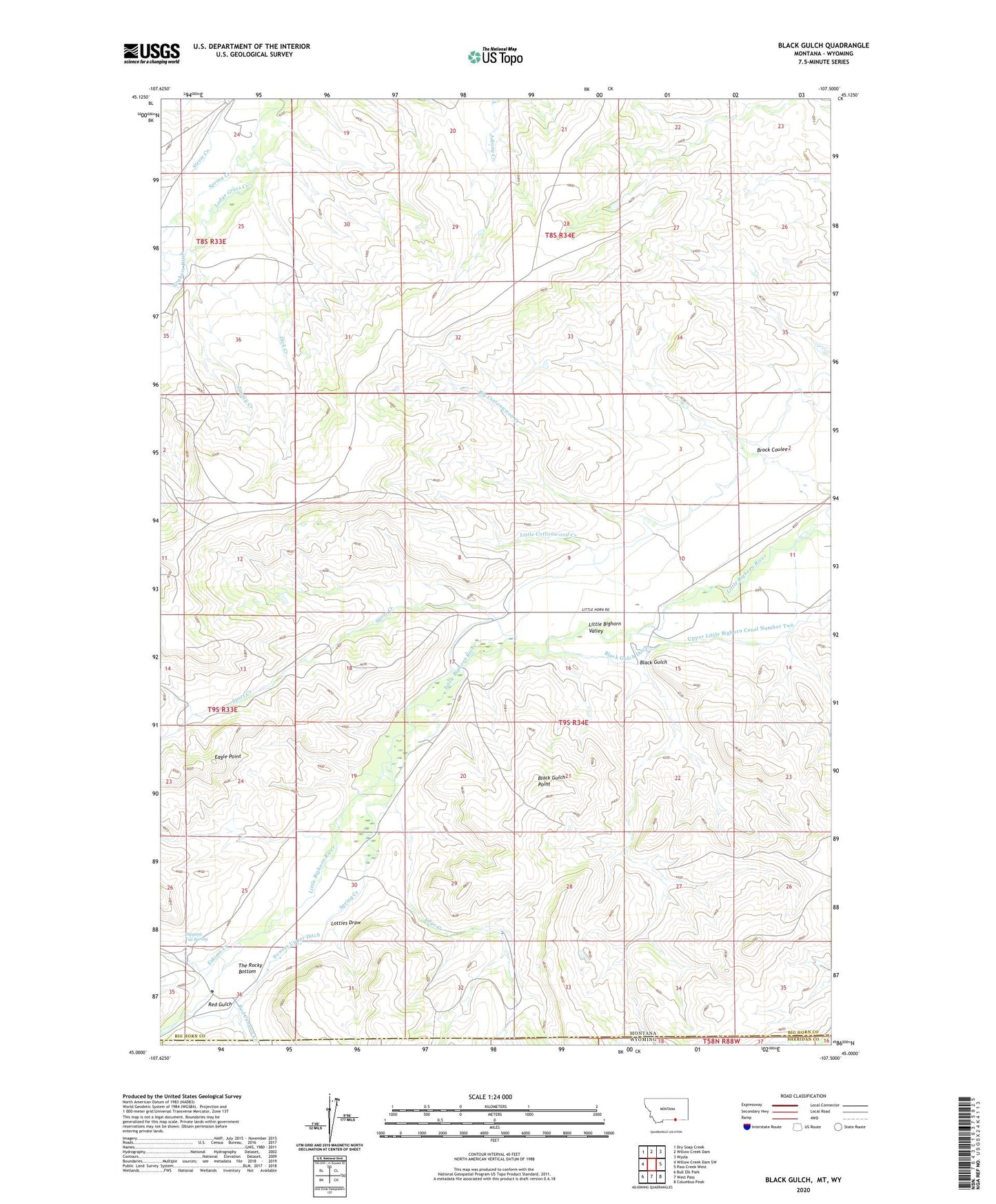
2024 topographic map quadrangle Black Gulch in the state of Montana. Scale: 1:24000. Based on the newly updated USGS 7.5' US Topo map series, this map is in the following counties: Big Horn, Sheridan. The map contains contour data, water features, and other items you are used to seeing on USGS maps, but also has updated roads and other features. This is the next generation of topographic maps. Printed on high-quality waterproof paper with UV fade-resistant inks.
Quads adjacent to this one:
West: Willow Creek Dam SW
Northwest: Dry Soap Creek
North: Willow Creek Dam
Northeast: Wyola
East: Pass Creek West
Southeast: Columbus Peak
South: West Pass
Southwest: Bull Elk Park
Contains the following named places: Big Cottonwood Creek, Black Gulch, Black Gulch Ditch, Black Gulch Point, Brock Coulee, Dick Creek, Dipping Vat Spring, Eagle Point, Edge Creek, Eskimo Creek, Graham Ditch, Jimmy Creek, Little Cottonwood Creek, Little Horn School, Lotties Draw, Powers School, Powers Upper Ditch, Red Canyon Creek, Red Gulch, Sport Creek, Spring Creek, The Rocky Bottom