MyTopo
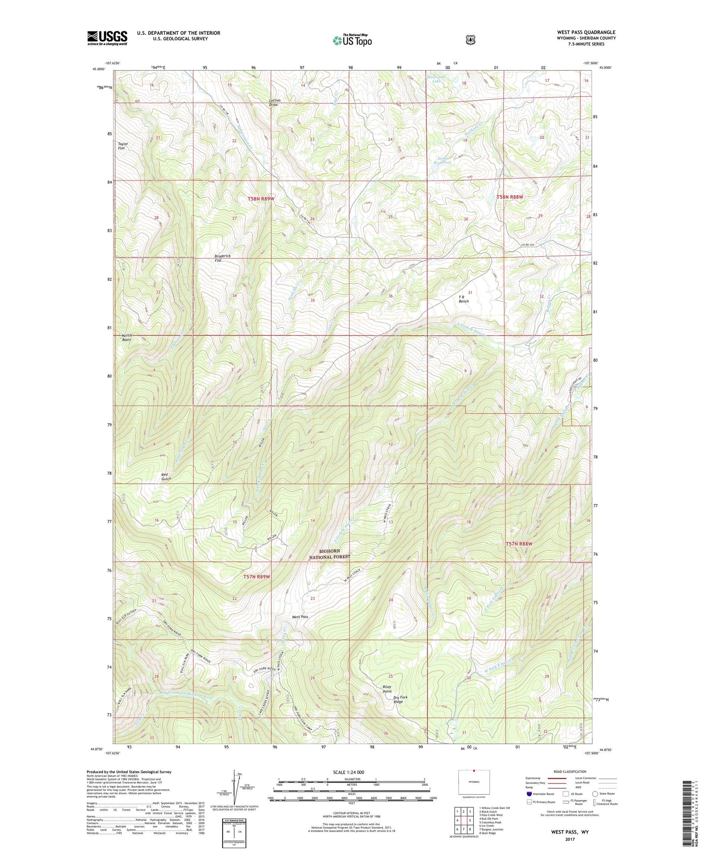
West Pass Wyoming US Topo Map
Couldn't load pickup availability
Also explore the West Pass Forest Service Topo of this same quad for updated USFS data
2021 topographic map quadrangle West Pass in the state of Wyoming. Scale: 1:24000. Based on the newly updated USGS 7.5' US Topo map series, this map is in the following counties: Sheridan. The map contains contour data, water features, and other items you are used to seeing on USGS maps, but also has updated roads and other features. This is the next generation of topographic maps. Printed on high-quality waterproof paper with UV fade-resistant inks.
Quads adjacent to this one:
West: Bull Elk Park
Northwest: Willow Creek Dam SW
North: Black Gulch
Northeast: Pass Creek West
East: Columbus Peak
Southeast: Skull Ridge
South: Burgess Junction
Southwest: Ice Creek
This map covers the same area as the classic USGS quad with code o44107h5.
Contains the following named places: Broderick Flat, Dana Dam, Dana Reservoir, Dinwiddie Lake, East Fork Taffner Creek, Fuller Ranch, Keiwit Acme Ditch Reservoir Number 1, Kern Ranch, Kettle Basin, Kiewit Acme Ditch Number 1 Dam, Kiewit Herb Creek Number 1 Dam, Kiewit Herb Creek Reservoir Number 1, Kiewit Herbs Creek Number 2 Dam, Kiewit Herbs Creek Number 2 Reservoir, Kiewit Herbs Creek Number 3 Dam, Kiewit Herbs Creek Reservoir Number 3, Kiewit Stockade Creek Number 1 Dam, Kiewit Stockade Creek Reservoir Number 1, Lake Creek, Lick Creek, Miller Creek, North Fork West Pass Creek, Riley Point, Sheridan County Elk Winter Pasture, South Fork West Pass Creek, Stockade Creek, T R Bench, Taylor Flat, West Fork Taffner Creek, West Pass, X X Ranch, ZIP Code: 82838