MyTopo
Willow Creek Dam Montana US Topo Map
Couldn't load pickup availability
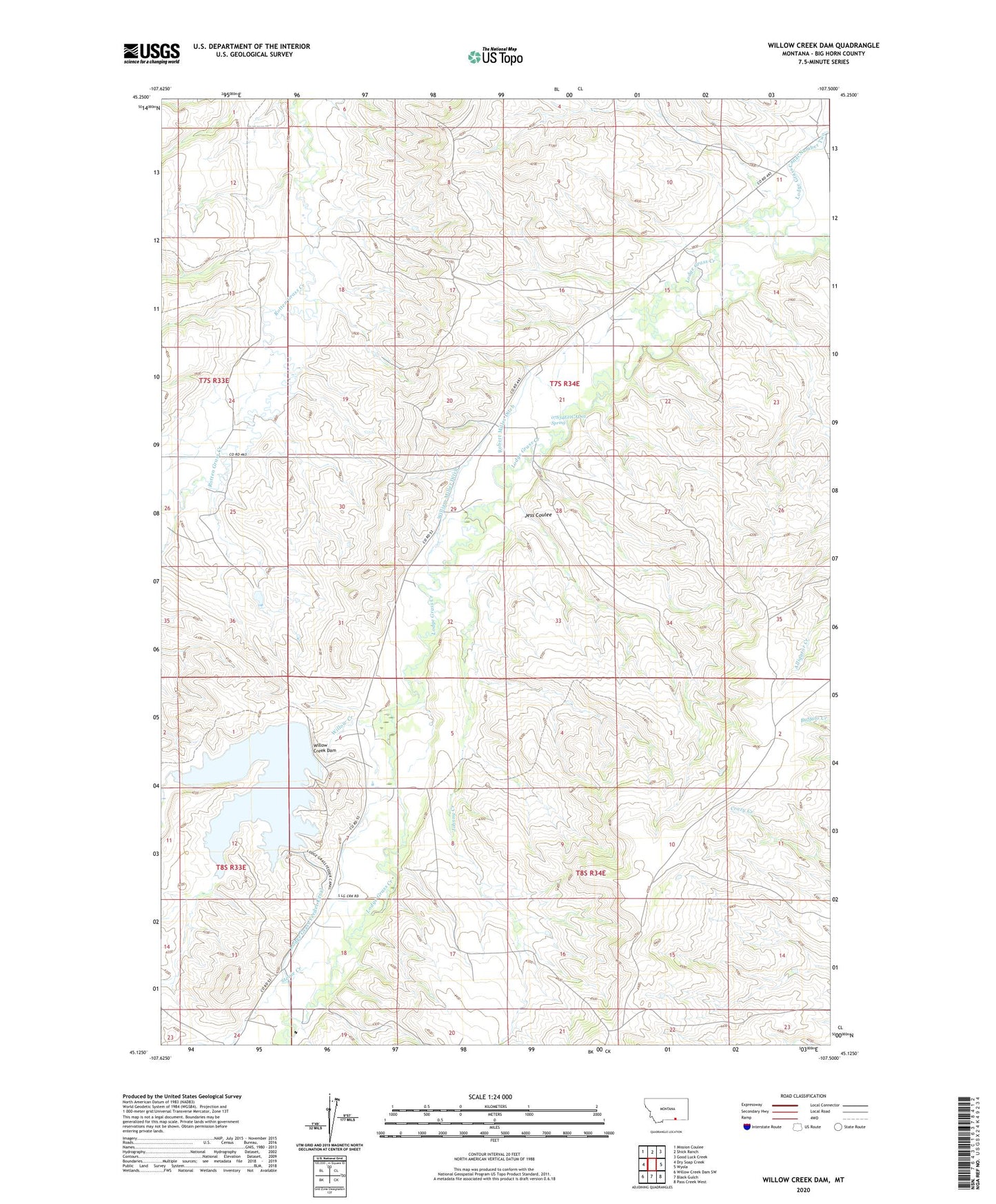
2020 topographic map quadrangle Willow Creek Dam in the state of Montana. Scale: 1:24000. Based on the newly updated USGS 7.5' US Topo map series, this map is in the following counties: Big Horn. The map contains contour data, water features, and other items you are used to seeing on USGS maps, but also has updated roads and other features. This is the next generation of topographic maps. Printed on high-quality waterproof paper with UV fade-resistant inks.
Quads adjacent to this one:
West: Dry Soap Creek
Northwest: Mission Coulee
North: Shick Ranch
Northeast: Good Luck Creek
East: Wyola
Southeast: Pass Creek West
South: Black Gulch
Southwest: Willow Creek Dam SW
Contains the following named places: 07S3411AADB01_ Well, 07S34E11CBDD01 Well, 07S34E15CBDA01 Well, 07S34E21CAD01_ Spring, 07S34E21CCDA01 Well, 07S34E29ADCB01 Well, 08S34E06ACDC01 Well, Jess Coulee, Johnny Creek, Lodge Grass Feeder Canal, Lodge Grass Storage Reservoir, Robert Miller Ditch, Stevie Creek, Upper Rotten Grass School, William Miller Ditch, Willow Creek, Willow Creek Dam