MyTopo
Willow Mountain Montana US Topo Map
Couldn't load pickup availability
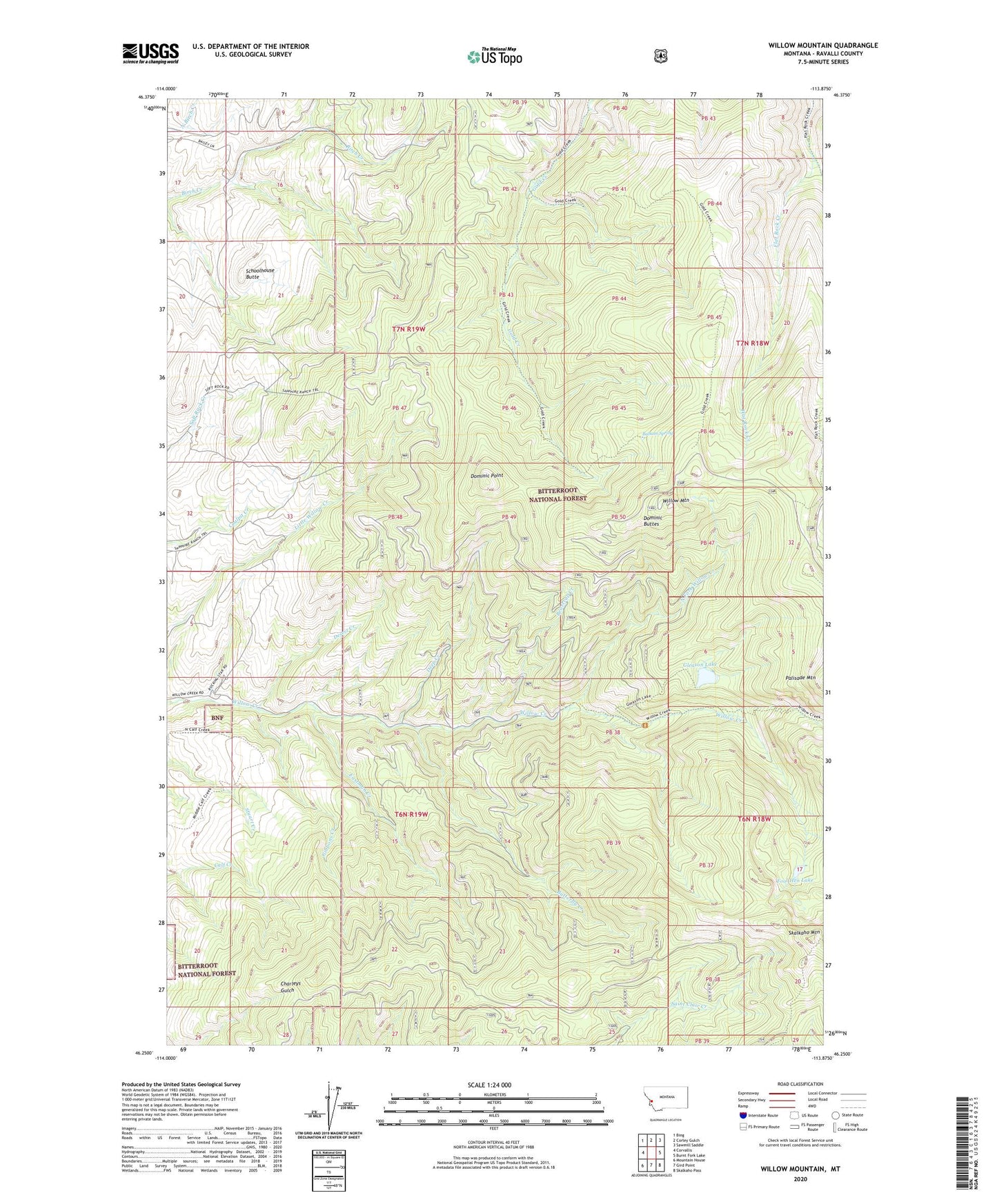
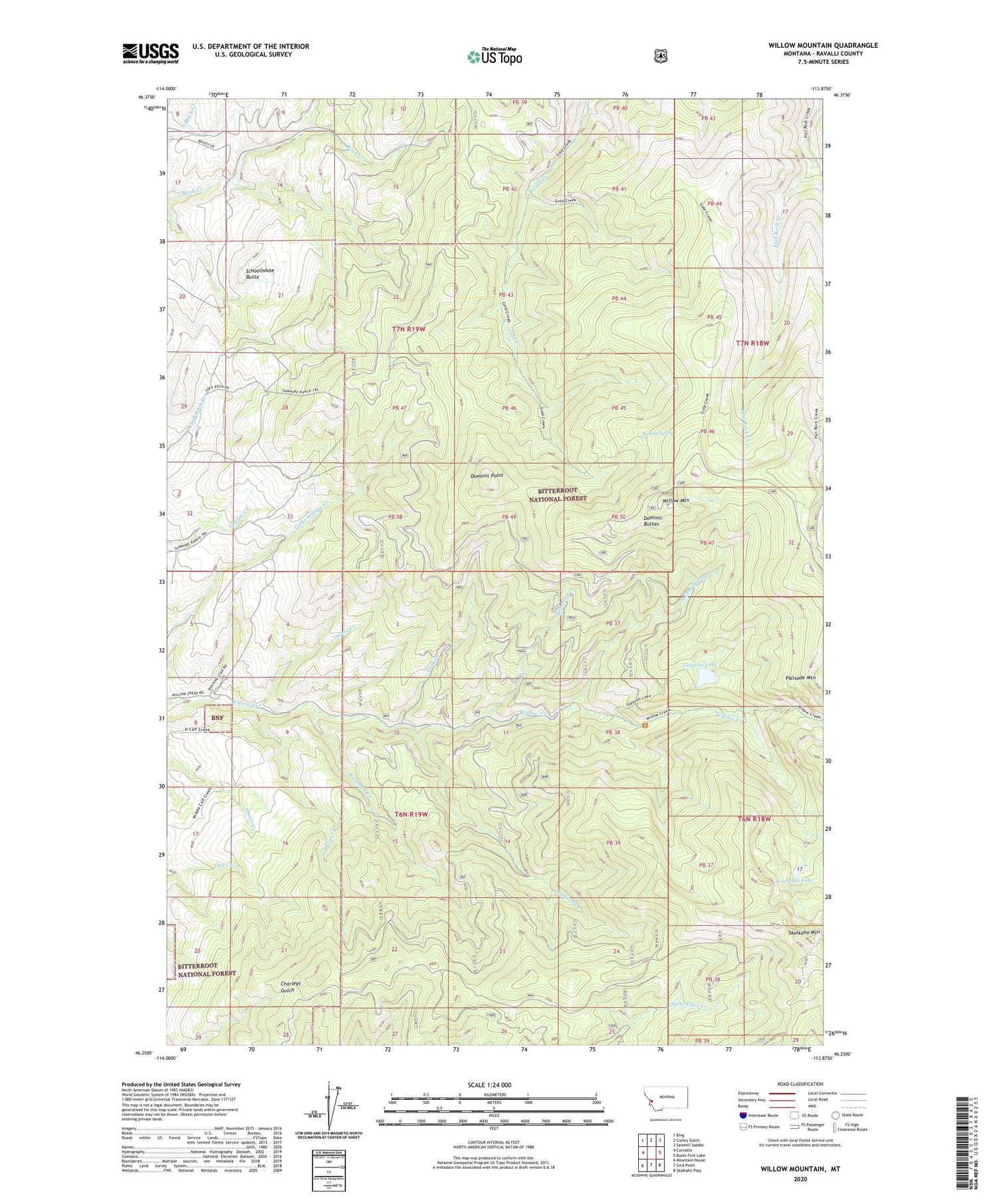
2020 topographic map quadrangle Willow Mountain in the state of Montana. Scale: 1:24000. Based on the newly updated USGS 7.5' US Topo map series, this map is in the following counties: Ravalli. The map contains contour data, water features, and other items you are used to seeing on USGS maps, but also has updated roads and other features. This is the next generation of topographic maps. Printed on high-quality waterproof paper with UV fade-resistant inks.
Quads adjacent to this one:
West: Corvallis
Northwest: Bing
North: Corley Gulch
Northeast: Sawmill Saddle
East: Burnt Fork Lake
Southeast: Skalkaho Pass
South: Gird Point
Southwest: Mountain House
Contains the following named places: Balsam Spring, Beartrap Creek, Bitterroot State Wildlife Management Area Calf Creek Segment, Butterfly Creek, Deep Creek, Desert Creek, Dominic Buttes, Dominic Point, Eastman Creek, Fool Hen Lake, Gibbons Creek, Gleason Lake, Gleason Lake Dam, NE SE Section 26 Mine, North Fork Willow Creek, Schoolhouse Butte, Skalkaho Mountain, SW NW Section 16 Mine, Vermiculite Mine, Willow Mountain, ZIP Code: 59828