MyTopo
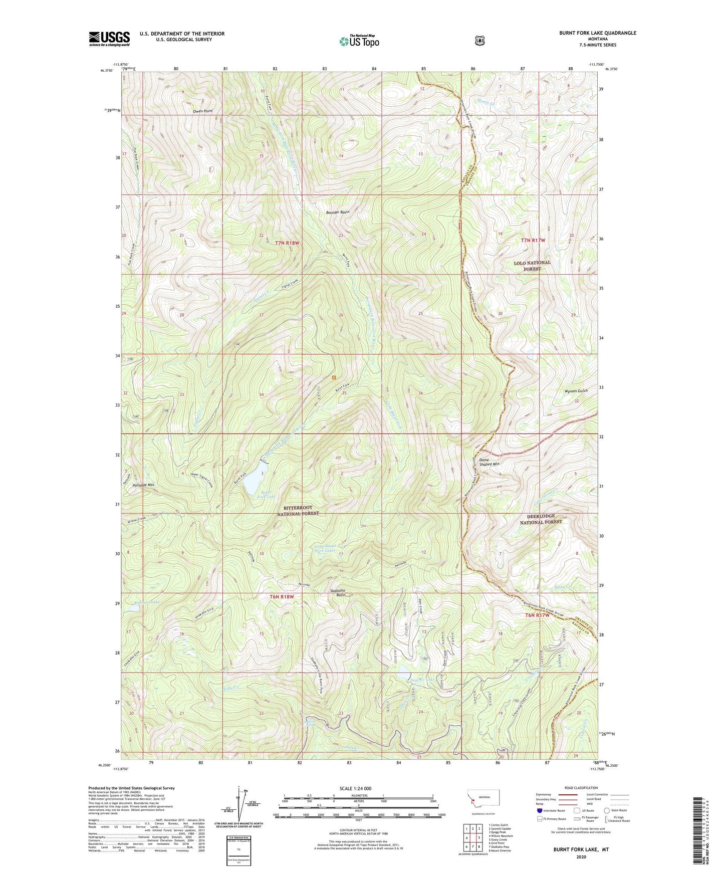
Burnt Fork Lake Montana US Topo Map
Couldn't load pickup availability
Also explore the Burnt Fork Lake Forest Service Topo of this same quad for updated USFS data
2024 topographic map quadrangle Burnt Fork Lake in the state of Montana. Scale: 1:24000. Based on the newly updated USGS 7.5' US Topo map series, this map is in the following counties: Ravalli, Granite. The map contains contour data, water features, and other items you are used to seeing on USGS maps, but also has updated roads and other features. This is the next generation of topographic maps. Printed on high-quality waterproof paper with UV fade-resistant inks.
Quads adjacent to this one:
West: Willow Mountain
Northwest: Corley Gulch
North: Sawmill Saddle
Northeast: Quigg Peak
East: Stony Creek
Southeast: Mount Emerine
South: Skalkaho Pass
Southwest: Gird Point
This map covers the same area as the classic USGS quad with code o46113c7.
Contains the following named places: Boulder Basin, Burnt Fork Dam, Burnt Fork Lake, Daly Lake Dam, Dam Creek, Dam Creek Lake, Dome Shaped Mountain, Falls Creek, Kneaves Lake, Little Burnt Fork, Little Burnt Fork Lakes, Moose Creek, Owen Point, Palisade Mountain, Signal Creek, Skalkaho Basin, Skalkaho Falls, Skalkaho Wildlife Management Area