MyTopo
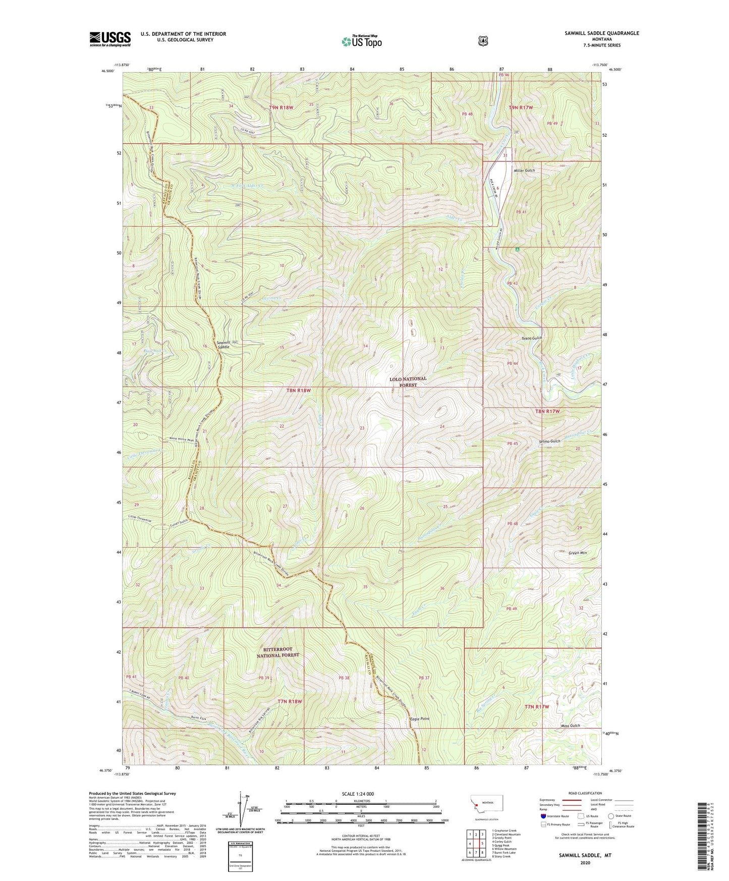
Sawmill Saddle Montana US Topo Map
Couldn't load pickup availability
Also explore the Sawmill Saddle Forest Service Topo of this same quad for updated USFS data
2024 topographic map quadrangle Sawmill Saddle in the state of Montana. Scale: 1:24000. Based on the newly updated USGS 7.5' US Topo map series, this map is in the following counties: Granite, Ravalli. The map contains contour data, water features, and other items you are used to seeing on USGS maps, but also has updated roads and other features. This is the next generation of topographic maps. Printed on high-quality waterproof paper with UV fade-resistant inks.
Quads adjacent to this one:
West: Corley Gulch
Northwest: Grayhorse Creek
North: Cleveland Mountain
Northeast: Grizzly Point
East: Quigg Peak
Southeast: Stony Creek
South: Burnt Fork Lake
Southwest: Willow Mountain
This map covers the same area as the classic USGS quad with code o46113d7.
Contains the following named places: Alder Creek, Arastra Creek, Bitterroot Flat Campground, Burnt Fork Campground, Chelan Creek, Cougar Creek, Eagle Point, Green Mountain, Lavina Creek, Little Hogback Creek, Miller Gulch, Sawmill Saddle, Selmo Gulch, Tekoa Gulch, West Fork Alder Creek