MyTopo
Windy Rock Montana US Topo Map
Couldn't load pickup availability
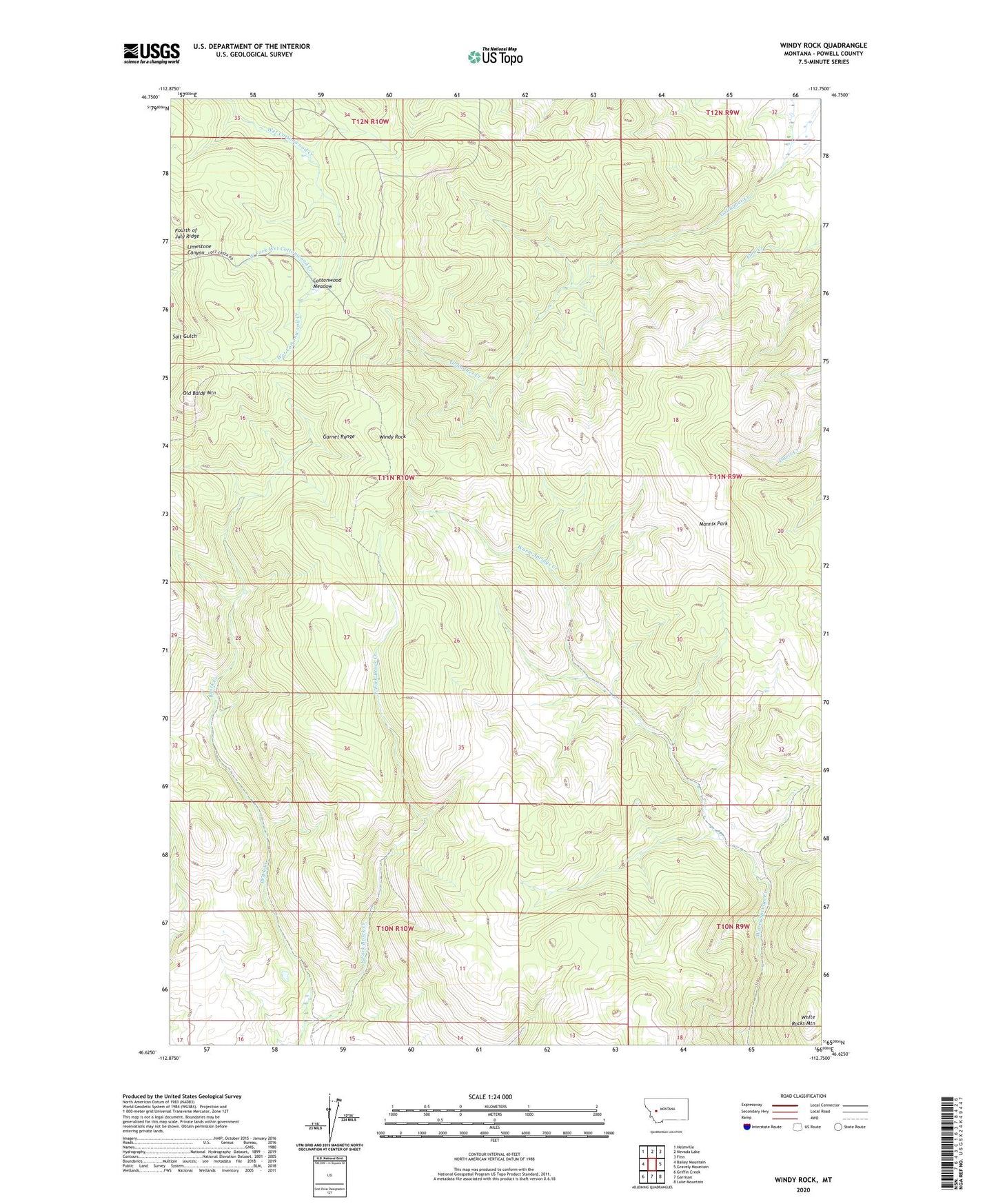
2020 topographic map quadrangle Windy Rock in the state of Montana. Scale: 1:24000. Based on the newly updated USGS 7.5' US Topo map series, this map is in the following counties: Powell. The map contains contour data, water features, and other items you are used to seeing on USGS maps, but also has updated roads and other features. This is the next generation of topographic maps. Printed on high-quality waterproof paper with UV fade-resistant inks.
Quads adjacent to this one:
West: Bailey Mountain
Northwest: Helmville
North: Nevada Lake
Northeast: Finn
East: Gravely Mountain
Southeast: Luke Mountain
South: Garrison
Southwest: Griffin Creek
Contains the following named places: 09N10W14CDCD01 Well, 09N10W16AADB01 Well, Anderson Mine, Cottonwood Meadow, East Fork Brock Creek, Mannix Park, NE NW Section 7 Mine, Old Baldy Mountain, Relyea Mine, Sharkeyville, Silver La Donna Mine, West Fork Wet Cottonwood Creek, White Rocks Mountain, Windy Rock