MyTopo
Luke Mountain Montana US Topo Map
Couldn't load pickup availability
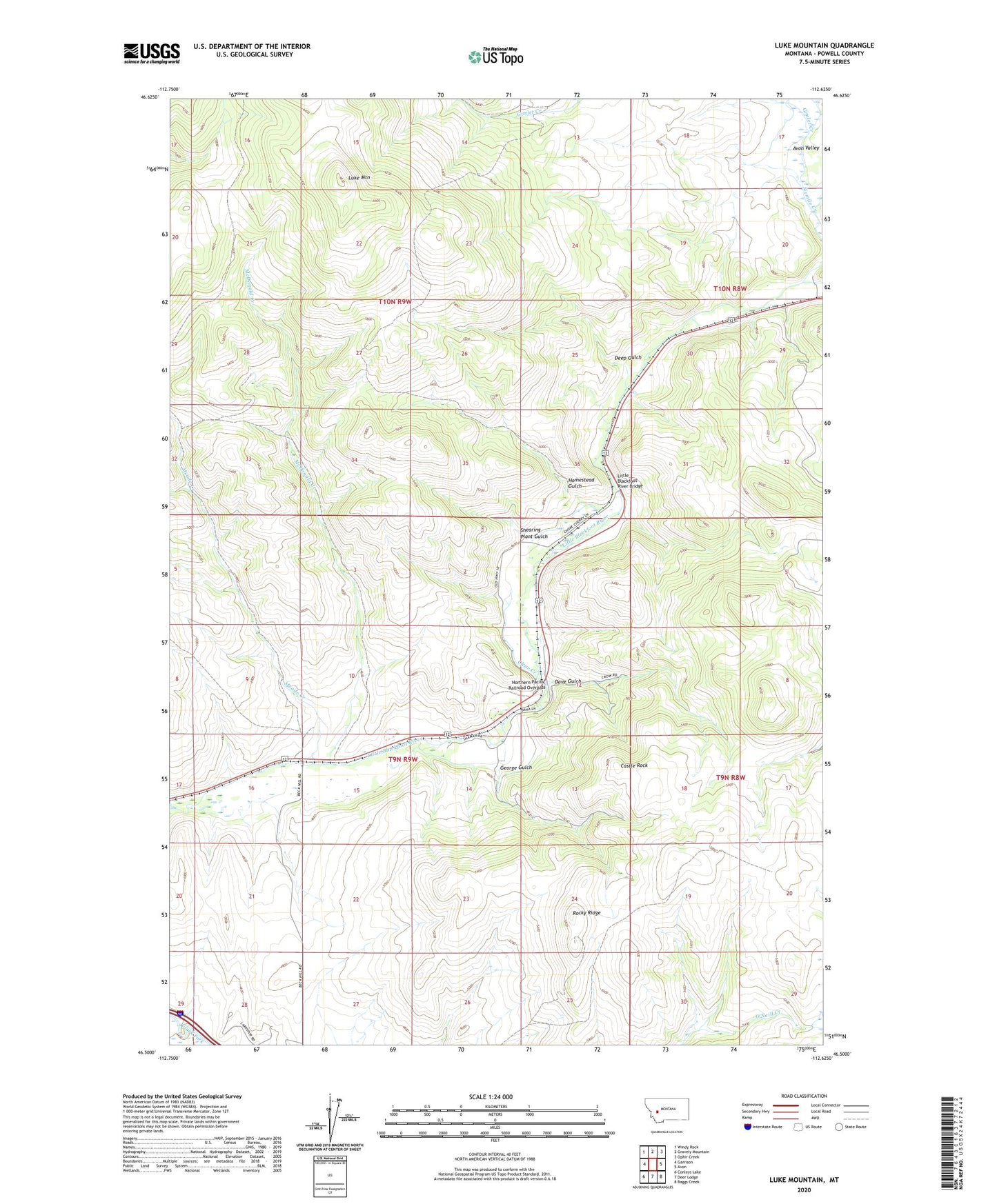
2024 topographic map quadrangle Luke Mountain in the state of Montana. Scale: 1:24000. Based on the newly updated USGS 7.5' US Topo map series, this map is in the following counties: Powell. The map contains contour data, water features, and other items you are used to seeing on USGS maps, but also has updated roads and other features. This is the next generation of topographic maps. Printed on high-quality waterproof paper with UV fade-resistant inks.
Quads adjacent to this one:
West: Garrison
Northwest: Windy Rock
North: Gravely Mountain
Northeast: Ophir Creek
East: Avon
Southeast: Baggs Creek
South: Deer Lodge
Southwest: Conleys Lake
This map covers the same area as the classic USGS quad with code o46112e6.
Contains the following named places: 09N09W01AABA01 Well, 09N09W28CABD01 Well, 09N09W28DCBB01 Well, 09N09W29AADD01 Well, 10N09W13BBCC01 Well, Avon Rest Area, Avon-Elliston Division, Bradley, Bradley School, Castle Rock, Clear Creek, Dave Gulch, Deep Gulch, George Gulch, Gimlet Creek, Homestead Gulch, Little Blackfoot River Bridge, Luke Mine, Luke Mountain, McDonald Creek, Meade Creek, Northern Pacific Railroad Overpass, Orwell, Rocky Ridge, Shearing Plant Gulch, Sixmile Creek, Tavenner Dam, Threemile Creek, Valley of a Thousand Haystacks Historical Marker