MyTopo
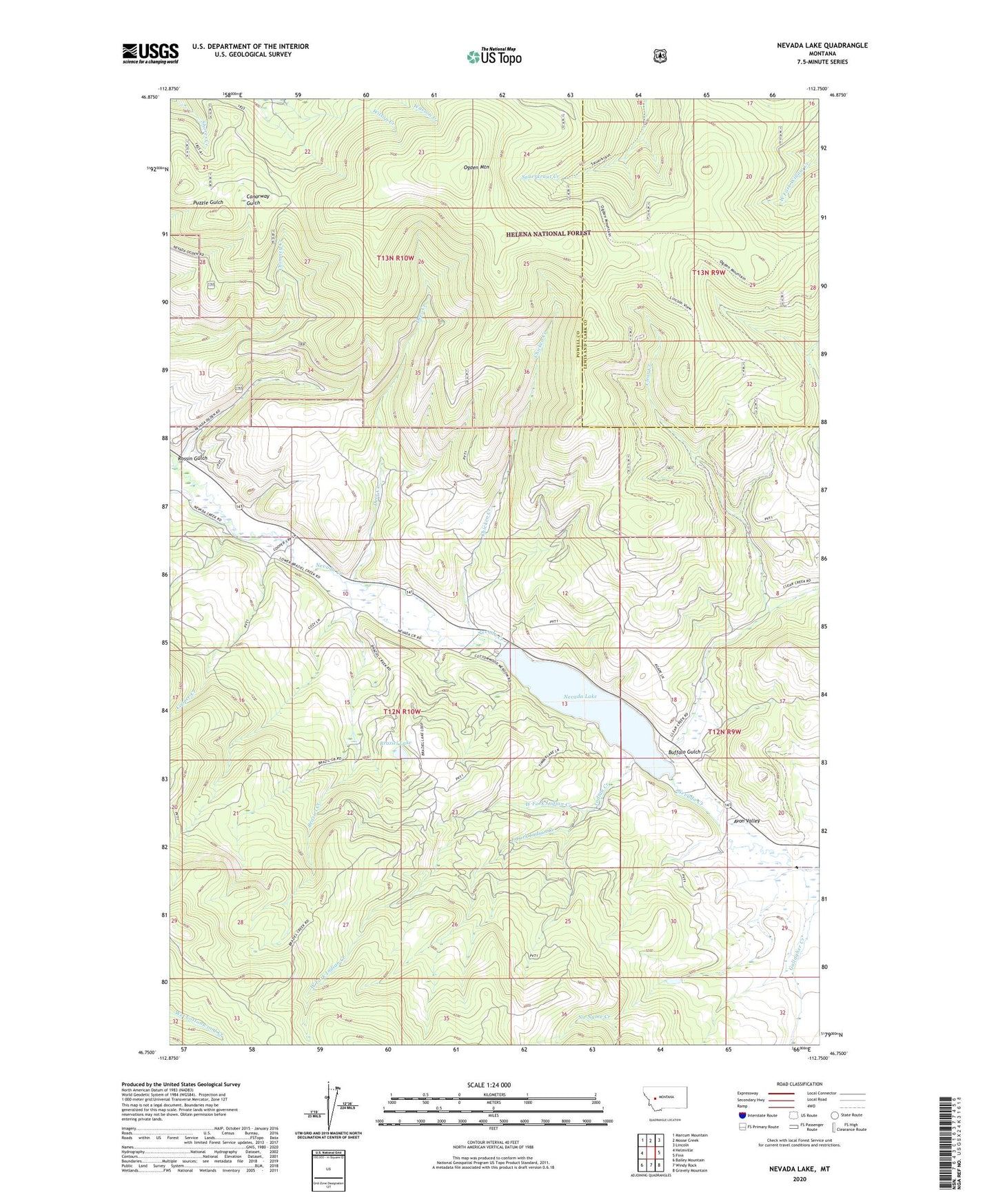
Nevada Lake Montana US Topo Map
Couldn't load pickup availability
Also explore the Nevada Lake Forest Service Topo of this same quad for updated USFS data
2024 topographic map quadrangle Nevada Lake in the state of Montana. Scale: 1:24000. Based on the newly updated USGS 7.5' US Topo map series, this map is in the following counties: Powell, Lewis and Clark. The map contains contour data, water features, and other items you are used to seeing on USGS maps, but also has updated roads and other features. This is the next generation of topographic maps. Printed on high-quality waterproof paper with UV fade-resistant inks.
Quads adjacent to this one:
West: Helmville
Northwest: Marcum Mountain
North: Moose Creek
Northeast: Lincoln
East: Finn
Southeast: Gravely Mountain
South: Windy Rock
Southwest: Bailey Mountain
This map covers the same area as the classic USGS quad with code o46112g7.
Contains the following named places: 12N10W10CAAA01 Well, Avon Valley, Blackfoot Mine, Braziel Creek, Braziel Lake, Buffalo Gulch, Chicken Creek, Clear Creek, Cooper Creek, Deer Creek, East Fork Indian Creek, Harrisburgh Post Office, Higgins Mine, Indian Creek, Isabel Post Office, Jefferson Gulch, Mannix, NE NW Section 21 Mine, Nevada Creek Dam, Nevada Lake, No Name Creek, Ogden Mountain, Rhea City, Rossin Gulch, SW NW Section 26 Mine, SW SE Section 24 Mine, West Fork Indian Creek