MyTopo
Worden Montana US Topo Map
Couldn't load pickup availability
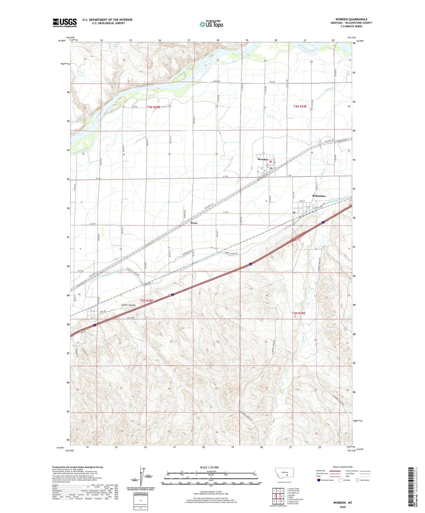
2020 topographic map quadrangle Worden in the state of Montana. Scale: 1:24000. Based on the newly updated USGS 7.5' US Topo map series, this map is in the following counties: Yellowstone. The map contains contour data, water features, and other items you are used to seeing on USGS maps, but also has updated roads and other features. This is the next generation of topographic maps. Printed on high-quality waterproof paper with UV fade-resistant inks.
Quads adjacent to this one:
West: Huntley
Northwest: Cotton Creek
North: P K Ranch SW
Northeast: P K Ranch SE
East: Nibbe
Southeast: Gails Coulee
South: Indian Arrow
Southwest: Cottonwood Creek
Contains the following named places: 02N28E01CDBA01 Well, 02N28E09DDBA01 Well, 02N28E09DDBD01 Well, 02N28E09DDCD01 Well, 02N28E22AACB01 Well, 03N28E33CADD01 Well, Ballantine, Ballantine Census Designated Place, Ballantine Post Office, Cabin Creek, Custer Coulee, Gritty Stone Fishing Access Site, Knox, Worden, Worden Ambulance, Worden Census Designated Place, Worden Post Office, Worden Volunteer Fire Department Station 1 Headquarters