MyTopo
Nibbe Montana US Topo Map
Couldn't load pickup availability
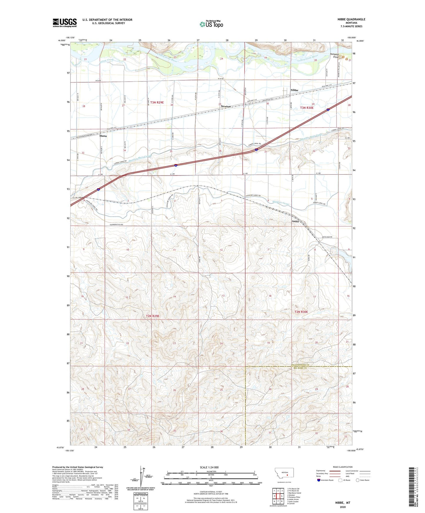
2024 topographic map quadrangle Nibbe in the state of Montana. Scale: 1:24000. Based on the newly updated USGS 7.5' US Topo map series, this map is in the following counties: Yellowstone, Big Horn. The map contains contour data, water features, and other items you are used to seeing on USGS maps, but also has updated roads and other features. This is the next generation of topographic maps. Printed on high-quality waterproof paper with UV fade-resistant inks.
Quads adjacent to this one:
West: Worden
Northwest: P K Ranch SW
North: P K Ranch SE
Northeast: Big Marys Island
East: Pompeys Pillar
Southeast: Corinth
South: Gails Coulee
Southwest: Indian Arrow
This map covers the same area as the classic USGS quad with code o45108h1.
Contains the following named places: 02N29E01DAAD01 Well, 02N29E04BADD01 Well, 03N29E34CCBC01 Well, 59006, Anita, Anita Dam, Anita Reservoir, Arrow Creek, Gravel Pit Coulee, Highline Canal, Huntley Main Canal, Mann, Newton, Nibbe, Nibbe Census Designated Place, Pompeys Pillar, Pompeys Pillar Creek, Pompeys Pillar Fishing Access Site, Pompeys Pillar National Monument, Voyagers Rest Fishing Access Site