MyTopo
Ainsworth SW Nebraska US Topo Map
Couldn't load pickup availability
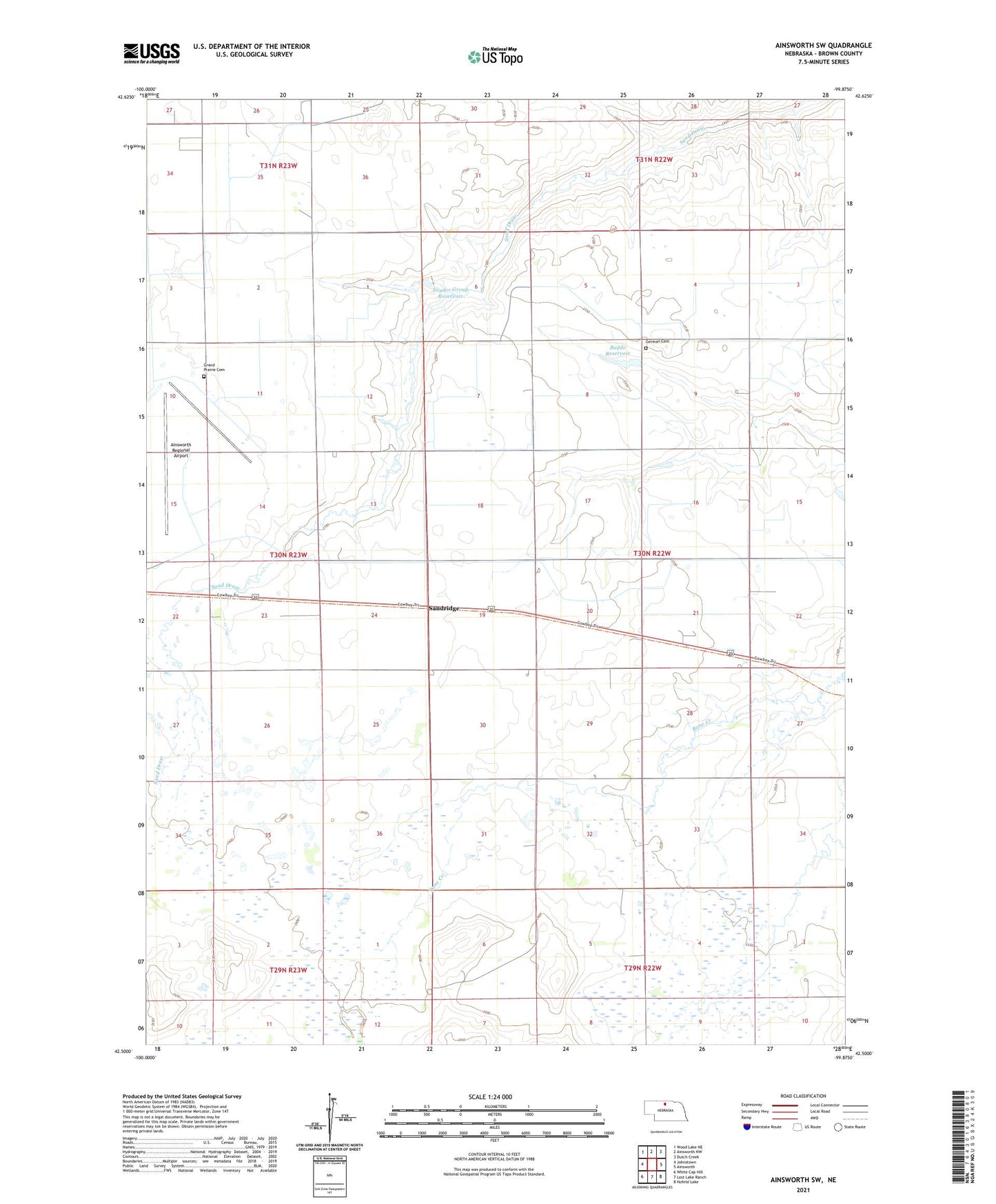
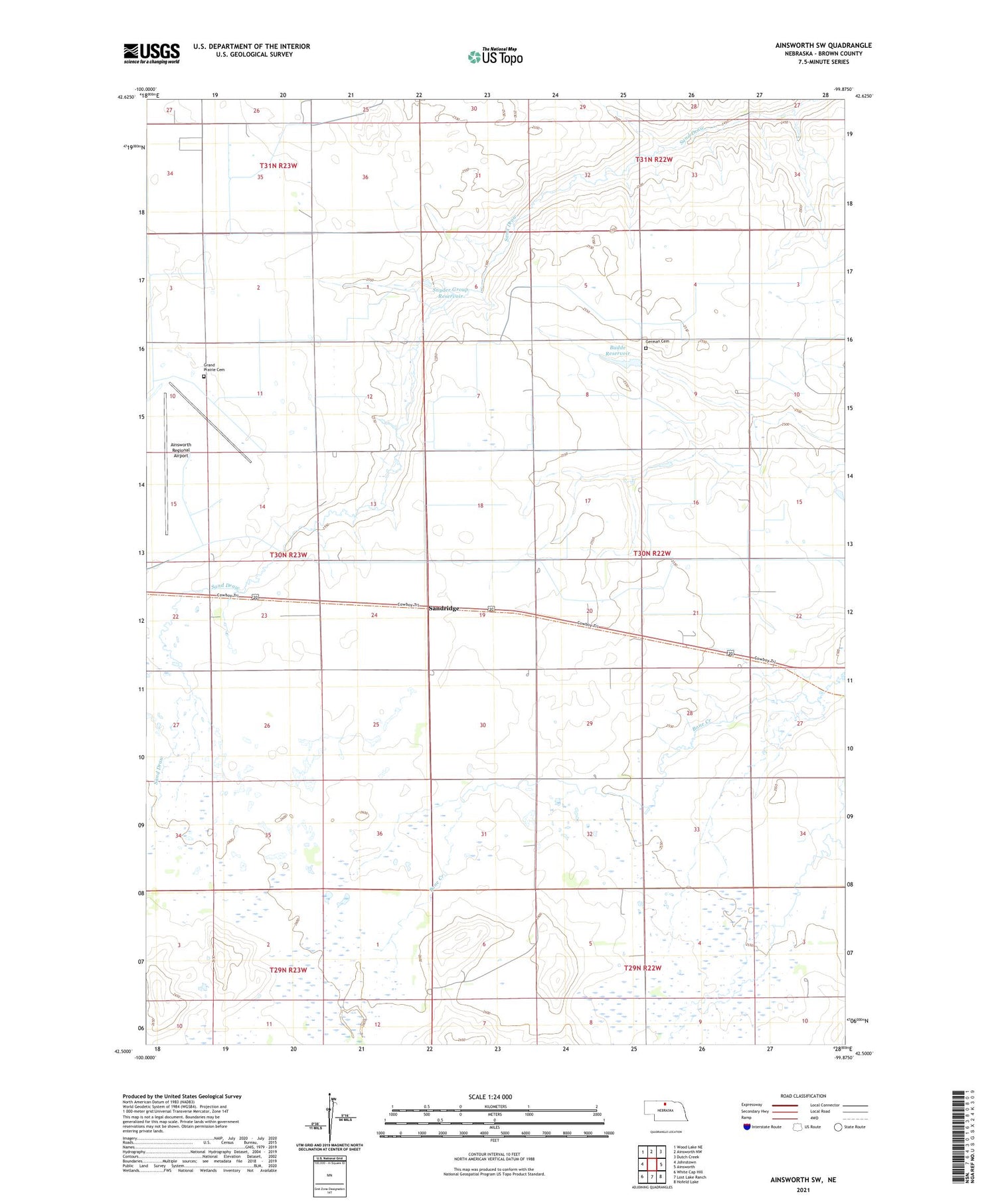
2021 topographic map quadrangle Ainsworth SW in the state of Nebraska. Scale: 1:24000. Based on the newly updated USGS 7.5' US Topo map series, this map is in the following counties: Brown. The map contains contour data, water features, and other items you are used to seeing on USGS maps, but also has updated roads and other features. This is the next generation of topographic maps. Printed on high-quality waterproof paper with UV fade-resistant inks.
Quads adjacent to this one:
West: Johnstown
Northwest: Wood Lake NE
North: Ainsworth NW
Northeast: Dutch Creek
East: Ainsworth
Southeast: Hofeld Lake
South: Lost Lake Ranch
Southwest: White Cap Hill
Contains the following named places: Ainsworth Army Air Field, Ainsworth Army Air Field Historical Marker, Ainsworth Municipal Golf Course, Bejot Feedlots, Budde and Brown County Detention Dam, Budde Reservoir, German Cemetery, Grand Prairie Cemetery, Sandridge, School Number 13, School Number 40, School Number 8, Snyder Group Dam, Snyder Group Reservoir, Westside Public School