MyTopo
Johnstown Nebraska US Topo Map
Couldn't load pickup availability
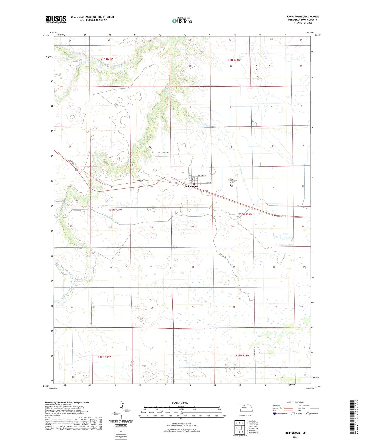
2021 topographic map quadrangle Johnstown in the state of Nebraska. Scale: 1:24000. Based on the newly updated USGS 7.5' US Topo map series, this map is in the following counties: Brown. The map contains contour data, water features, and other items you are used to seeing on USGS maps, but also has updated roads and other features. This is the next generation of topographic maps. Printed on high-quality waterproof paper with UV fade-resistant inks.
Quads adjacent to this one:
West: Brush Creek
Northwest: Wood Lake
North: Wood Lake NE
Northeast: Ainsworth NW
East: Ainsworth SW
Southeast: Lost Lake Ranch
South: White Cap Hill
Southwest: Harr Valley
This map covers the same area as the classic USGS quad with code o42100e1.
Contains the following named places: Ainsworth Regional Airport, Arent Ranch, Bergen Ranch, Berry Park, Boyd Ranch, Cedar Creek, Coon Creek, Dry Creek, East Woodlawn Cemetery, Edwards Ranch, Evergreen Creek, Johnstown, Johnstown Post Office, Johnstown Public School, Johnstown Volunteer Fire Department, Lakeland Sod High School Historical Marker, Leach Ranch, North Fork Plum Creek, Pelc Ranch, School Number 84 North, School Number 84 South, Shaw Ranch, South Fork Plum Creek, United Methodist Church, Village of Johnstown, Woodlawn Cemetery, ZIP Code: 69214