MyTopo
Alliance West Nebraska US Topo Map
Couldn't load pickup availability
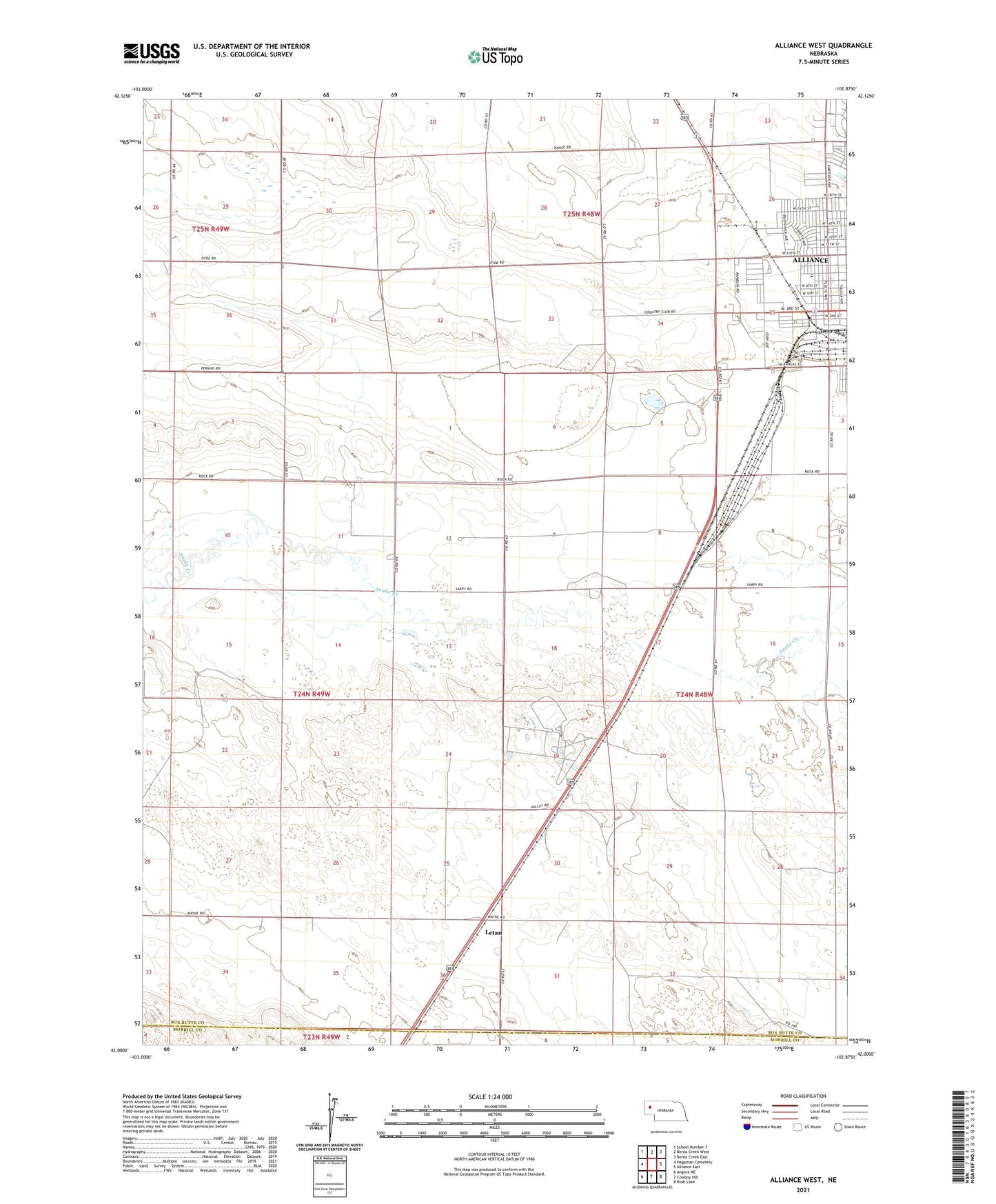
2021 topographic map quadrangle Alliance West in the state of Nebraska. Scale: 1:24000. Based on the newly updated USGS 7.5' US Topo map series, this map is in the following counties: Box Butte, Morrill. The map contains contour data, water features, and other items you are used to seeing on USGS maps, but also has updated roads and other features. This is the next generation of topographic maps. Printed on high-quality waterproof paper with UV fade-resistant inks.
Quads adjacent to this one:
West: Hagaman Cemetery
Northwest: School Number 7
North: Berea Creek West
Northeast: Berea Creek East
East: Alliance East
Southeast: Rush Lake
South: Cowboy Hill
Southwest: Angora NE
This map covers the same area as the classic USGS quad with code o42102a8.
Contains the following named places: Alliance Berean Church, Alliance Country Club, Belle Acres Farm, Bronco Lake, City of Alliance, Cody Medical Associates, Copsey Clinic, Emerson Elementary School, Episcopal Evangelical Free Church, Gardner Farms, Hal Murray Softball Complex, KCOW-AM (Alliance), Kelley Bean Company Incorporated Elevator, Knight Park, Lakefield Wesleyan Chapel, Letan, Letan School, Presbyterian Church, Saint Johns Lutheran Church, School Number 1, School Number 11, Seventh Day Adventist Church, Spanish Assembly of God Church, The Church of Jesus Christ of Latter Day Saints, ZIP Code: 69301