MyTopo
Argo Hill Nebraska US Topo Map
Couldn't load pickup availability
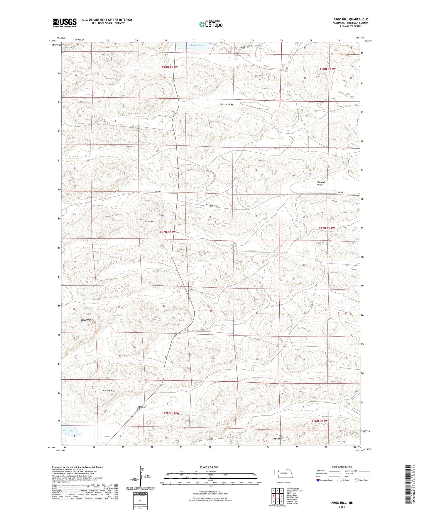
2021 topographic map quadrangle Argo Hill in the state of Nebraska. Scale: 1:24000. Based on the newly updated USGS 7.5' US Topo map series, this map is in the following counties: Sheridan. The map contains contour data, water features, and other items you are used to seeing on USGS maps, but also has updated roads and other features. This is the next generation of topographic maps. Printed on high-quality waterproof paper with UV fade-resistant inks.
Quads adjacent to this one:
West: Green Lake
Northwest: Twin Lakes NE
North: Dolly Warden Lake
Northeast: Billys Lake
East: Wolford Valley
Southeast: Lowe Valley
South: Arnold Lake
Southwest: White Lake
This map covers the same area as the classic USGS quad with code o42102c2.
Contains the following named places: A Hamilton Ranch, Argo Hill, Bunger Lake, C Hamilton Ranch, D Hamilton Ranch, Dukat Ranch, E Hamilton Ranch, F Sandoz Ranch, H Glasgow South Ranch, Highland Flats, Kinkaid Election Precinct, Lloyd Hill, Mari Sandoz State Historical Marker, Mooney Ranch, Morton Hill, N Hamilton Ranch, School Number 131, School Number 143, Star Lake, T Strasburger Ranch, Wolf Hill