MyTopo
Ashton Nebraska US Topo Map
Couldn't load pickup availability
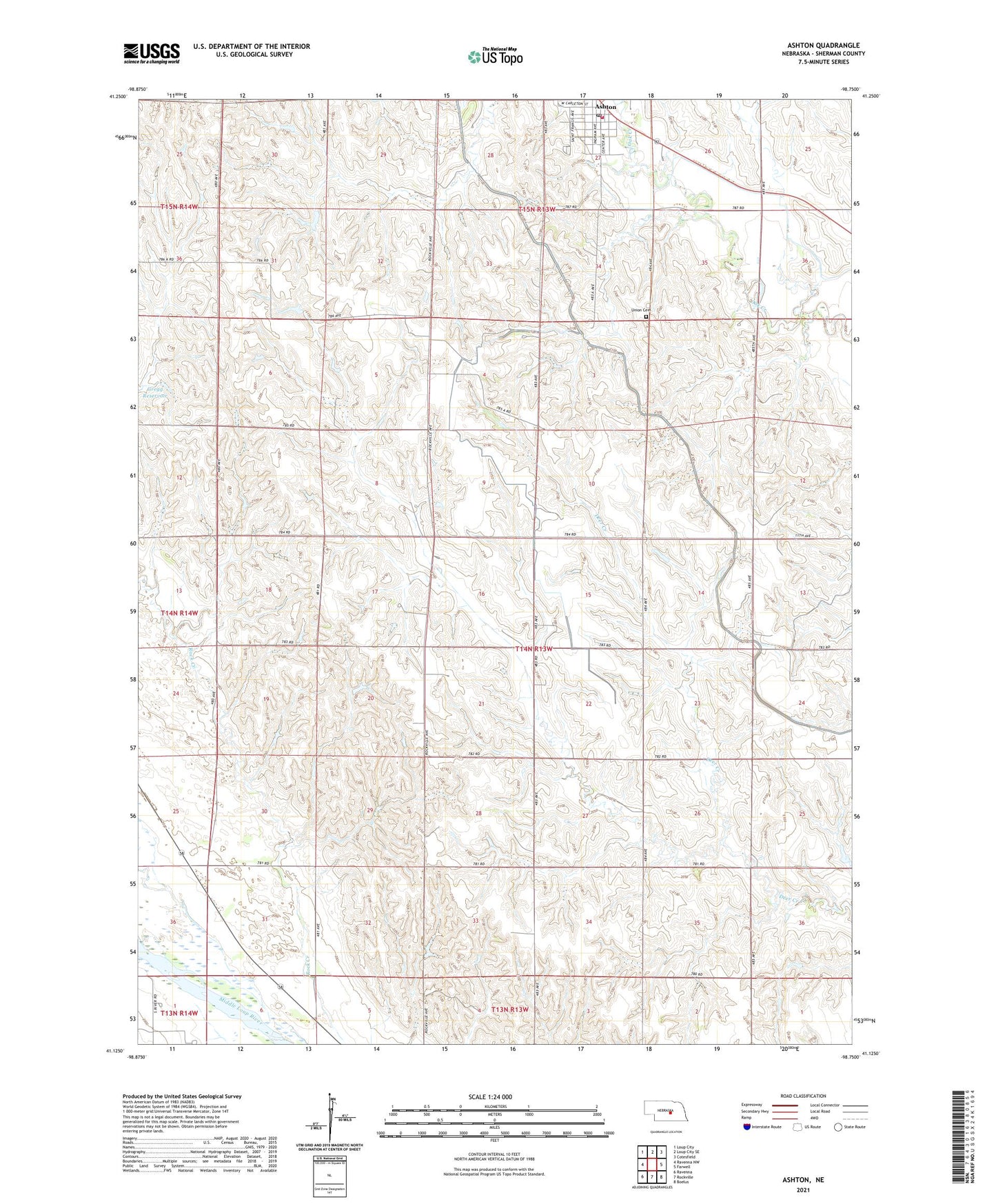
2021 topographic map quadrangle Ashton in the state of Nebraska. Scale: 1:24000. Based on the newly updated USGS 7.5' US Topo map series, this map is in the following counties: Sherman. The map contains contour data, water features, and other items you are used to seeing on USGS maps, but also has updated roads and other features. This is the next generation of topographic maps. Printed on high-quality waterproof paper with UV fade-resistant inks.
Quads adjacent to this one:
West: Ravenna NW
Northwest: Loup City
North: Loup City SE
Northeast: Cotesfield
East: Farwell
Southeast: Boelus
South: Rockville
Southwest: Ravenna
Contains the following named places: Ashton, Ashton Fire and Rescue, Ashton Post Office, Ashton Schools, Gregg Dam, Gregg Reservoir, Immanuel Church, Saint Francis Catholic Church, School Number 12, School Number 26, School Number 54, School Number 6, Township of Rockville, Trotter Incorporated Elevator, Union Cemetery, Village of Ashton, ZIP Code: 68871