MyTopo
Ravenna NW Nebraska US Topo Map
Couldn't load pickup availability
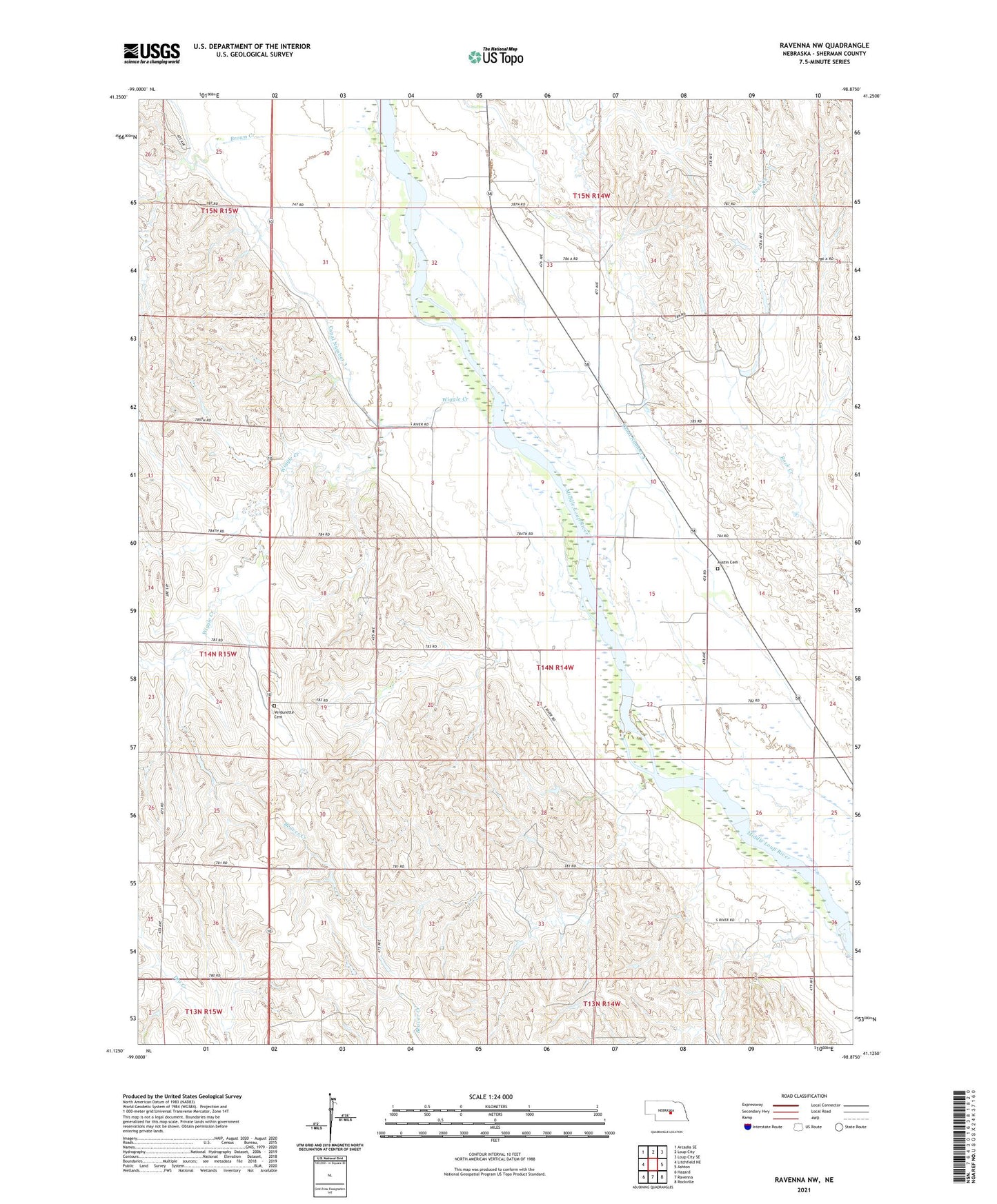
2021 topographic map quadrangle Ravenna NW in the state of Nebraska. Scale: 1:24000. Based on the newly updated USGS 7.5' US Topo map series, this map is in the following counties: Sherman. The map contains contour data, water features, and other items you are used to seeing on USGS maps, but also has updated roads and other features. This is the next generation of topographic maps. Printed on high-quality waterproof paper with UV fade-resistant inks.
Quads adjacent to this one:
West: Litchfield NE
Northwest: Arcadia SE
North: Loup City
Northeast: Loup City SE
East: Ashton
Southeast: Rockville
South: Ravenna
Southwest: Hazard
This map covers the same area as the classic USGS quad with code o41098b8.
Contains the following named places: Austin Cemetery, Austin Post Office, Austin School, Brown Creek, Fletcher School, Hawk School, School Number 13, School Number 28, School Number 29, School Number 61, School Number 79, Sherman County, South Loup City Election Precinct, Township of Loup City, Verdurette Cemetery, Wiggle Creek, Wiggle Creek School