MyTopo
Cotesfield Nebraska US Topo Map
Couldn't load pickup availability
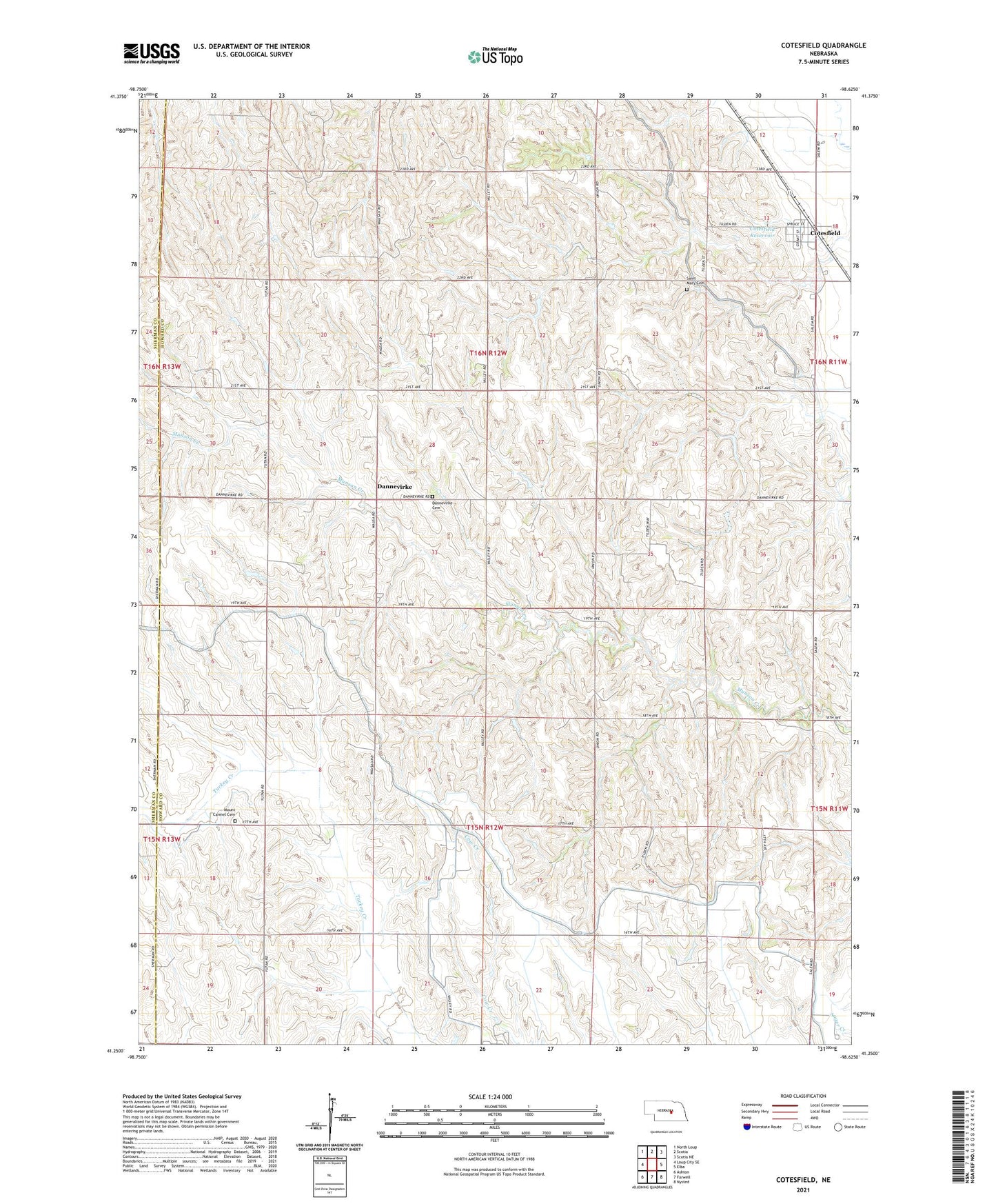
2021 topographic map quadrangle Cotesfield in the state of Nebraska. Scale: 1:24000. Based on the newly updated USGS 7.5' US Topo map series, this map is in the following counties: Howard, Sherman. The map contains contour data, water features, and other items you are used to seeing on USGS maps, but also has updated roads and other features. This is the next generation of topographic maps. Printed on high-quality waterproof paper with UV fade-resistant inks.
Quads adjacent to this one:
West: Loup City SE
Northwest: North Loup
North: Scotia
Northeast: Scotia NE
East: Elba
Southeast: Nysted
South: Farwell
Southwest: Ashton
This map covers the same area as the classic USGS quad with code o41098c6.
Contains the following named places: Cotesfield, Cotesfield City Park, Cotesfield Detention Dam, Cotesfield Post Office, Cotesfield Reservoir, Cotesfield Village Police Department, Danish Evangelical Lutheran Church, Dannevirke, Dannevirke Cemetery, Dannevirke Election Precinct, Dannevirke Post Office, Mount Carmel Cemetery, Our Lady of Mount Carmel Church, Paplin, Saint Mary Cemetery, School Number 29, School Number 35, School Number 5, School Number 52, School Number 58, School Number 71, Township of Dannevirke, Village of Cotesfield