MyTopo
Axtell East Nebraska US Topo Map
Couldn't load pickup availability
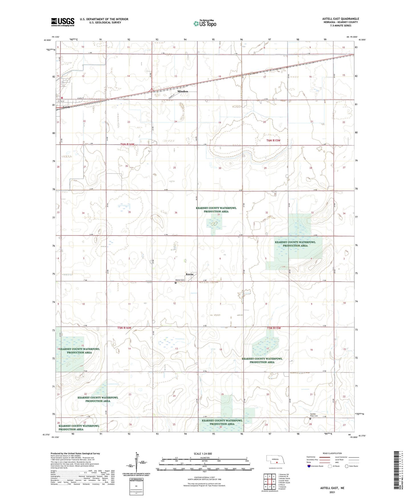
2021 topographic map quadrangle Axtell East in the state of Nebraska. Scale: 1:24000. Based on the newly updated USGS 7.5' US Topo map series, this map is in the following counties: Kearney. The map contains contour data, water features, and other items you are used to seeing on USGS maps, but also has updated roads and other features. This is the next generation of topographic maps. Printed on high-quality waterproof paper with UV fade-resistant inks.
Quads adjacent to this one:
West: Axtell West
Northwest: Kearney SW
North: Kearney SE
Northeast: Minden North
East: Minden South
Southeast: Upland
South: Hildreth
Southwest: Wilcox
Contains the following named places: Axtell Volunteer Fire and Rescue, Bethany Church, Bethpage Mission, Bluestem Federal Waterfowl Production Area, Clark Federal Waterfowl Production Area, Garden Plain Cemetery, Gleason Federal Waterfowl Production Area, Keene, Keene Cemetery, Keene Co-op Grain and Supply Company Elevator, Keene Evangelical Free Church, Keene Post Office, Kildeer Federal Waterfowl Production Area, Lindau Federal Waterfowl Production Area, Motala, Prairie Dog Federal Waterfowl Production Area, Township of Hayes, Township of Mirage, Township of Oneida, Township of Sherman, Trinity Lutheran Church, ZIP Code: 68924