MyTopo
Axtell West Nebraska US Topo Map
Couldn't load pickup availability
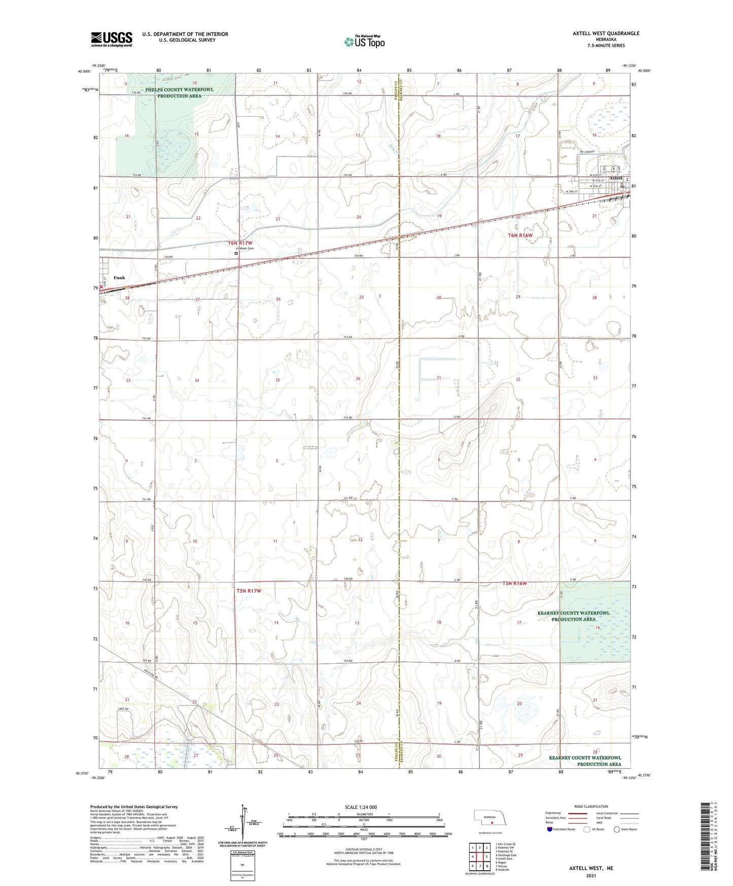
2021 topographic map quadrangle Axtell West in the state of Nebraska. Scale: 1:24000. Based on the newly updated USGS 7.5' US Topo map series, this map is in the following counties: Phelps, Kearney. The map contains contour data, water features, and other items you are used to seeing on USGS maps, but also has updated roads and other features. This is the next generation of topographic maps. Printed on high-quality waterproof paper with UV fade-resistant inks.
Quads adjacent to this one:
West: Holdrege East
Northwest: Elm Creek SE
North: Kearney SW
Northeast: Kearney SE
East: Axtell East
Southeast: Hildreth
South: Wilcox
Southwest: Ragan
This map covers the same area as the classic USGS quad with code o40099d2.
Contains the following named places: Axtell, Axtell City Park, Axtell Community Schools, Axtell Medical Clinic, Axtell Nebraska Historical Marker, Axtell Post Office, Axtell Public Library, Election Precinct 5, First Presbyterian Church, Fridhem Cemetery, Fridhem Lutheran Church, Funk, Funk Federal Waterfowl Production Area, Funk First Response Team, Funk Nebraska Historical Marker, Funk Public School, Funk Rural Fire Department, Harmony Park, Kearney County Waterfowl Production Area, Midland Co-op Elevator, Salem Church, Township of Divide, Township of Lake, Village of Axtell