MyTopo
Wilcox Nebraska US Topo Map
Couldn't load pickup availability
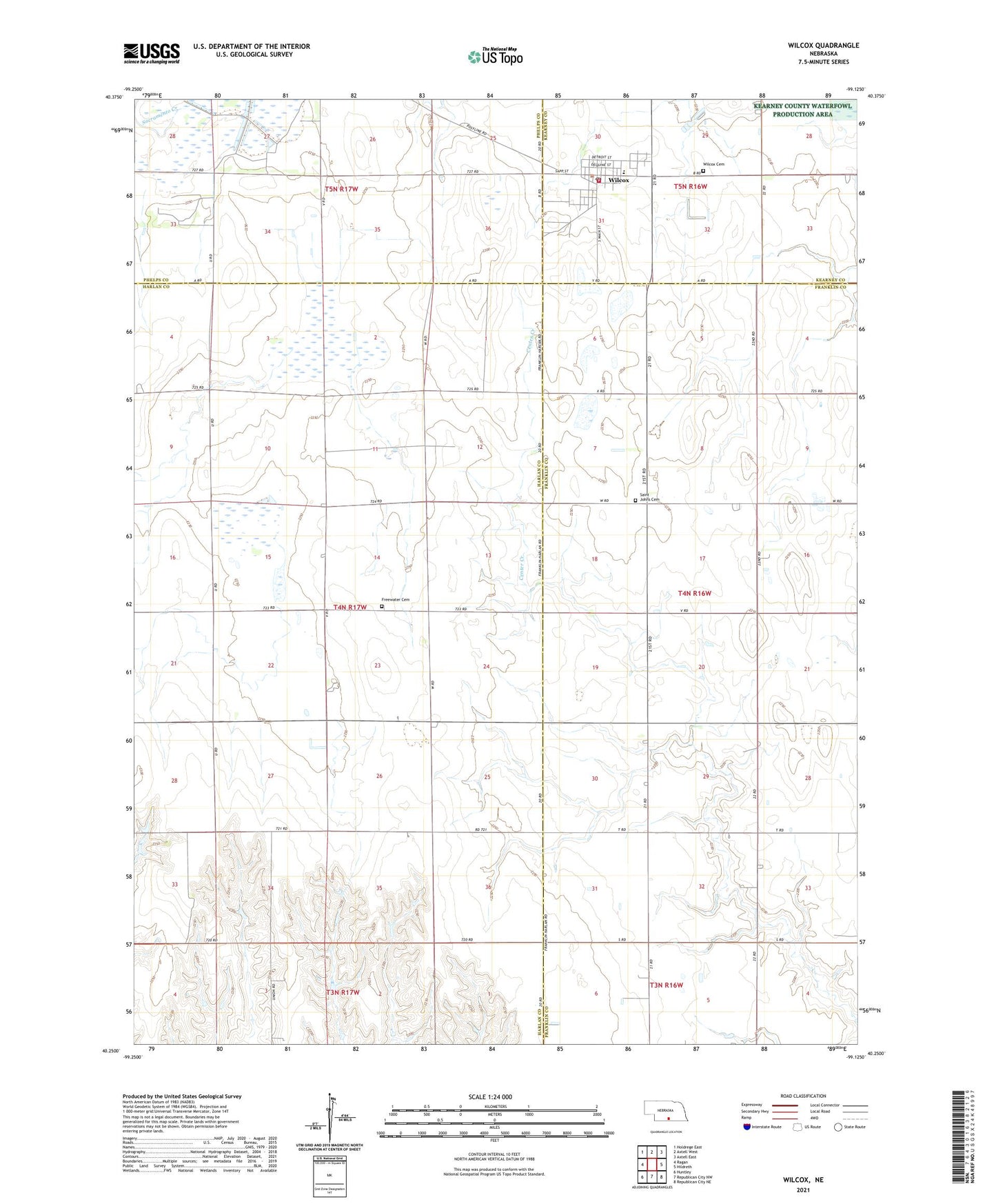
2021 topographic map quadrangle Wilcox in the state of Nebraska. Scale: 1:24000. Based on the newly updated USGS 7.5' US Topo map series, this map is in the following counties: Harlan, Franklin, Phelps, Kearney. The map contains contour data, water features, and other items you are used to seeing on USGS maps, but also has updated roads and other features. This is the next generation of topographic maps. Printed on high-quality waterproof paper with UV fade-resistant inks.
Quads adjacent to this one:
West: Ragan
Northwest: Holdrege East
North: Axtell West
Northeast: Axtell East
East: Hildreth
Southeast: Republican City NE
South: Republican City NW
Southwest: Huntley
This map covers the same area as the classic USGS quad with code o40099c2.
Contains the following named places: Evangelical Free Church, Freewater Cemetery, Frerichs Federal Waterfowl Production Area, Midland Co-op Elevator, Sacramento Creek, Saint Johns Cemetery, Saint Johns Lutheran Church, South East Sacramento State Wildlife Mgt Are, South Sacramento State Wildlife Mgt Area, Township of Antelope, Village of Wilcox, Walkers Ranch Historical Marker, Wilcox, Wilcox Cemetery, Wilcox City Park, Wilcox Medical Clinic, Wilcox Post Office, Wilcox Public Library, Wilcox Public School, Wilcox Volunteer Fire Department, ZIP Code: 68982