MyTopo
Barada Nebraska US Topo Map
Couldn't load pickup availability
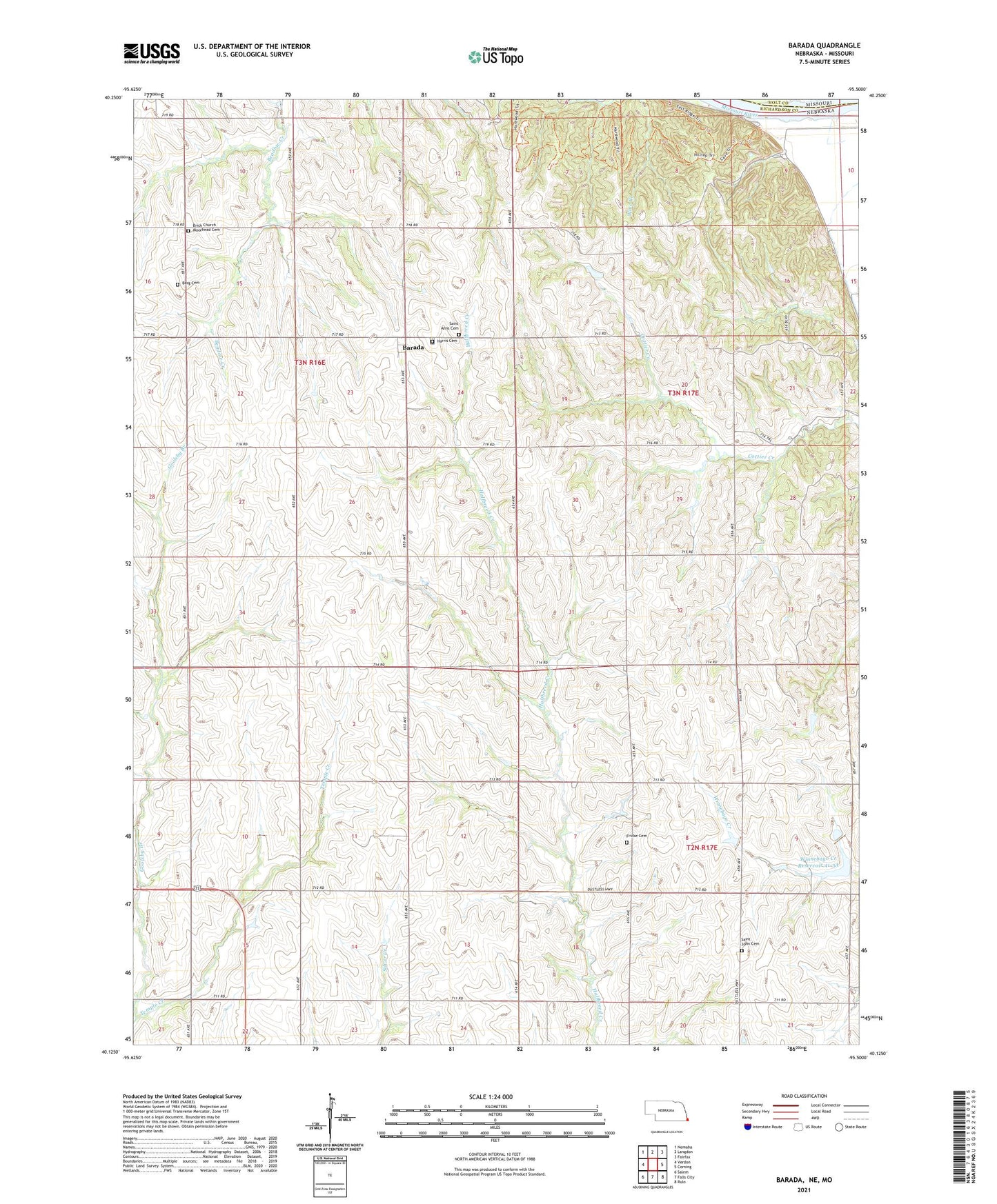
2021 topographic map quadrangle Barada in the state of Nebraska. Scale: 1:24000. Based on the newly updated USGS 7.5' US Topo map series, this map is in the following counties: Richardson, Holt. The map contains contour data, water features, and other items you are used to seeing on USGS maps, but also has updated roads and other features. This is the next generation of topographic maps. Printed on high-quality waterproof paper with UV fade-resistant inks.
Quads adjacent to this one:
West: Verdon
Northwest: Nemaha
North: Langdon
Northeast: Fairfax
East: Corning
Southeast: Rulo
South: Falls City
Southwest: Salem
Contains the following named places: Antoine Barada Marker, Arago Center School, Arago School, Barada, Barada Election Precinct, Barada Post Office, Barada United Methodist Church, Berg Cemetery, Brick Church Moorhead Cemetery, Feicht School, Franklin School, Fricke Cemetery, Glendale School, Harris Cemetery, Ohio Election Precinct, Saint Anns Cemetery, Saint John Cemetery, Saint Paul School, Saint Peters Church, Saint Stephens Post Office, School Number 1, Stumps Station, Temple Creek, Township of Arago, Township of Barada, Township of Ohio, Village of Barada, Williamsville, Williamsville Post Office, Williamsville School, Winnebago Creek Dam 41-3A, Winnebago Creek Dam 41-4, Winnebago Creek Dam 41-5, Winnebago Creek Reservoir 41-3A, Winnebago Creek Reservoir 41-4, Winnebago Creek Reservoir 41-5