MyTopo
Corning Missouri US Topo Map
Couldn't load pickup availability
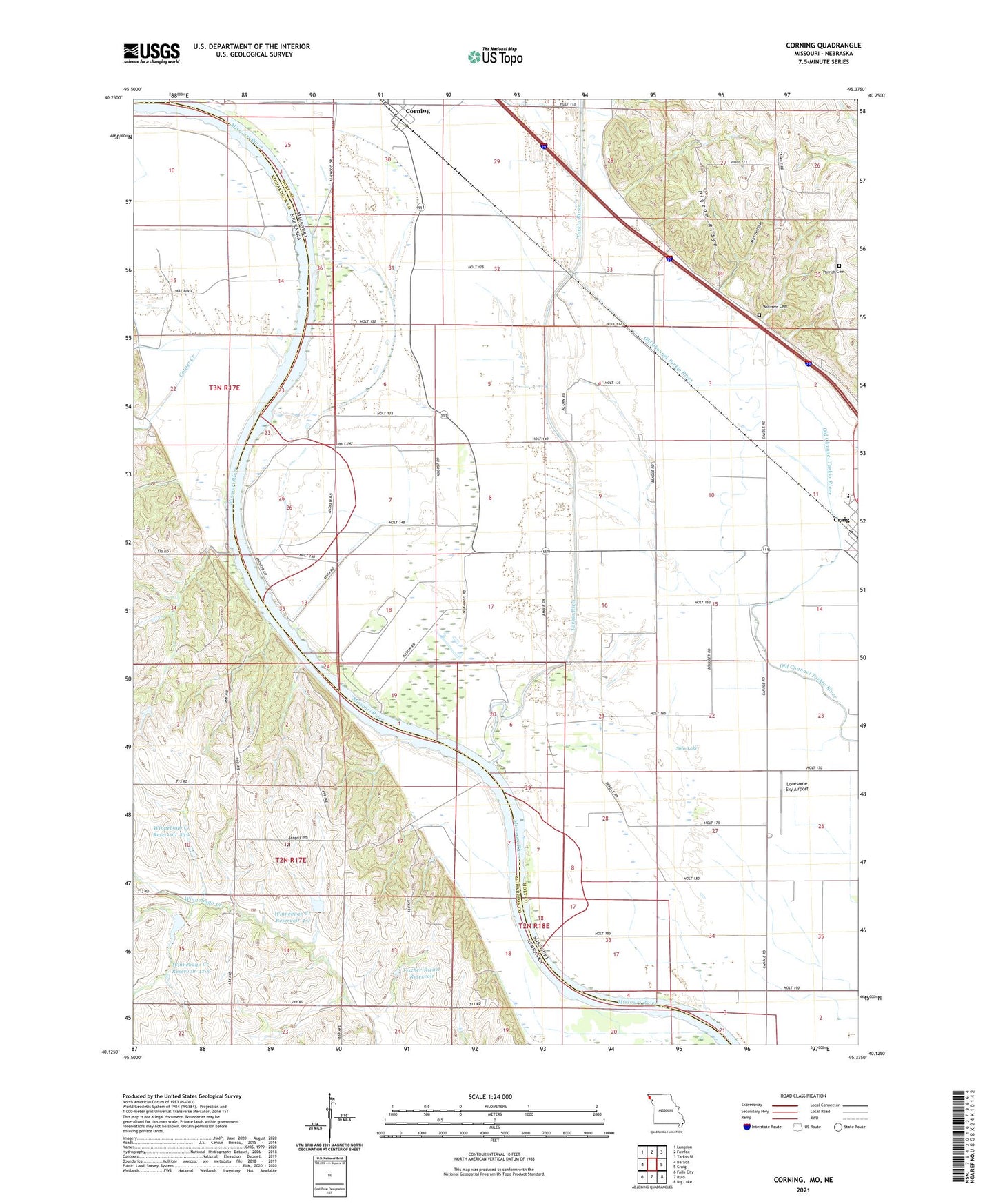
2021 topographic map quadrangle Corning in the states of Missouri, Nebraska. Scale: 1:24000. Based on the newly updated USGS 7.5' US Topo map series, this map is in the following counties: Holt, Richardson. The map contains contour data, water features, and other items you are used to seeing on USGS maps, but also has updated roads and other features. This is the next generation of topographic maps. Printed on high-quality waterproof paper with UV fade-resistant inks.
Quads adjacent to this one:
West: Barada
Northwest: Langdon
North: Fairfax
Northeast: Tarkio SE
East: Craig
Southeast: Big Lake
South: Rulo
Southwest: Falls City
This map covers the same area as the classic USGS quad with code o36090d5.
Contains the following named places: Arago, Arago Cemetery, Arago Election Precinct, Arago Post Office, Center School, Corning, Cottier Creek, Craig Elementary School, Craig High School, Fargo Post Office, Fargo School, Fischer School, Fischer-Rieger Dam, Fischer-Rieger Reservoir, Guilliams Cemetery, Kelso School, Lake Shore Community Hall, Lake Shore School, Lescher Lake, Lescher Lake Dam, Lonesome Sky Airport, Marietta School, Mill Hollow, Parrish Cemetery, Pigeon Ridge, Saint Marys Church, Saint Peters Church, Sims Lake, Star School, Tarkio River, Thurnau State Wildlife Area, Town of Corning, Township of Lincoln, Township of Union, Welton Ideker Dam, Wine Branch, Winnebago Creek Dam 42-5, Winnebago Creek Dam 43-2, Winnebago Creek Dam 4-4, Winnebago Creek Reservoir 42-5, Winnebago Creek Reservoir 43-2, Winnebago Creek Reservoir 4-4