MyTopo
Blair Nebraska US Topo Map
Couldn't load pickup availability
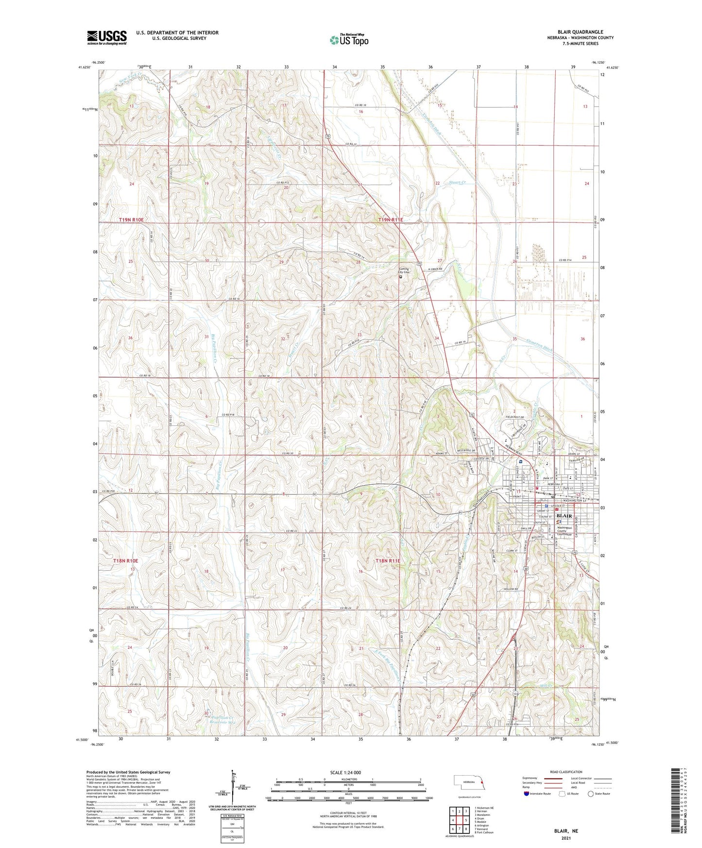
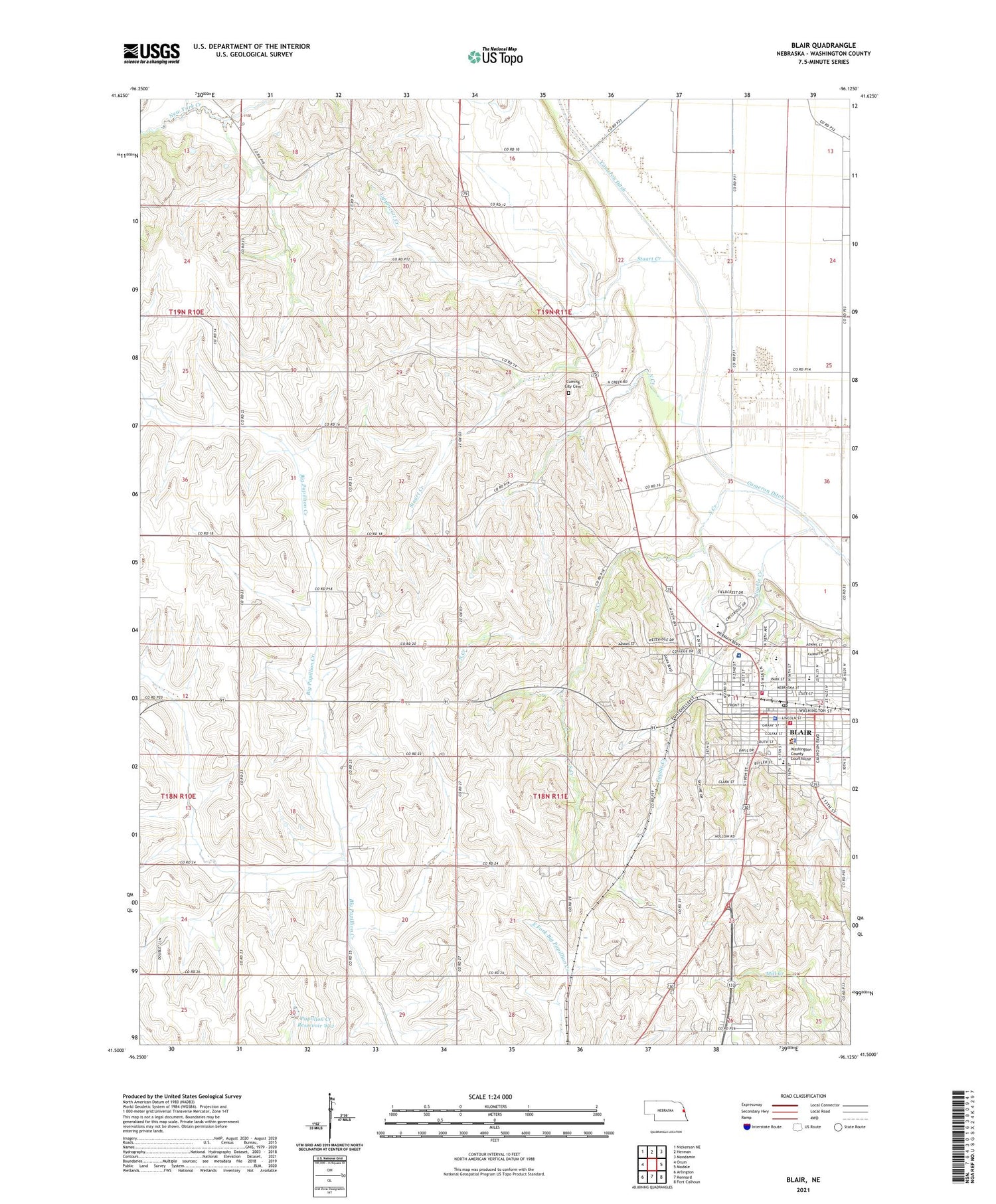
2021 topographic map quadrangle Blair in the state of Nebraska. Scale: 1:24000. Based on the newly updated USGS 7.5' US Topo map series, this map is in the following counties: Washington. The map contains contour data, water features, and other items you are used to seeing on USGS maps, but also has updated roads and other features. This is the next generation of topographic maps. Printed on high-quality waterproof paper with UV fade-resistant inks.
Quads adjacent to this one:
West: Orum
Northwest: Nickerson NE
North: Herman
Northeast: Mondamin
East: Modale
Southeast: Fort Calhoun
South: Kennard
Southwest: Arlington
Contains the following named places: Alegent Health Immanuel Clinic, Argo Hall, Black Elk - Neihardt Park, Blair, Blair Arbor Park Middle School, Blair Chiropractic Center, Blair Clinic, Blair Dental Clinic, Blair Eyecare Center, Blair Feed Mill Elevator, Blair Foot Clinic, Blair Golf Club, Blair Hall, Blair North Elementary School, Blair Police Department, Blair Post Office, Blair Public Library, Blair South Elementary School, Blair Volunteer Fire and Rescue District 2 North Station, Blair Volunteer Fire and Rescue South Station District 1, Blair West Elementary School, Borup Coliseum, C A Dana - Life Library, C A Dana Hall of Science, Cauble Creek, Central School, Church of Christ, City of Blair, Congregational Church of Blair Historical Marker, Cornerstone Assembly of God Church, Country Bible Church, Country Estates Mobile Home Park, Crowell Memorial Home, Cuming City Cemetery, Cuming City Cemetery and Nature Preserve Historical Marker, Cuming City School, Dana Classroom Center, Dana College, E C Hunt Campus Center, Elk Horn Hall Conference-Retreat Center, First Baptist Church, First Christian Church, First Lutheran Church, First United Methodist Church, Good Shepherd Lutheran Home, Heartland Family Dentistry, Holling Hall, KDCV-FM (Blair), Kingdom Hall of Jehovahs Witnesses, Kuether Chiropractic Clinic, Lions Club Park, Lippincott Creek, Madsen Fine Arts Center, Mathiesen Grain Company Elevator, Memorial Community Hospital, Mickelsen Hall, Midwest Dermatology, Municipal RV Park, North Creek, Olds Path Baptist Tabernacle Church, Omaha Village Apartments, Papillion Creek Dam W-2, Papillion Creek Reservoir W-2, Peterson Field, Pioneer Memorial Building, Ralph Steyer Park, Rasmussen Hall, Rhoades Park, Saint Francis Borgia Catholic Church, Saint Marys Episcopal Church, Son-Rise Community Church, South Creek, Stuart Creek, The Church of Jesus Christ of Latter Day Saints, Tower of the Four Winds, Township 3, Township 4, Trinity Lutheran Church, Tyson Elevators, United Church of Christ, Veterans Memorial Ball Field, Viking Field, Washington County, Washington County Courthouse, Washington County Sheriff's Office, Wilson Dam, Wilson Reservoir, Zimmerman Field, ZIP Code: 68008