MyTopo
Fort Calhoun Nebraska US Topo Map
Couldn't load pickup availability
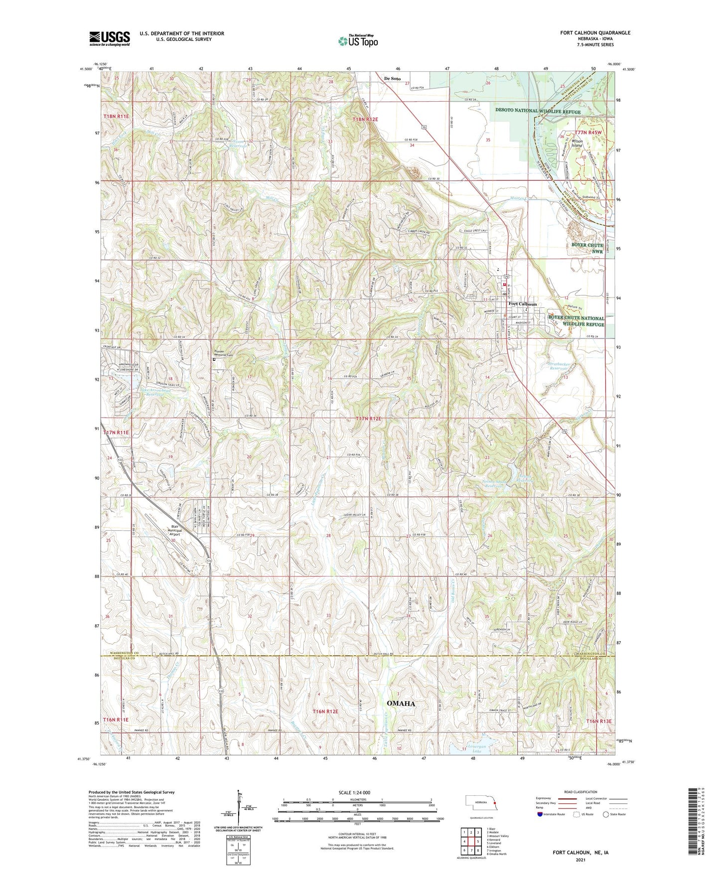
2021 topographic map quadrangle Fort Calhoun in the states of Nebraska, Iowa. Scale: 1:24000. Based on the newly updated USGS 7.5' US Topo map series, this map is in the following counties: Washington, Douglas, Pottawattamie. The map contains contour data, water features, and other items you are used to seeing on USGS maps, but also has updated roads and other features. This is the next generation of topographic maps. Printed on high-quality waterproof paper with UV fade-resistant inks.
Quads adjacent to this one:
West: Kennard
Northwest: Blair
North: Modale
Northeast: Missouri Valley
East: Loveland
Southeast: Omaha North
South: Irvington
Southwest: Elkhorn
This map covers the same area as the classic USGS quad with code o41096d1.
Contains the following named places: Bil Lo Airport, Blair Municipal Airport, Calhoun, City of Fort Calhoun, De Soto, De Soto National Wildlife Refuge, Desoto, DeSoto Lake, DeSoto Post Office, Fort Atkinson, Fort Atkinson Historical Marker, Fort Atkinson Post Office, Fort Atkinson State Historical Park, Fort Atkinson Trail, Fort Calhoun, Fort Calhoun Baptist Church, Fort Calhoun Clinic, Fort Calhoun Elementary School, Fort Calhoun High School, Fort Calhoun Post Office, Fort Calhoun Volunteer Fire and Rescue Department, Harold W Anderson Visitor Center, Hinz Fork, Lake Arrowhead Dam, Lake Arrowhead Reservoir, Lewis and Clark Camp Site Historical Marker, Long Creek Dam, Long Creek Reservoir, Mill Creek, Moores Creek, Nelson Detention Dam, Nelson Reservoir, Nelson South Dam, Nelson South Reservoir, Nixon Dam, Nixon Reservoir, Old Bones Creek, Pioneer Memorial Cemetery, Presbyterian Church, Saint John the Baptist Catholic Church, School Number 49, School Number 56, School Number 7, School Number 8, Snyder Dam, Snyder Reservoir, Stratbucker Dam, Stratbucker Reservoir, Township 1, Township 2, Turkey Creek, Twin Brooks Camp, Washington County Historical Museum, Wilson Island, Wilson Island State Park, Wranch School, ZIP Code: 68023