
MyTopo
Bourquim Hill Nebraska US Topo Map
Couldn't load pickup availability
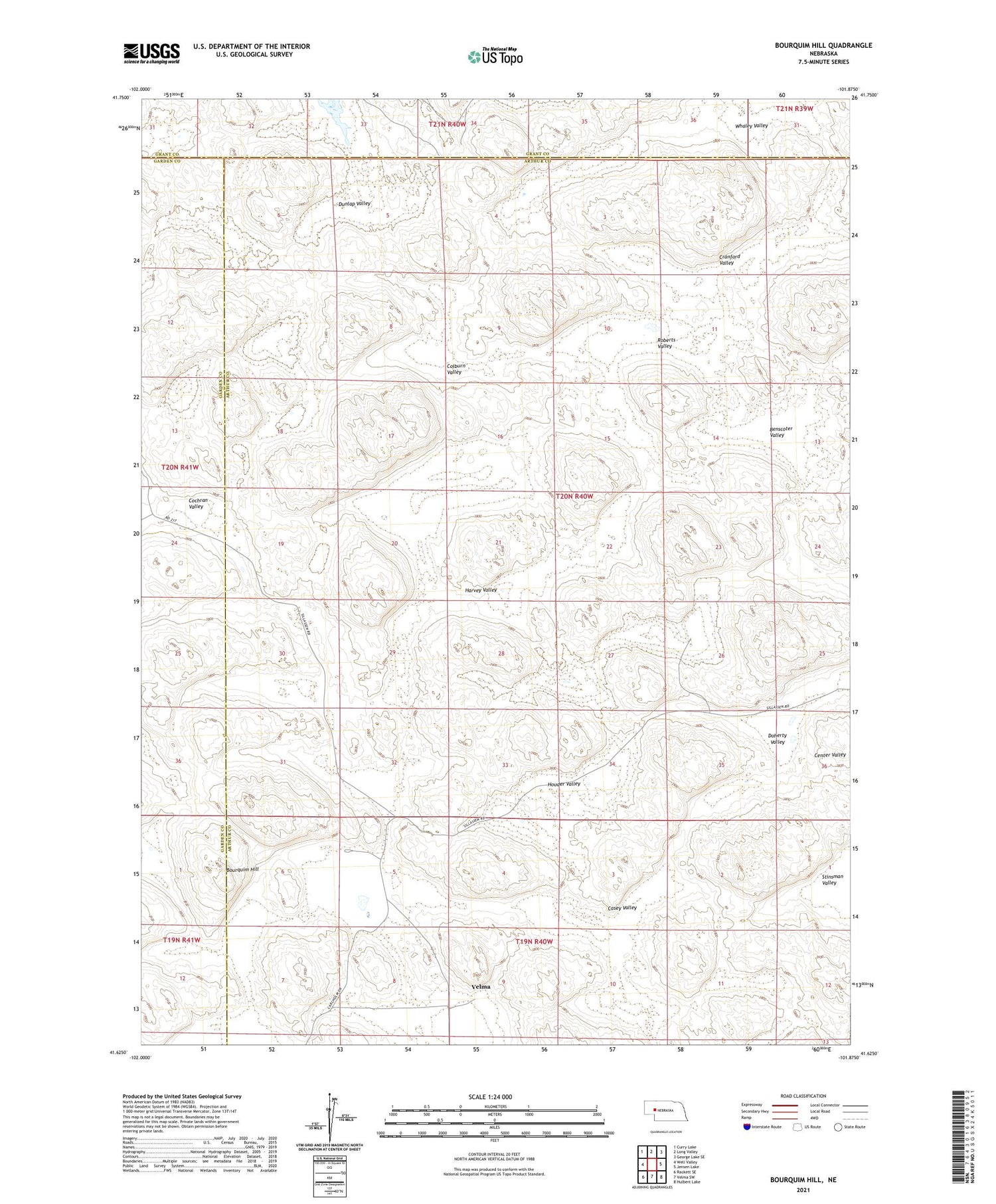
2021 topographic map quadrangle Bourquim Hill in the state of Nebraska. Scale: 1:24000. Based on the newly updated USGS 7.5' US Topo map series, this map is in the following counties: Arthur, Garden, Grant. The map contains contour data, water features, and other items you are used to seeing on USGS maps, but also has updated roads and other features. This is the next generation of topographic maps. Printed on high-quality waterproof paper with UV fade-resistant inks.
Quads adjacent to this one:
West: Well Valley
Northwest: Curry Lake
North: Long Valley
Northeast: George Lake SE
East: Jensen Lake
Southeast: Hulbert Lake
South: Velma SW
Southwest: Rackett SE
Contains the following named places: Benscoter Valley, Bourquim Hill, Casey Valley, Cochran Valley, Cocklebur Windmill, Colburn Valley, Cranford Valley, Doherty Valley, Dunlap Valley, F Lane Ranch, Harvey Valley, Houder Valley, Roberts Valley, School Number 27, Stinsman Valley, Velma, Velma Post Office, Whaley Valley


