MyTopo
Brewster Nebraska US Topo Map
Couldn't load pickup availability
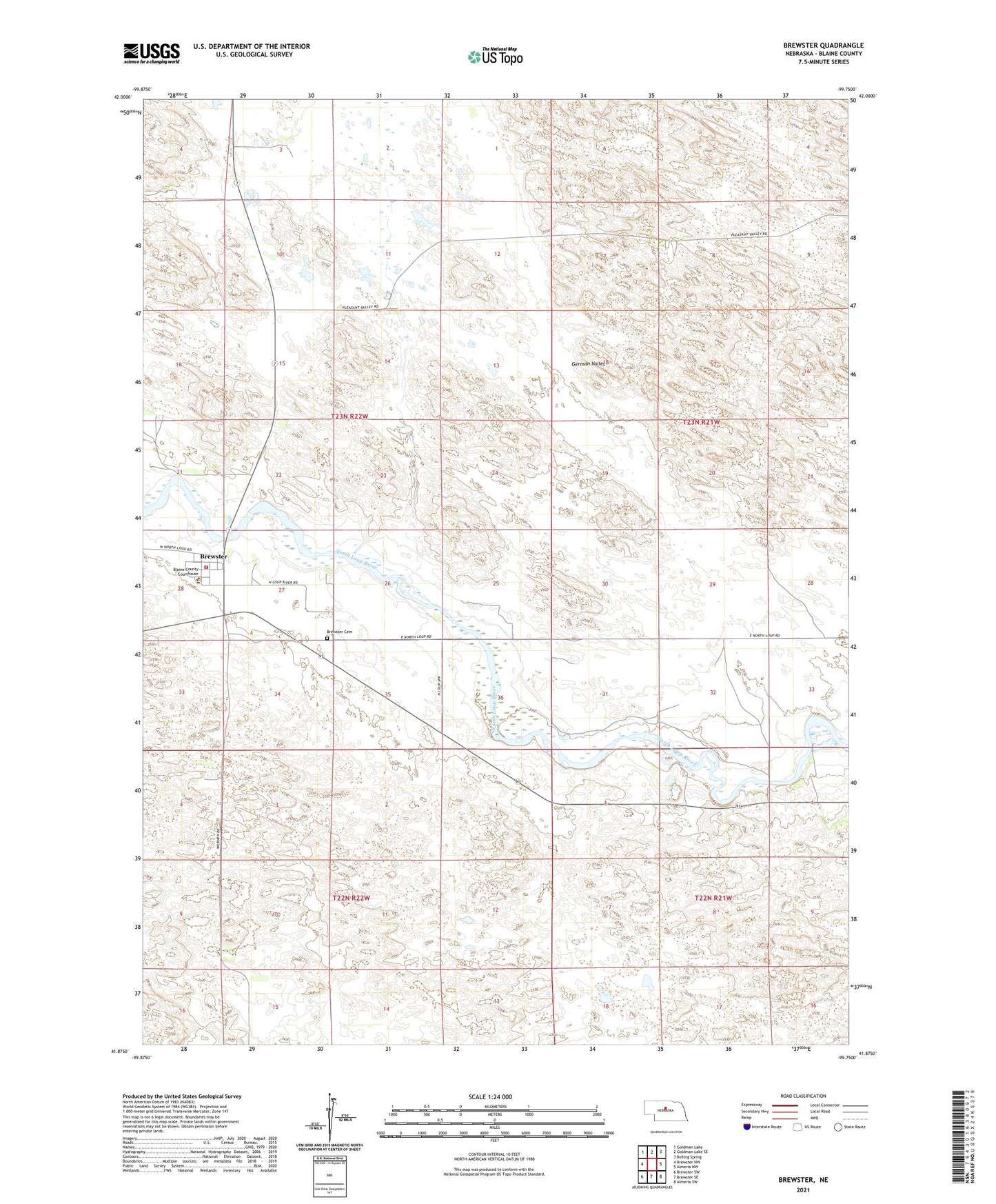
2021 topographic map quadrangle Brewster in the state of Nebraska. Scale: 1:24000. Based on the newly updated USGS 7.5' US Topo map series, this map is in the following counties: Blaine. The map contains contour data, water features, and other items you are used to seeing on USGS maps, but also has updated roads and other features. This is the next generation of topographic maps. Printed on high-quality waterproof paper with UV fade-resistant inks.
Quads adjacent to this one:
West: Brewster NW
Northwest: Goldman Lake
North: Goldman Lake SE
Northeast: Boiling Spring
East: Almeria NW
Southeast: Almeria SW
South: Brewster SE
Southwest: Brewster SW
This map covers the same area as the classic USGS quad with code o41099h7.
Contains the following named places: Blaine County Courthouse, Blaine County Rescue Squad, Blaine County Sheriff's Office, Brewster, Brewster Cemetery, Brewster City Police Department, Brewster Election Precinct, Brewster Post Office, Brewster Rural Fire District, Burke Ranch, Miller Ranch, Niemoth Ranch, Uncle Bucks Campground, Village of Brewster