MyTopo
Bruning Nebraska US Topo Map
Couldn't load pickup availability
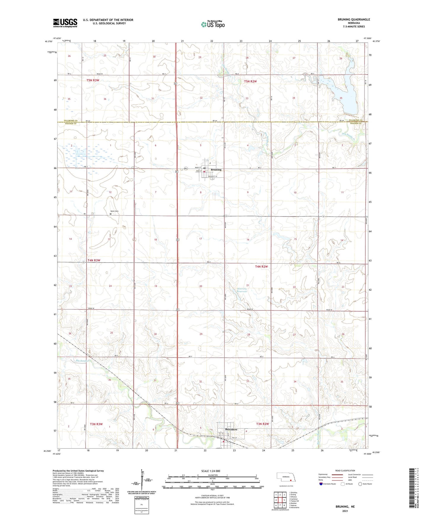
2021 topographic map quadrangle Bruning in the state of Nebraska. Scale: 1:24000. Based on the newly updated USGS 7.5' US Topo map series, this map is in the following counties: Thayer, Fillmore. The map contains contour data, water features, and other items you are used to seeing on USGS maps, but also has updated roads and other features. This is the next generation of topographic maps. Printed on high-quality waterproof paper with UV fade-resistant inks.
Quads adjacent to this one:
West: Carleton
Northwest: Shickley
North: Strang
Northeast: Ohiowa
East: Tobias SW
Southeast: Alexandria
South: Hebron
Southwest: Deshler
Contains the following named places: Belvidere, Belvidere Election Precinct, Belvidere Post Office, Belvidere Public School, Belvidere Rural Fire Department, Bruning, Bruning Dam Campground, Bruning Election Precinct, Bruning Grain and Feed Company Elevator, Bruning Medical Clinic, Bruning Post Office, Bruning Public Library, Bruning Public Schools, Bruning Volunteer Fire and Rescue, East Ward School, Forty-Niner Trail Historical Marker, Hinrichs Dam, Hinrichs Reservoir, Keim Cemetery, Lahners School, Nedza School, Pickett School, Prairie Marsh State Wildlife Management Area, Prairie Star School, Thayer County Museum, Town Four School, Township of Belvidere, Township of Bruning, Trinity Lutheran Church, Trinity Lutheran Parochial School, United Methodist Church, Village of Belvidere, Village of Bruning, West Ward School, Wilkening School, ZIP Codes: 68315, 68322