MyTopo
Carleton Nebraska US Topo Map
Couldn't load pickup availability
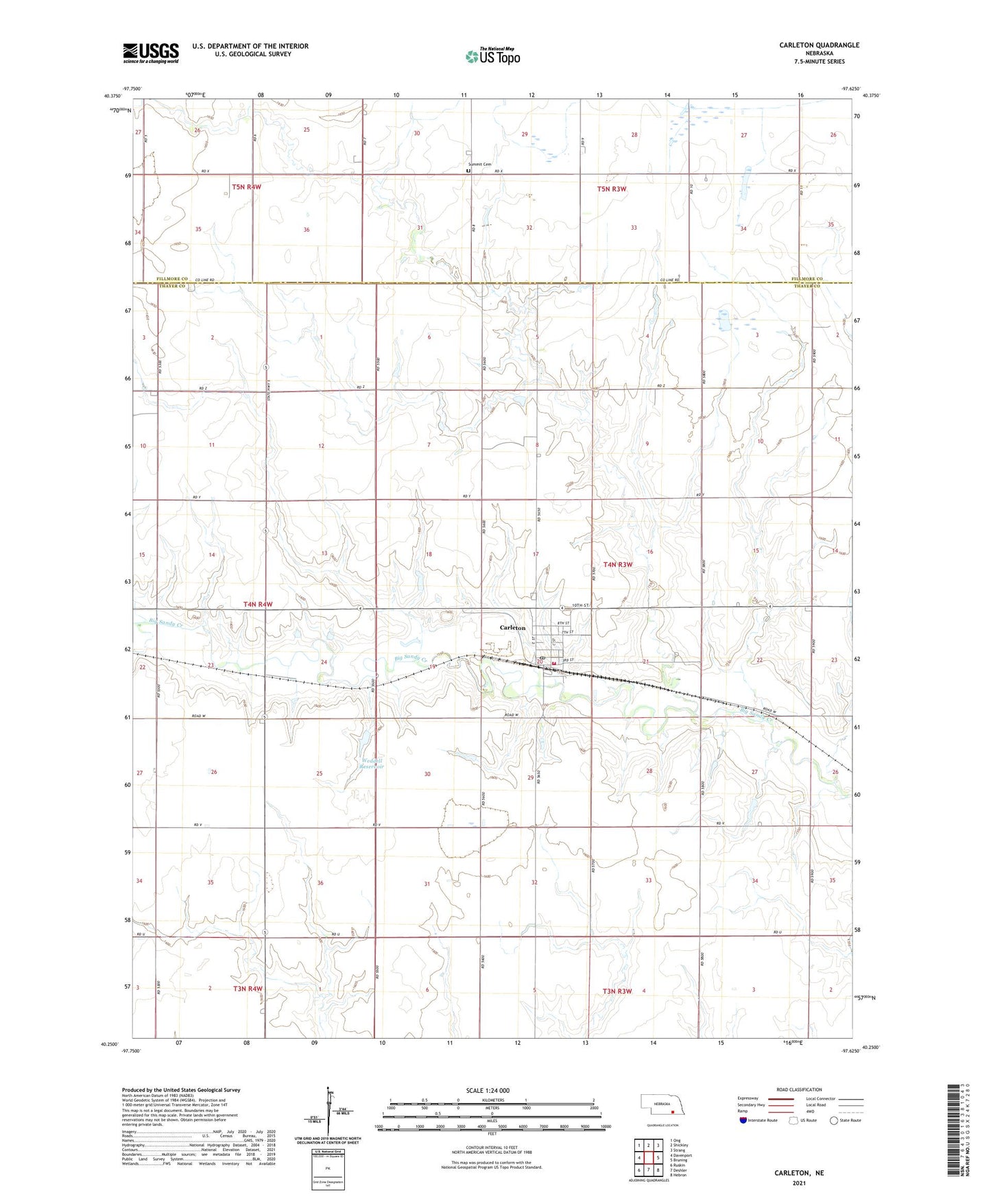
2021 topographic map quadrangle Carleton in the state of Nebraska. Scale: 1:24000. Based on the newly updated USGS 7.5' US Topo map series, this map is in the following counties: Thayer, Fillmore. The map contains contour data, water features, and other items you are used to seeing on USGS maps, but also has updated roads and other features. This is the next generation of topographic maps. Printed on high-quality waterproof paper with UV fade-resistant inks.
Quads adjacent to this one:
West: Davenport
Northwest: Ong
North: Shickley
Northeast: Strang
East: Bruning
Southeast: Hebron
South: Deshler
Southwest: Ruskin
This map covers the same area as the classic USGS quad with code o40097c6.
Contains the following named places: Bauman School, Bethel Church, Cargill Incorporated Elevator, Carleton, Carleton Election Precinct, Carleton Post Office, Carleton Public School, Carleton Volunteer Fire and Rescue, Coon Ridge School, Davenport Election Precinct, Folkerts Airport, Lippitt Dam, Lippitt Reservoir, Pioneer School, Plum College School, Prairie Marsh West State Wildlife Management Area, Rolling Plains School, Summit Cemetery, Township of Carleton, Village of Carleton, Weddell Dam, Weddell Reservoir, Zion Lutheran Church, ZIP Code: 68326