MyTopo
Shickley Nebraska US Topo Map
Couldn't load pickup availability
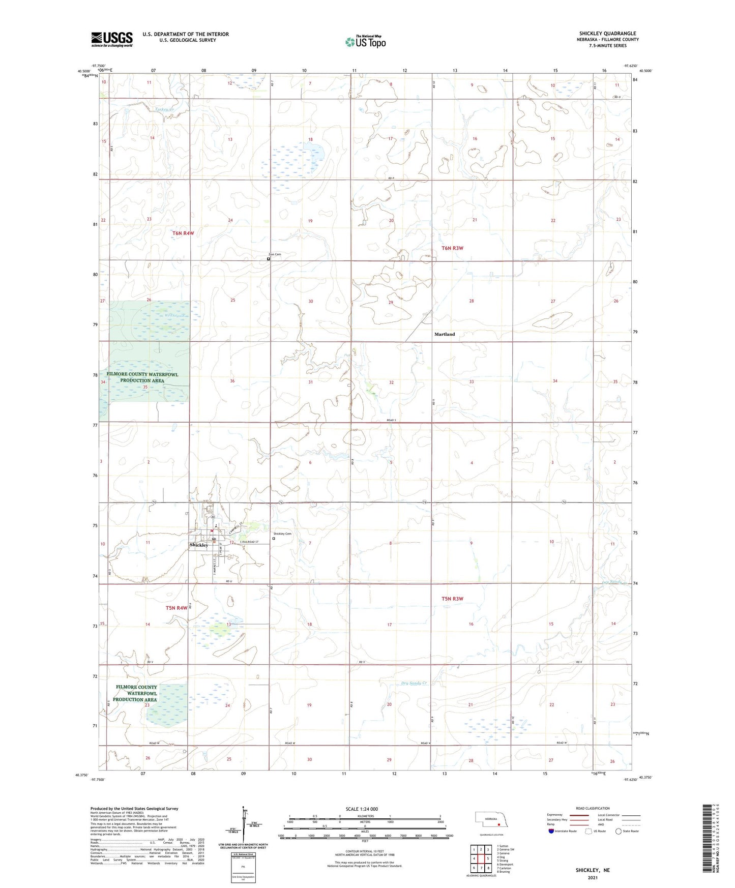
2021 topographic map quadrangle Shickley in the state of Nebraska. Scale: 1:24000. Based on the newly updated USGS 7.5' US Topo map series, this map is in the following counties: Fillmore. The map contains contour data, water features, and other items you are used to seeing on USGS maps, but also has updated roads and other features. This is the next generation of topographic maps. Printed on high-quality waterproof paper with UV fade-resistant inks.
Quads adjacent to this one:
West: Ong
Northwest: Sutton
North: Geneva SW
Northeast: Geneva
East: Strang
Southeast: Bruning
South: Carleton
Southwest: Davenport
This map covers the same area as the classic USGS quad with code o40097d6.
Contains the following named places: Filmore County Waterfowl Production Area, Martland, Martland Post Office, Norder Agri-grain Incorporated Elevator, Saint Marys Catholic Church, Salem Mennonite Church, Sandpiper State Wildlife Management Area, Shickley, Shickley Cemetery, Shickley Grain Company Elevator, Shickley Post Office, Shickley Public Schools, Shickley Volunteer Fire Department, Township of Hamilton, Township of Stanton, United Methodist Church, Village of Shickley, Virgil Biegert Public Library, Weis Lagoon, Zion Cemetery, ZIP Code: 68436