MyTopo
Burger Canyon East Nebraska US Topo Map
Couldn't load pickup availability
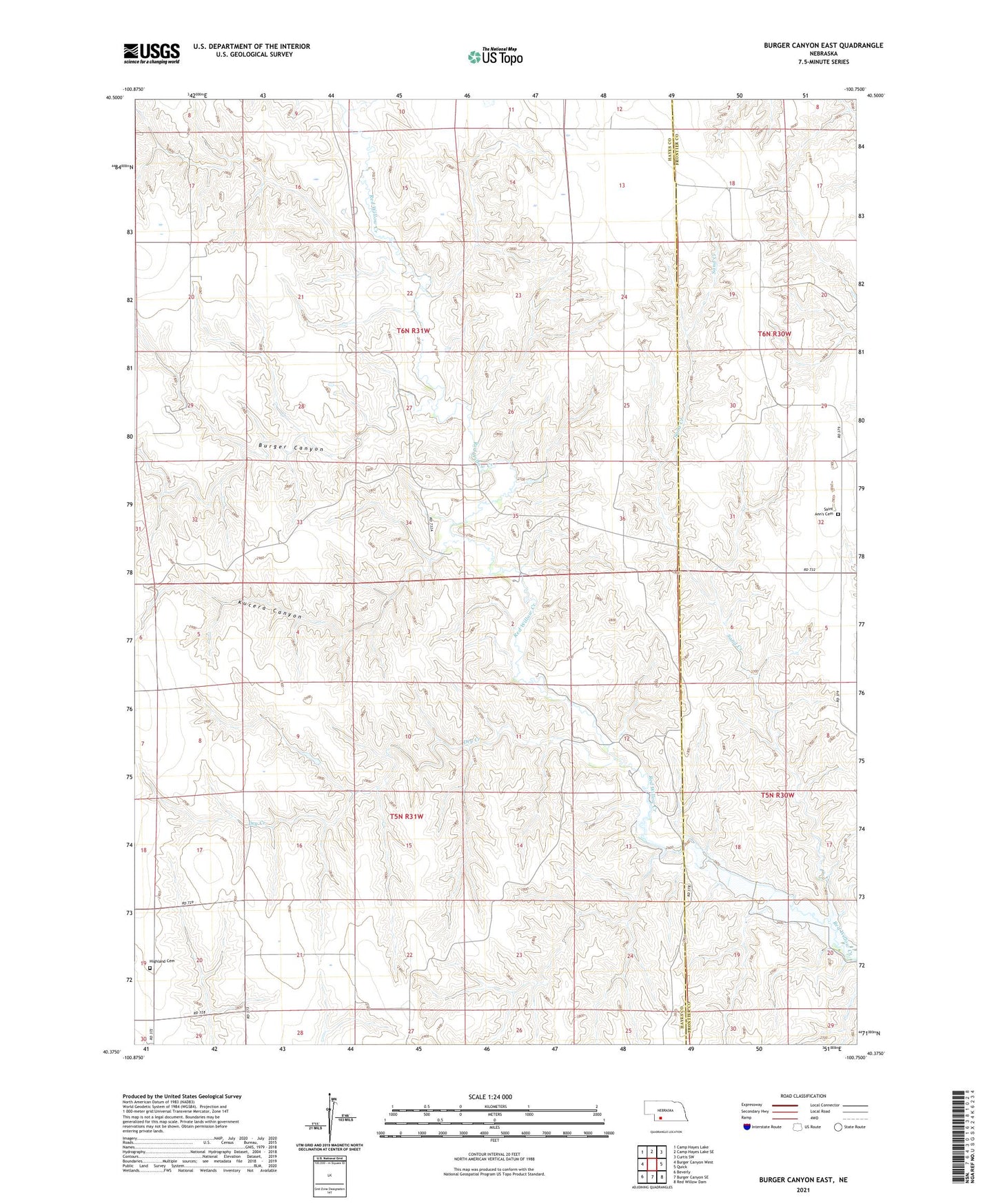
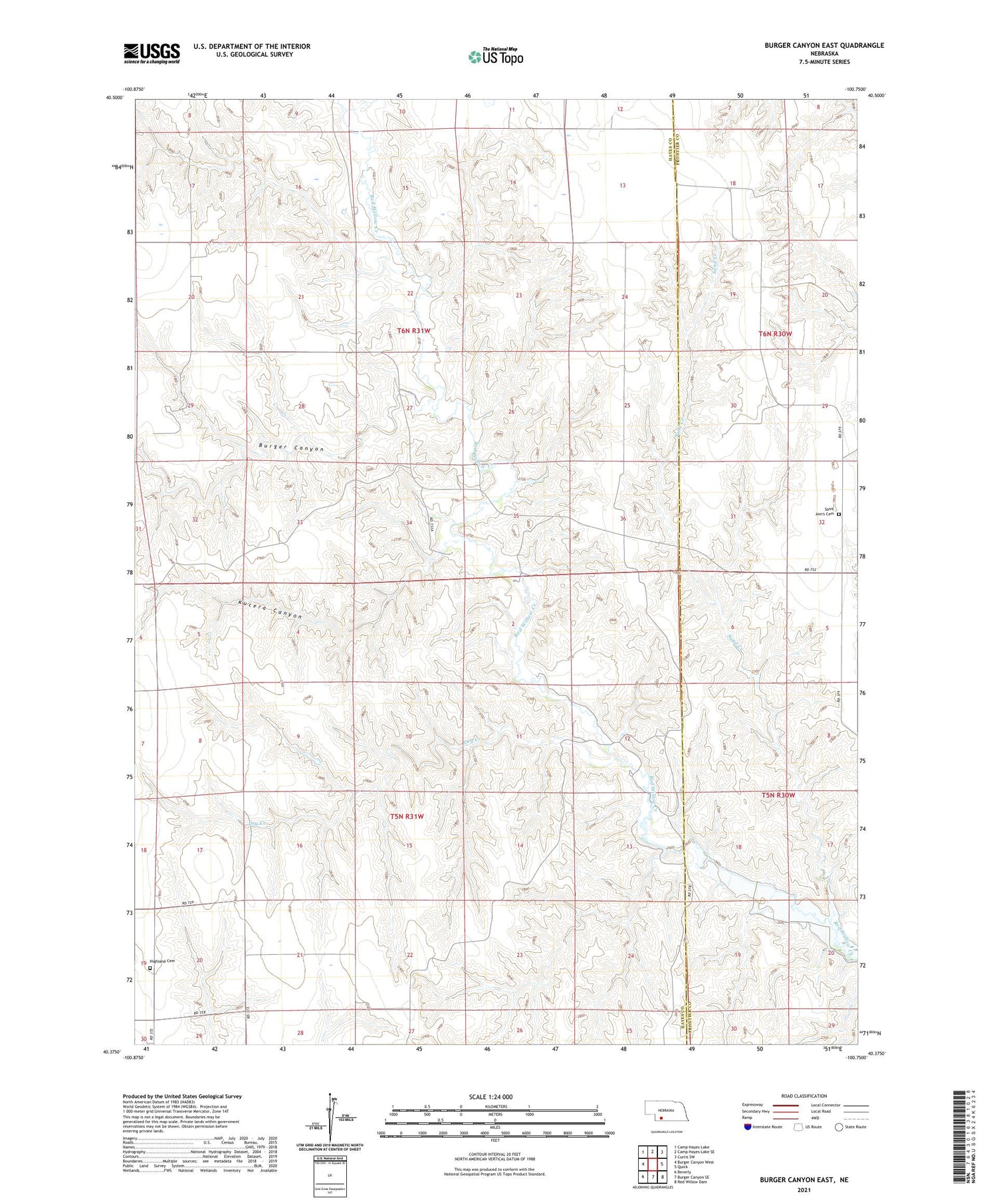
2021 topographic map quadrangle Burger Canyon East in the state of Nebraska. Scale: 1:24000. Based on the newly updated USGS 7.5' US Topo map series, this map is in the following counties: Hayes, Frontier. The map contains contour data, water features, and other items you are used to seeing on USGS maps, but also has updated roads and other features. This is the next generation of topographic maps. Printed on high-quality waterproof paper with UV fade-resistant inks.
Quads adjacent to this one:
West: Burger Canyon West
Northwest: Camp Hayes Lake
North: Camp Hayes Lake SE
Northeast: Curtis SW
East: Quick
Southeast: Red Willow Dam
South: Burger Canyon SE
Southwest: Beverly
Contains the following named places: Beebe Airport, Burger Canyon, Dry Creek, Highland Cemetery, Highland Election Precinct, Kucera Canyon, Saint Ann Church, Saint Ann Post Office, Saint Ann School, Saint Ann's Cemetery, Sand Creek, School Number 116, Thornburg Election Precinct