MyTopo
Red Willow Dam Nebraska US Topo Map
Couldn't load pickup availability
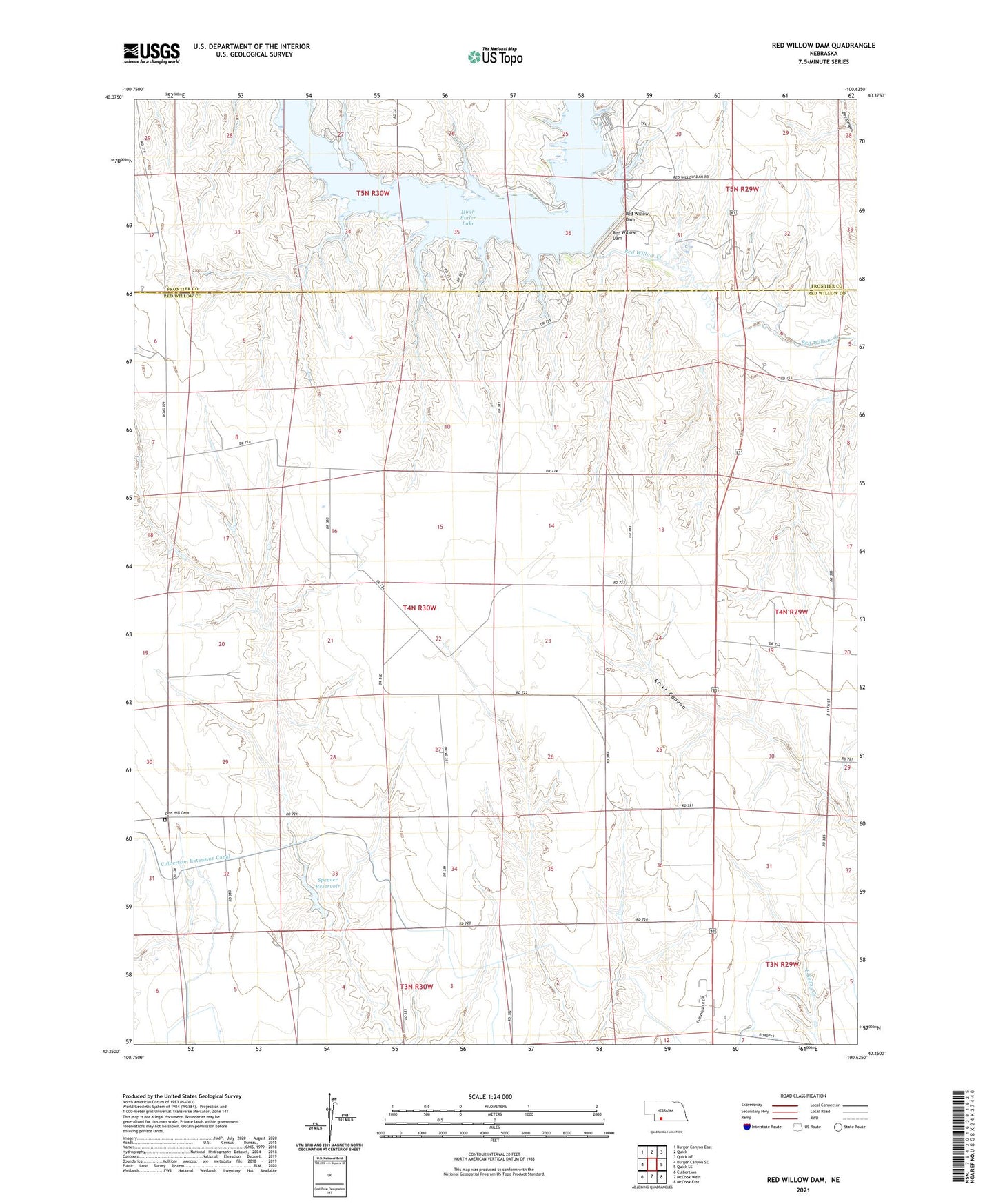
2021 topographic map quadrangle Red Willow Dam in the state of Nebraska. Scale: 1:24000. Based on the newly updated USGS 7.5' US Topo map series, this map is in the following counties: Red Willow, Frontier. The map contains contour data, water features, and other items you are used to seeing on USGS maps, but also has updated roads and other features. This is the next generation of topographic maps. Printed on high-quality waterproof paper with UV fade-resistant inks.
Quads adjacent to this one:
West: Burger Canyon SE
Northwest: Burger Canyon East
North: Quick
Northeast: Quick NE
East: Quick SE
Southeast: McCook East
South: McCook West
Southwest: Culbertson
This map covers the same area as the classic USGS quad with code o40100c6.
Contains the following named places: Coleman Election Precinct, Culbertson Extension Canal, Hugh Butler Lake, Indian Point Campground, Indian Point Recreation Area, McCook Army Air Base, McCook Army Air Base Historical Marker, McCook Army Air Base Museum, Red Willow Dam, Red Willow Reservoir State Recreation Area, Red Willow Reservoir State Wildlife Management Area, School Number 41, Spencer Dam, Spencer Reservoir, Spring Creek Recreation Area, Township of Coleman, Willow View Campground, Zion Hill Cemetery