MyTopo
Burwell SE Nebraska US Topo Map
Couldn't load pickup availability
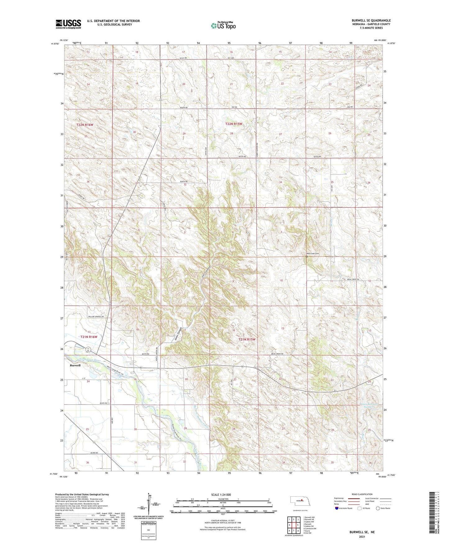
2021 topographic map quadrangle Burwell SE in the state of Nebraska. Scale: 1:24000. Based on the newly updated USGS 7.5' US Topo map series, this map is in the following counties: Garfield. The map contains contour data, water features, and other items you are used to seeing on USGS maps, but also has updated roads and other features. This is the next generation of topographic maps. Printed on high-quality waterproof paper with UV fade-resistant inks.
Quads adjacent to this one:
West: Burwell
Northwest: Burwell NW
North: Burwell NE
Northeast: Gables NW
East: Gables SW
Southeast: Ord NW
South: Elyria
Southwest: Comstock NW
Contains the following named places: Alfred James Detention Dam, Easter Blizzard of 1873 Historical Marker, Garfield County Fairgrounds, James Reservoir Number 1, Jones Canyon, Kamp Kaleo, Kamp Kaleo Historical Marker, Miller Diversion Dam, Miller Reservoir, Pebble Creek Fight Historical Marker, Richland School, Rosehill School, School Number 3, School Number 8, Township of Midvale, Township of Willow Springs, West Side Cemetery, West Side School, Willow Springs, Willow Springs Election Precinct, Willow Springs Post Office, Willow Springs School, Willow Springs Trailer Court Park