MyTopo
Elyria Nebraska US Topo Map
Couldn't load pickup availability
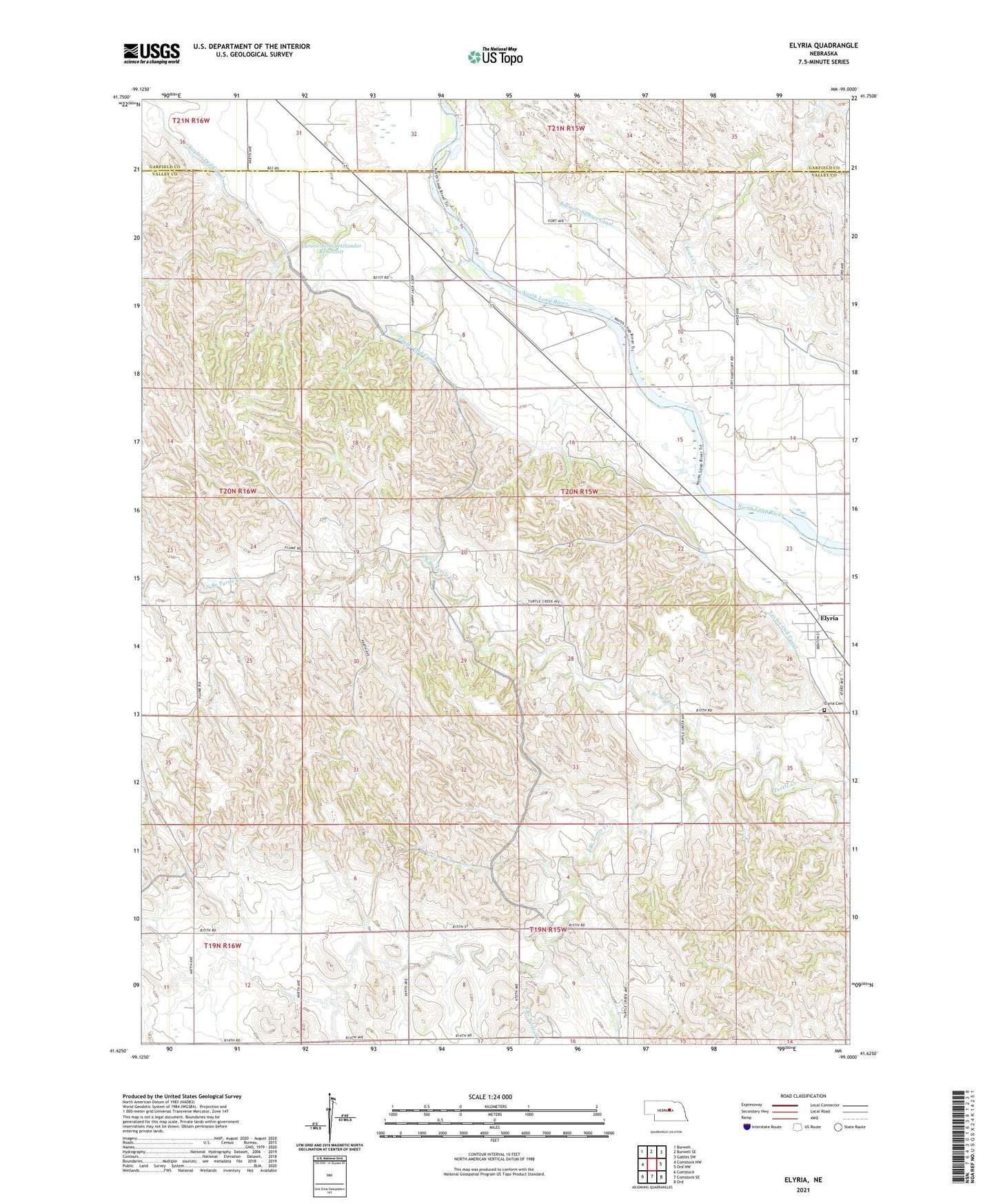
2021 topographic map quadrangle Elyria in the state of Nebraska. Scale: 1:24000. Based on the newly updated USGS 7.5' US Topo map series, this map is in the following counties: Valley, Garfield. The map contains contour data, water features, and other items you are used to seeing on USGS maps, but also has updated roads and other features. This is the next generation of topographic maps. Printed on high-quality waterproof paper with UV fade-resistant inks.
Quads adjacent to this one:
West: Comstock NW
Northwest: Burwell
North: Burwell SE
Northeast: Gables SW
East: Ord NW
Southeast: Ord
South: Comstock SE
Southwest: Comstock
This map covers the same area as the classic USGS quad with code o41099f1.
Contains the following named places: Bean Creek, Calamus Townsite Historical Marker, Elyria, Elyria Cemetery, Elyria Post Office, Elyria Public School, Fairplay School, Fort Hartsuff Historical Park, Fort Hartsuff School, Goodenow, Goodenow School, Hillsdale School, Larsen-Schwartzlander Dam, Larsen-Schwartzlander Reservoir, North Branch Turtle Creek, Saint Marys Catholic Church Historical Marker, School Number 48, South Branch Turtle Creek, Sunnyside School, Township of Elyria, Village of Elyria, ZIP Code: 68837