MyTopo
Bushnell Nebraska US Topo Map
Couldn't load pickup availability
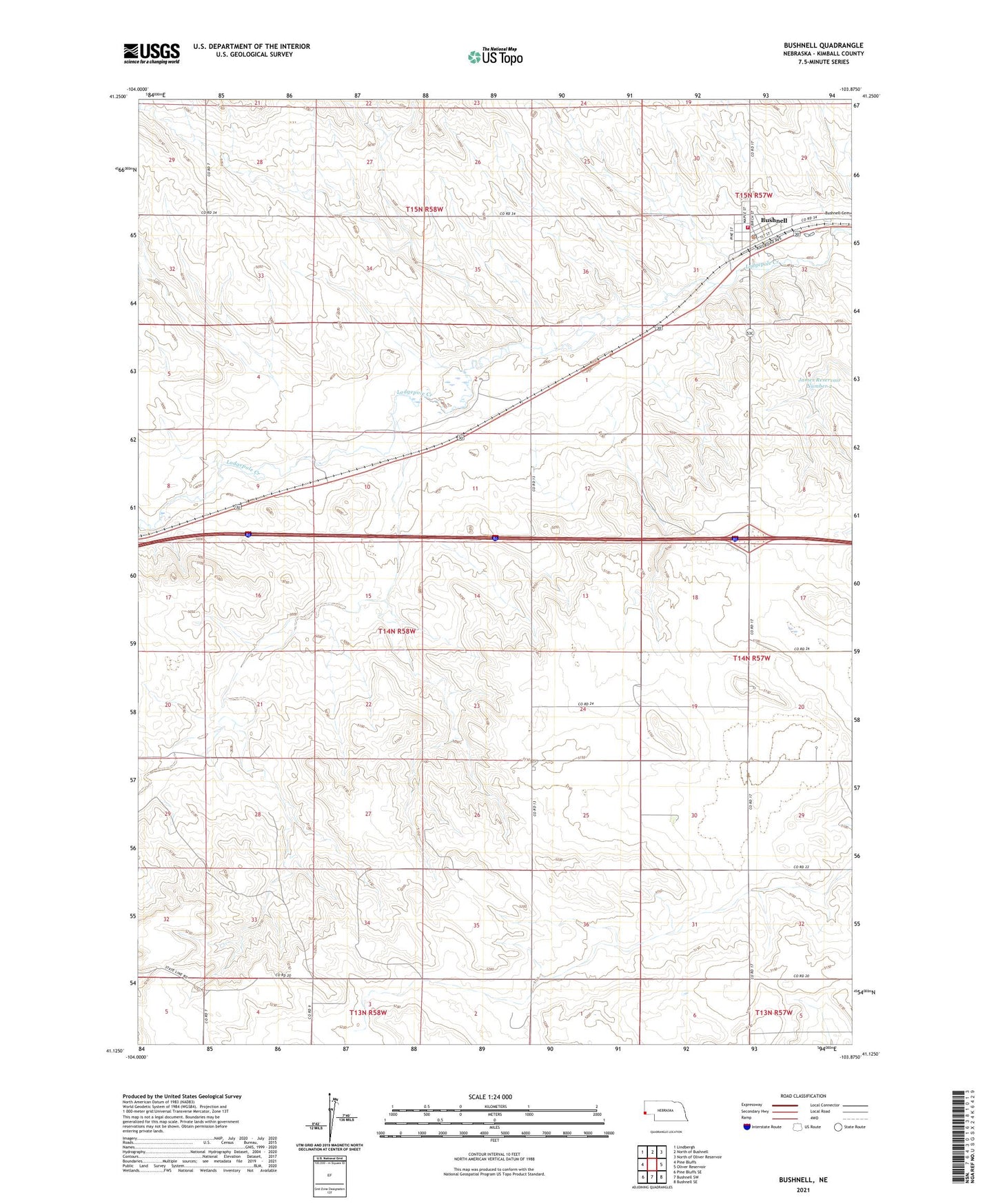
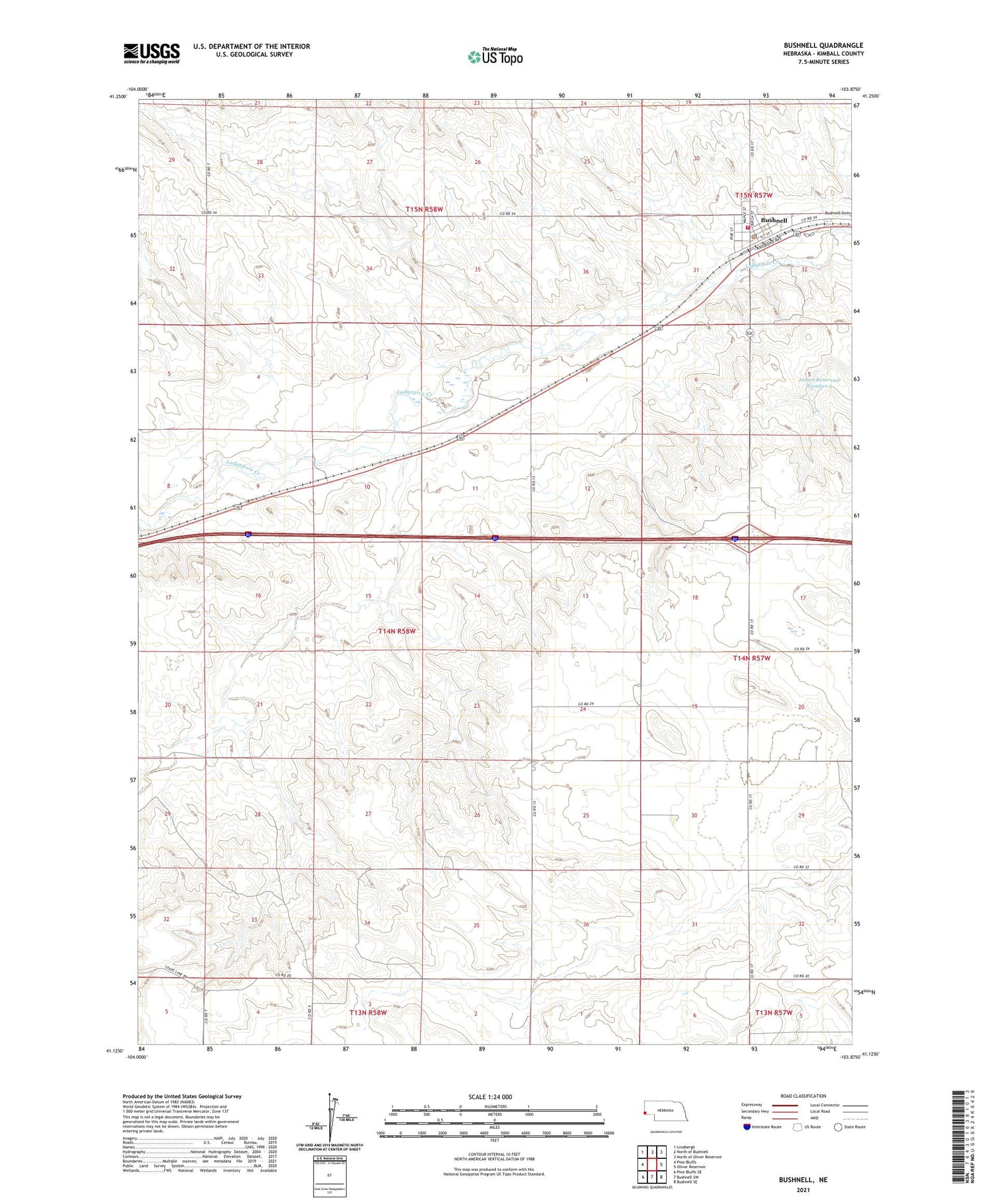
2021 topographic map quadrangle Bushnell in the state of Nebraska. Scale: 1:24000. Based on the newly updated USGS 7.5' US Topo map series, this map is in the following counties: Kimball. The map contains contour data, water features, and other items you are used to seeing on USGS maps, but also has updated roads and other features. This is the next generation of topographic maps. Printed on high-quality waterproof paper with UV fade-resistant inks.
Quads adjacent to this one:
West: Pine Bluffs
Northwest: Lindbergh
North: North of Bushnell
Northeast: North of Oliver Reservoir
East: Oliver Reservoir
Southeast: Bushnell SE
South: Bushnell SW
Southwest: Pine Bluffs SE
Contains the following named places: Bushnell, Bushnell - Johnson Volunteer Fire Department, Bushnell Election Precinct, Bushnell Post Office, Bushnell School, Calvary United Methodist Church, James Dam Number 2, James Reservoir Number 2, Pine Bluffs Feed and Grain Elevator, Smeed, Village of Bushnell, ZIP Code: 69128