MyTopo
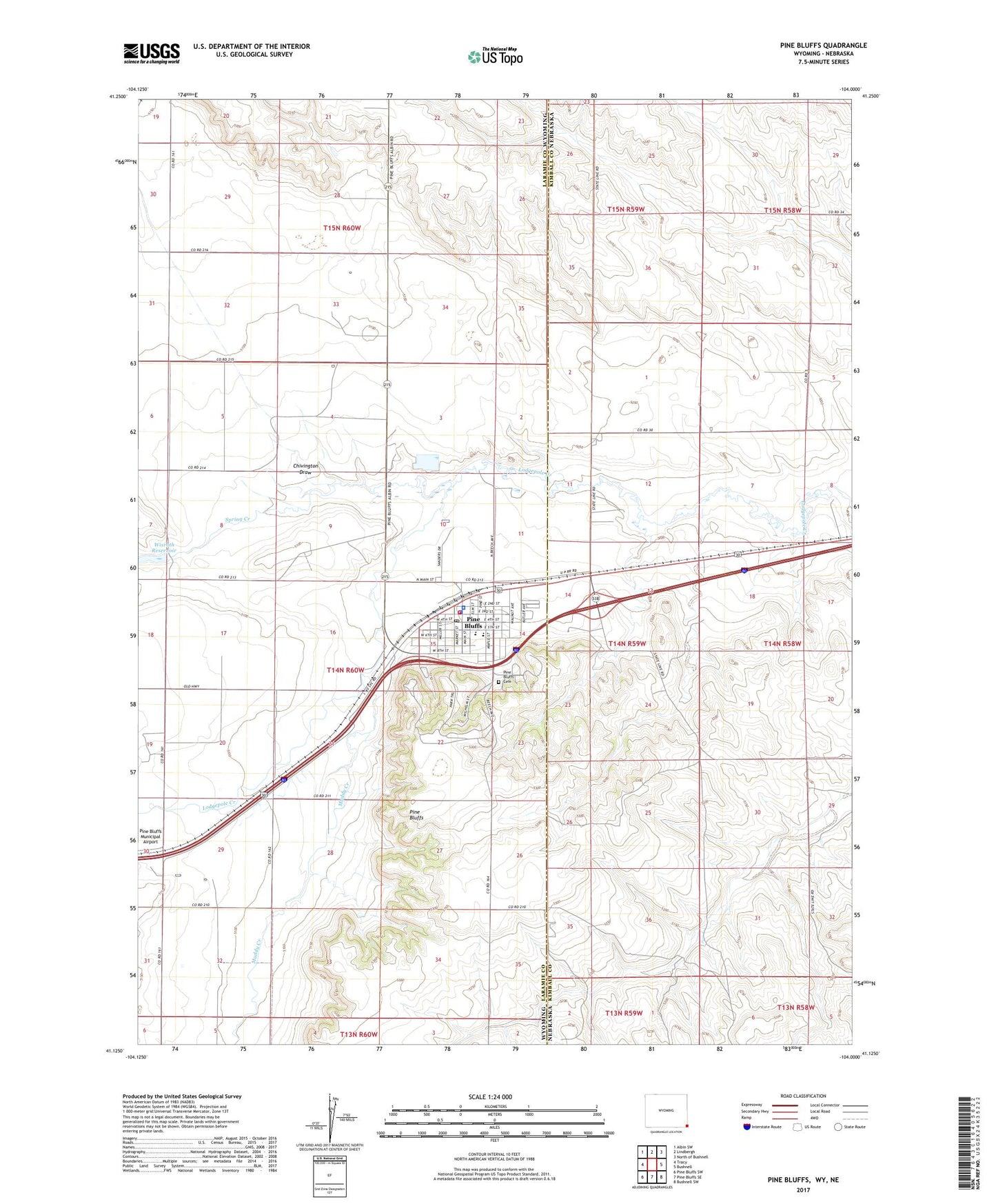
Pine Bluffs Wyoming US Topo Map
Couldn't load pickup availability
2021 topographic map quadrangle Pine Bluffs in the state of Wyoming. Scale: 1:24000. Based on the newly updated USGS 7.5' US Topo map series, this map is in the following counties: Laramie, Kimball. The map contains contour data, water features, and other items you are used to seeing on USGS maps, but also has updated roads and other features. This is the next generation of topographic maps. Printed on high-quality waterproof paper with UV fade-resistant inks.
Quads adjacent to this one:
West: Tracy
Northwest: Albin SW
North: Lindbergh
Northeast: North of Bushnell
East: Bushnell
Southeast: Bushnell SW
South: Pine Bluffs SE
Southwest: Pine Bluffs SW
This map covers the same area as the classic USGS quad with code o41104b1.
Contains the following named places: Chivington Draw, Laramie County Fire District 5 Pine Bluffs, Laramie County Sheriff's Office Eastern District, Muddy Creek, Pine Bluffs, Pine Bluffs Cemetery, Pine Bluffs Elementary School, Pine Bluffs Junior - Senior High School, Pine Bluffs Junior High School, Pine Bluffs Police Department, Pine Bluffs Post Office, Spring Creek, Town of Pine Bluffs, Whispering Pines Care Home, Wisroth Reservoir