MyTopo
Pine Bluffs SE Wyoming US Topo Map
Couldn't load pickup availability
Also explore the Pine Bluffs SE Forest Service Topo of this same quad for updated USFS data
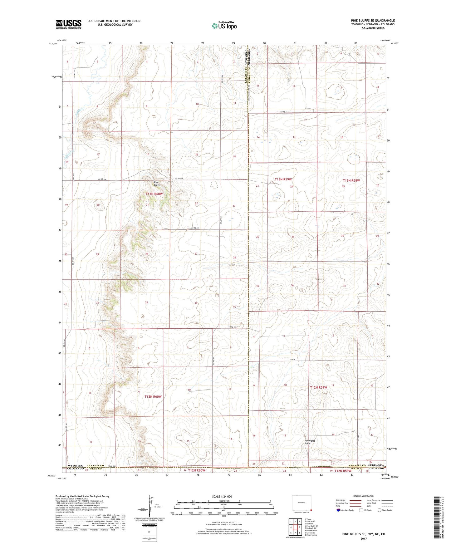
2021 topographic map quadrangle Pine Bluffs SE in the states of Wyoming, Nebraska. Scale: 1:24000. Based on the newly updated USGS 7.5' US Topo map series, this map is in the following counties: Laramie, Kimball, Weld. The map contains contour data, water features, and other items you are used to seeing on USGS maps, but also has updated roads and other features. This is the next generation of topographic maps. Printed on high-quality waterproof paper with UV fade-resistant inks.
Quads adjacent to this one:
West: Pine Bluffs SW
Northwest: Tracy
North: Pine Bluffs
Northeast: Bushnell
East: Bushnell SW
Southeast: Dolan Spring
South: Grover NE
Southwest: Grover North
This map covers the same area as the classic USGS quad with code o41104a1.
Contains the following named places: Culek Dam, Culek Reservoir, Panorama Point, Pine Bluffs, Spring Creek