MyTopo
Cambridge NE Nebraska US Topo Map
Couldn't load pickup availability
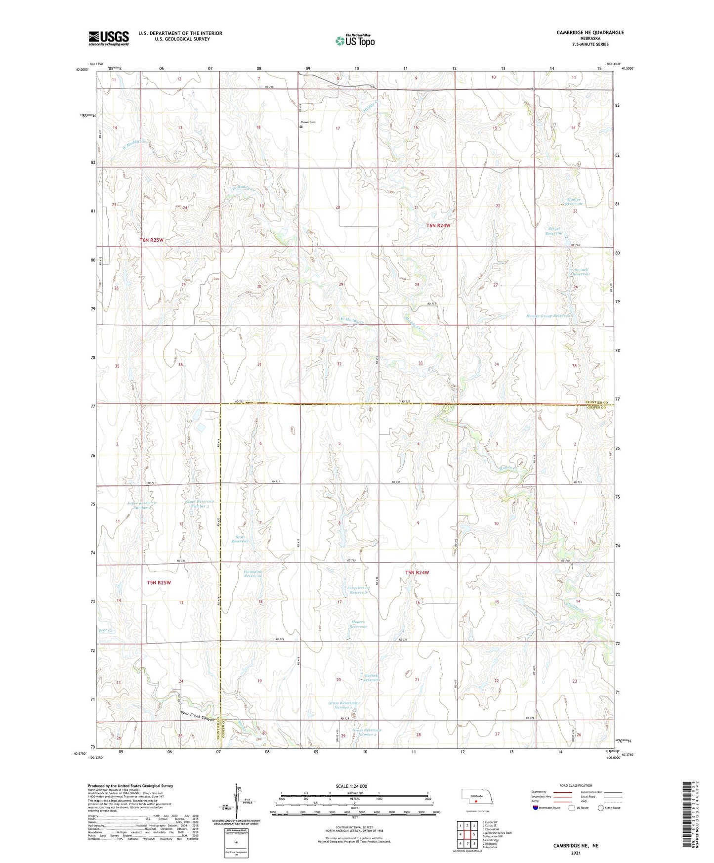
2021 topographic map quadrangle Cambridge NE in the state of Nebraska. Scale: 1:24000. Based on the newly updated USGS 7.5' US Topo map series, this map is in the following counties: Frontier, Gosper. The map contains contour data, water features, and other items you are used to seeing on USGS maps, but also has updated roads and other features. This is the next generation of topographic maps. Printed on high-quality waterproof paper with UV fade-resistant inks.
Quads adjacent to this one:
West: Medicine Creek Dam
Northwest: Eustis SW
North: Eustis SE
Northeast: Elwood SW
East: Arapahoe NW
Southeast: Arapahoe
South: Holbrook
Southwest: Cambridge
Contains the following named places: Barnett Dam, Barnett Reservoir, Bergstresser Dam, Bergstresser Reservoir, Deer Creek Canyon, Dwinell Dam, Dwinell Reservoir, Flammino Dam, Flammino Reservoir, Gross Dam Number 1, Gross Reservoir Number 1, Meyers Dam, Meyers Reservoir, Monter Dam, Monter Group Dam, Monter Group Reservoir, Monter Reservoir, Muddy Election Precinct, Sayer Dam Number 2, Sayer Dam Number 3, Sayer Reservoir Number 2, Sayer Reservoir Number 3, Scott Dam, Scott Reservoir, Sergel Dam, Sergel Reservoir, Stowe Cemetery, Township of Muddy, Township of West Muddy, West Muddy Creek, West Muddy Election Precinct