MyTopo
Medicine Creek Dam Nebraska US Topo Map
Couldn't load pickup availability
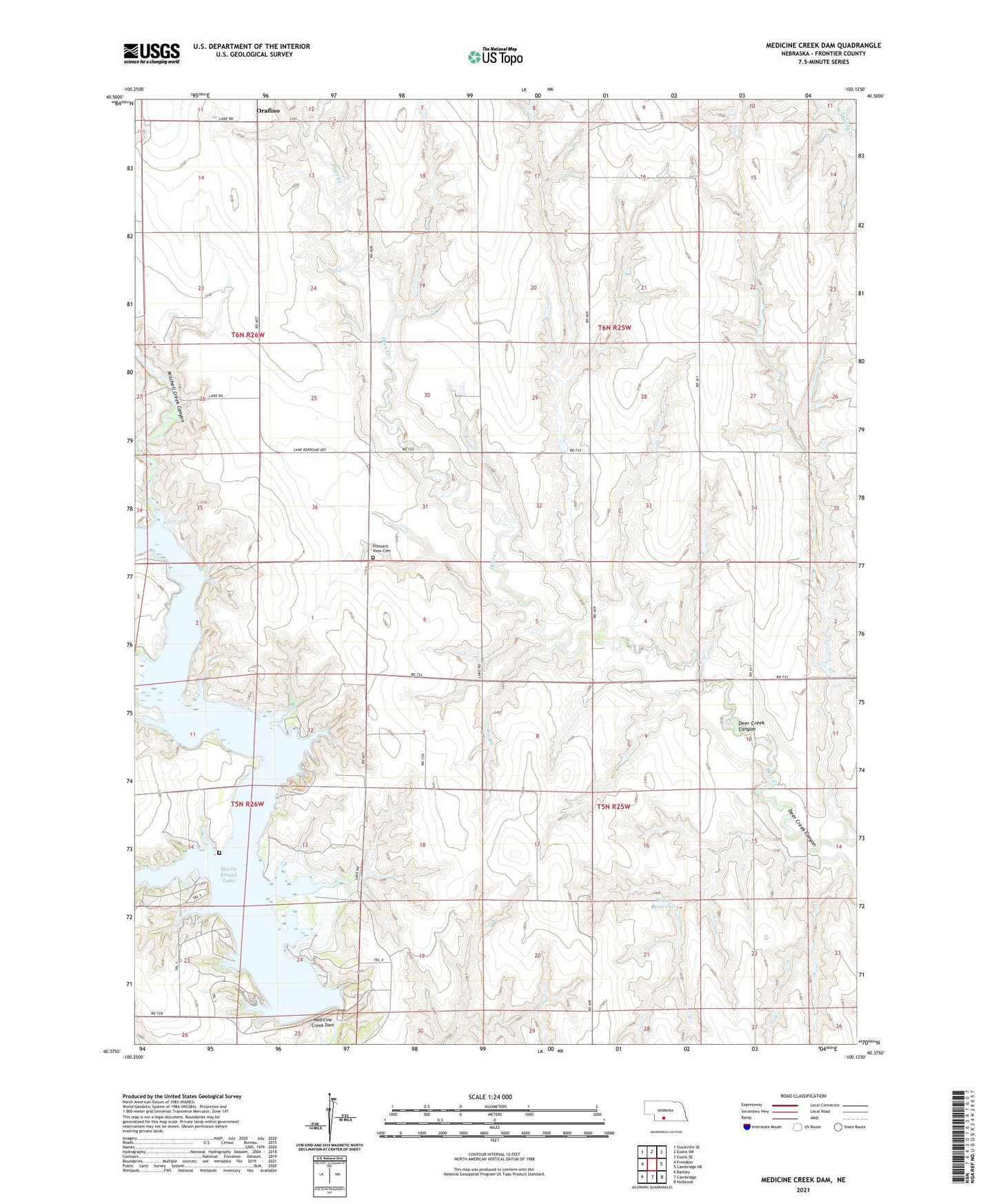
2021 topographic map quadrangle Medicine Creek Dam in the state of Nebraska. Scale: 1:24000. Based on the newly updated USGS 7.5' US Topo map series, this map is in the following counties: Frontier. The map contains contour data, water features, and other items you are used to seeing on USGS maps, but also has updated roads and other features. This is the next generation of topographic maps. Printed on high-quality waterproof paper with UV fade-resistant inks.
Quads adjacent to this one:
West: Freedom
Northwest: Stockville SE
North: Eustis SW
Northeast: Eustis SE
East: Cambridge NE
Southeast: Holbrook
South: Cambridge
Southwest: Bartley
This map covers the same area as the classic USGS quad with code o40100d2.
Contains the following named places: Afton Church, Afton Post Office, Afton School, Deer Creek Canyon, Druse Dam, Druse Reservoir, Earl Election Precinct, Grant Election Precinct, Hammond Cemetery, Medicine Creek Dam, Medicine Creek Reservoir State Recreation Area, Mitchell Creek Canyon, Orafino, Orafino Post Office, Pleasant View Cemetery, Prairie Belle School, Shady Bay Campground, Sunrise School, Township of Earl, Township of Grant, Trail Twelve Campground, ZIP Code: 69022