MyTopo
Center West Nebraska US Topo Map
Couldn't load pickup availability
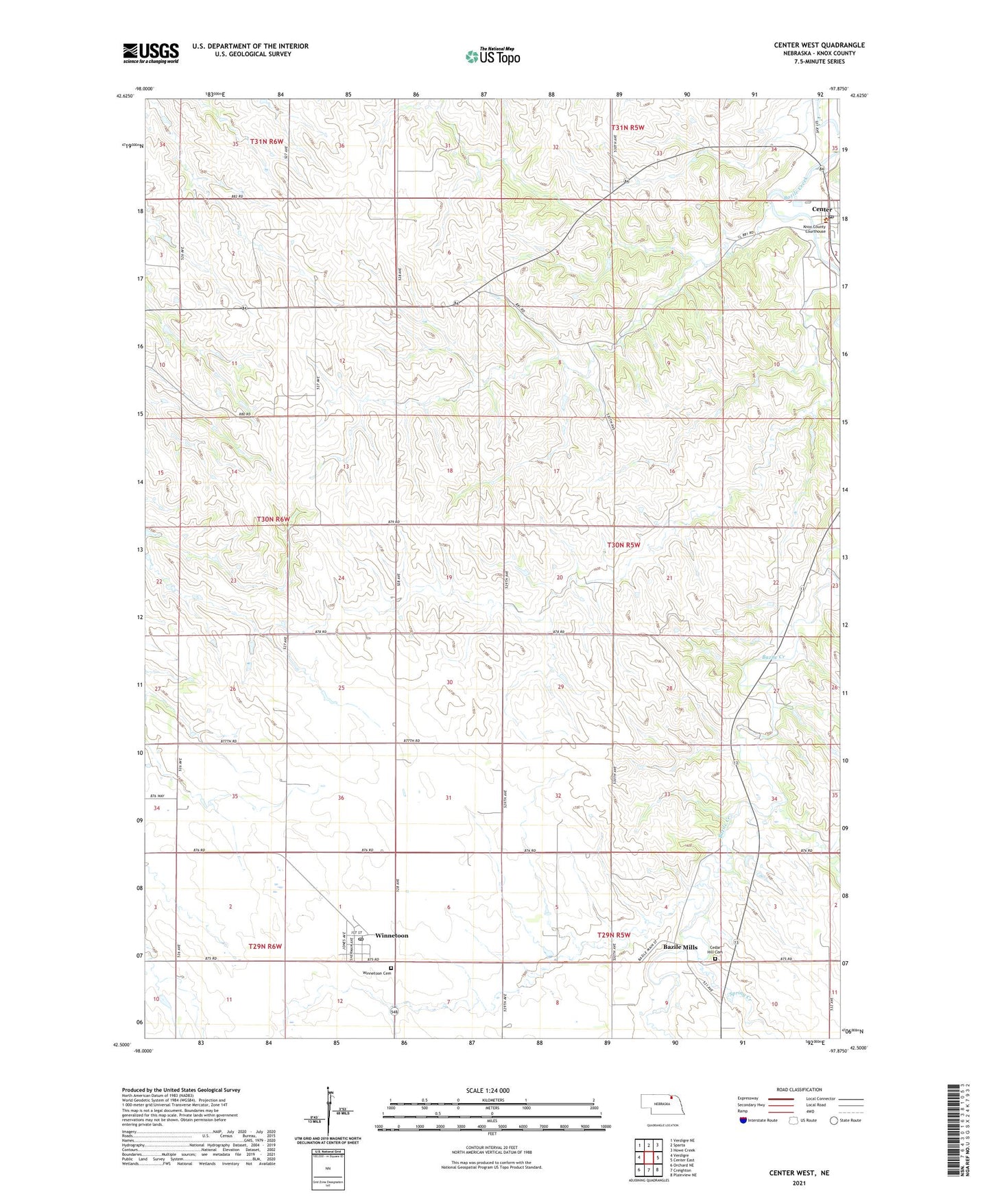
2021 topographic map quadrangle Center West in the state of Nebraska. Scale: 1:24000. Based on the newly updated USGS 7.5' US Topo map series, this map is in the following counties: Knox. The map contains contour data, water features, and other items you are used to seeing on USGS maps, but also has updated roads and other features. This is the next generation of topographic maps. Printed on high-quality waterproof paper with UV fade-resistant inks.
Quads adjacent to this one:
West: Verdigre
Northwest: Verdigre NE
North: Sparta
Northeast: Howe Creek
East: Center East
Southeast: Plainview NE
South: Creighton
Southwest: Orchard NE
This map covers the same area as the classic USGS quad with code o42097e8.
Contains the following named places: Bazile Mills, Bazile Mills Post Office, Bethesda Mini Camp, Cedar Hill Cemetery, Center, Center Post Office, Center United Church of Christ, Center Village Police Department, Herberts Farm Airport, Historical One Room School House, Knox County Court House, Knox County Sheriff's Office, Spring Creek, Township of Valley, Village of Bazile Mills, Village of Center, Village of Winnetoon, Winnetoon, Winnetoon Cemetery, Winnetoon Park, Winnetoon Post Office, Winnetoon School, ZIP Code: 68789