MyTopo
Central City West Nebraska US Topo Map
Couldn't load pickup availability
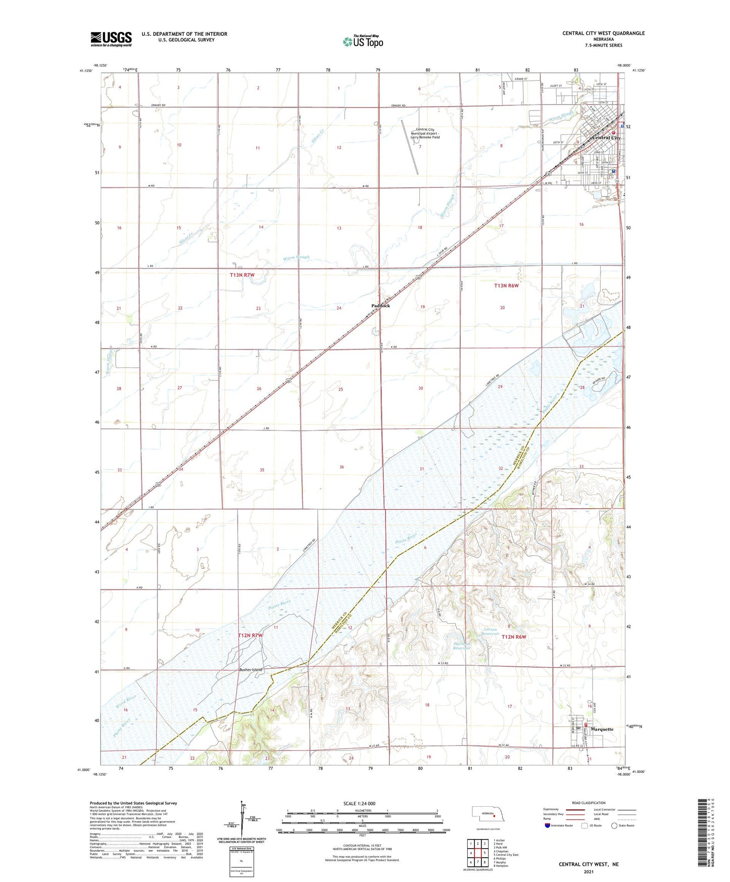
2021 topographic map quadrangle Central City West in the state of Nebraska. Scale: 1:24000. Based on the newly updated USGS 7.5' US Topo map series, this map is in the following counties: Merrick, Hamilton. The map contains contour data, water features, and other items you are used to seeing on USGS maps, but also has updated roads and other features. This is the next generation of topographic maps. Printed on high-quality waterproof paper with UV fade-resistant inks.
Quads adjacent to this one:
West: Chapman
Northwest: Archer
North: Hord
Northeast: Polk NW
East: Central City East
Southeast: Hampton
South: Murphy
Southwest: Phillips
Contains the following named places: Aurora Cooperative Elevator Company - Marquette Elevator, Bushes Island, Cancer Clinic, Cargill Incorporated Elevator, Central City, Central City Ambulance Service, Central City Dental Clinic, Central City Family Dental Center, Central City Mall, Central City Middle School, Central City Municipal Airport - Larry Reineke Field, Central City Police Department, Central City Volunteer Fire Department, Central Vision Clinic, Christian Church, City of Central City, Community Bible Church, Community Care of America, Evangelical Free Church, Faith Baptist Church, Friends Meeting House, Grace Lutheran Church, Kernel Field, Larsen Dam, Larsen Reservoir, Lone Tree Historical Marker, Lone Tree Medical Association, Lone Tree Park, Marquette, Marquette Post Office, Marquette Public School, Marquette Volunteer Fire and Rescue, Merrick County Fairgrounds, Merrick Medical Center Hospital, Mid Nebraska Foot Clinic, Nebraska Christian Schools, North Park, Paddock, Platte Valley Trailer Court, Presbyterian Church, Saint Michaels Catholic Church, Saint Pauls Lutheran Church, School Number 12, School Number 3, School Number 38, School Number 39, School Number 48, School Number 8, Sherman Reservoir, Tom Sherman Dam, Township of Lone Tree, United Co-op Incorporated Elevator, United Methodist Church, Valley View Golf Course, Village of Marquette, Vollers Chiropractic Clinic, Wood River, ZIP Code: 68854