MyTopo
Archer Nebraska US Topo Map
Couldn't load pickup availability
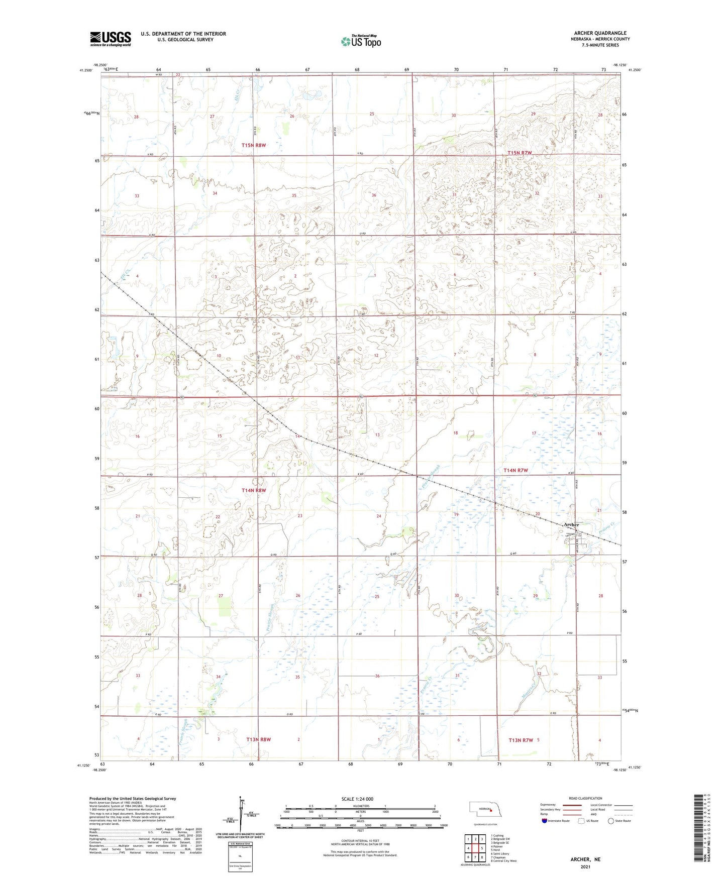
2021 topographic map quadrangle Archer in the state of Nebraska. Scale: 1:24000. Based on the newly updated USGS 7.5' US Topo map series, this map is in the following counties: Merrick. The map contains contour data, water features, and other items you are used to seeing on USGS maps, but also has updated roads and other features. This is the next generation of topographic maps. Printed on high-quality waterproof paper with UV fade-resistant inks.
Quads adjacent to this one:
West: Palmer
Northwest: Cushing
North: Belgrade SW
Northeast: Belgrade SE
East: Hord
Southeast: Central City West
South: Chapman
Southwest: Saint Libory
This map covers the same area as the classic USGS quad with code o41098b2.
Contains the following named places: Archer, Archer Census Designated Place, Archer Post Office, Moores Creek, Scoular Company Elevator, Sullivan Airstrip, Township of Loup, United Brethren Church, ZIP Code: 68816