MyTopo
Chalk Buttes Nebraska US Topo Map
Couldn't load pickup availability
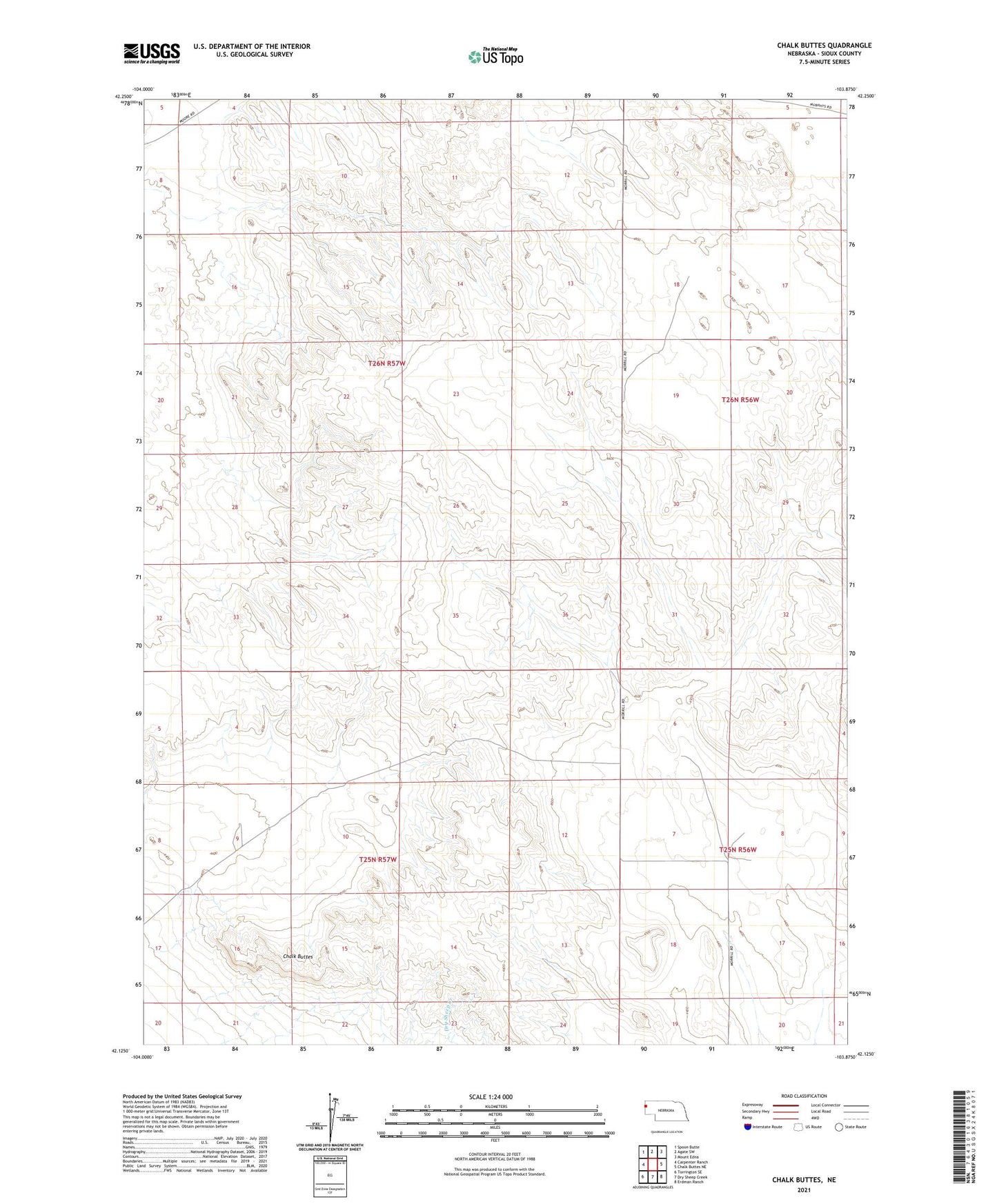
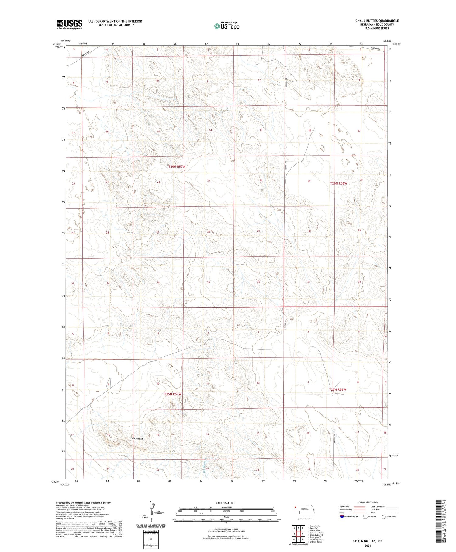
2021 topographic map quadrangle Chalk Buttes in the state of Nebraska. Scale: 1:24000. Based on the newly updated USGS 7.5' US Topo map series, this map is in the following counties: Sioux. The map contains contour data, water features, and other items you are used to seeing on USGS maps, but also has updated roads and other features. This is the next generation of topographic maps. Printed on high-quality waterproof paper with UV fade-resistant inks.
Quads adjacent to this one:
West: Carpenter Ranch
Northwest: Spoon Butte
North: Agate SW
Northeast: Mount Edna
East: Chalk Buttes NE
Southeast: Erdman Ranch
South: Dry Sheep Creek
Southwest: Torrington SE
Contains the following named places: Butte Windmill, Castile Windmill, Chalk Butte Public School, Chalk Buttes, East Windmill, Goodman Windmill, Grant Windmill, Hatch Ranch, Keating Windmill, New Windmill, North Windmill, Northwest Windmill, Nunn Ranch, Spurior Place, Thompson Windmill