MyTopo
Carpenter Ranch Nebraska US Topo Map
Couldn't load pickup availability
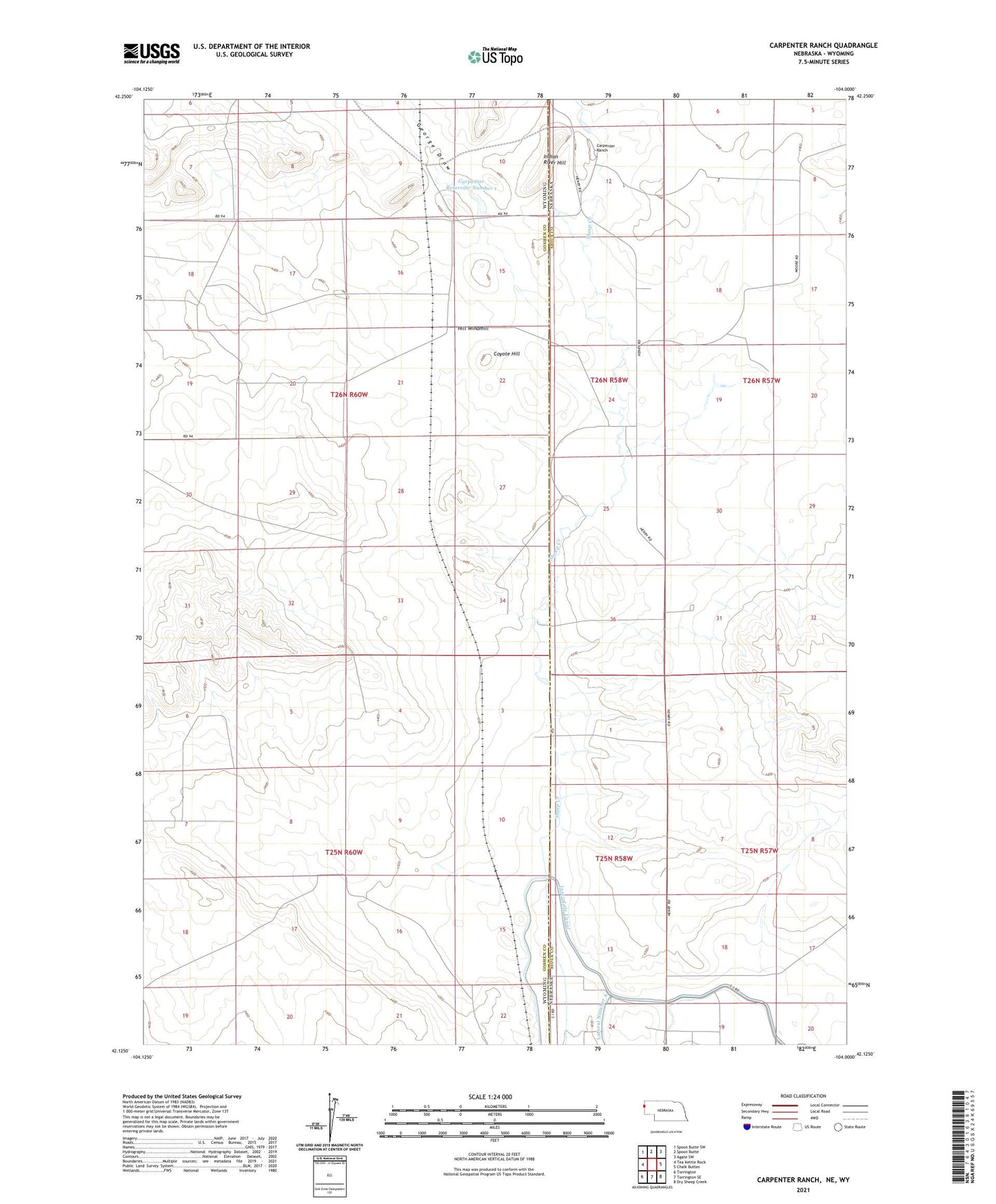
2021 topographic map quadrangle Carpenter Ranch in the states of Wyoming, Nebraska. Scale: 1:24000. Based on the newly updated USGS 7.5' US Topo map series, this map is in the following counties: Sioux, Goshen. The map contains contour data, water features, and other items you are used to seeing on USGS maps, but also has updated roads and other features. This is the next generation of topographic maps. Printed on high-quality waterproof paper with UV fade-resistant inks.
Quads adjacent to this one:
West: Tea Kettle Rock
Northwest: Spoon Butte SW
North: Spoon Butte
Northeast: Agate SW
East: Chalk Buttes
Southeast: Dry Sheep Creek
South: Torrington SE
Southwest: Torrington
Contains the following named places: Block Shed Windmill, Carpenter Number 1 Dam, Carpenter Ranch, Carpenter Reservoir Number 1, Coons Windmill, Coyote Hill, Duncan Place, East Windmill, Furnal Windmill, George Draw, Hill Windmill, Indian River Hill, Interstate Canal, Massey Windmill, Milligan Windmill, Nash Windmill, Stewart Windmill, Wildy Windmill