MyTopo
Erdman Ranch Nebraska US Topo Map
Couldn't load pickup availability
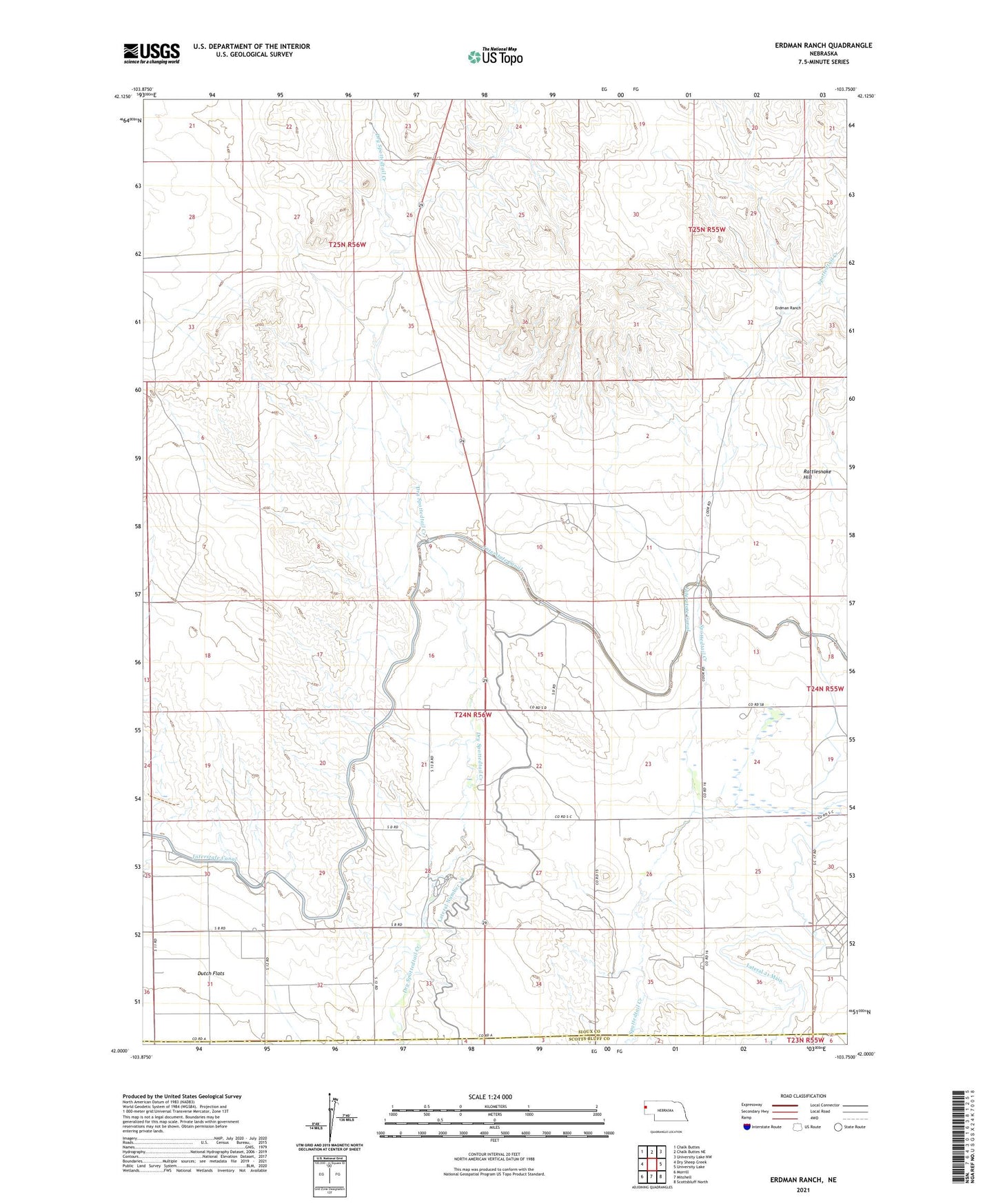
2021 topographic map quadrangle Erdman Ranch in the state of Nebraska. Scale: 1:24000. Based on the newly updated USGS 7.5' US Topo map series, this map is in the following counties: Sioux, Scotts Bluff. The map contains contour data, water features, and other items you are used to seeing on USGS maps, but also has updated roads and other features. This is the next generation of topographic maps. Printed on high-quality waterproof paper with UV fade-resistant inks.
Quads adjacent to this one:
West: Dry Sheep Creek
Northwest: Chalk Buttes
North: Chalk Buttes NE
Northeast: University Lake NW
East: University Lake
Southeast: Scottsbluff North
South: Mitchell
Southwest: Morrill
This map covers the same area as the classic USGS quad with code o42103a7.
Contains the following named places: Erdman Ranch, Interstate Canal, Lateral Number 18, Rattlesnake Hill, Selby Windmill, Sheep Creek Election Precinct, Spottedtail Community Hall, ZIP Code: 69357