MyTopo
Chappell Nebraska US Topo Map
Couldn't load pickup availability
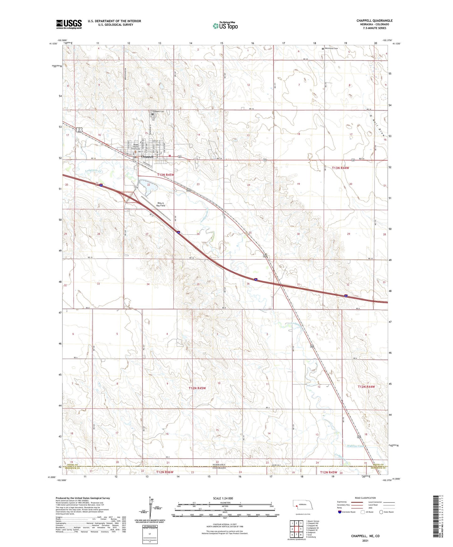
2021 topographic map quadrangle Chappell in the state of Nebraska. Scale: 1:24000. Based on the newly updated USGS 7.5' US Topo map series, this map is in the following counties: Deuel, Sedgwick. The map contains contour data, water features, and other items you are used to seeing on USGS maps, but also has updated roads and other features. This is the next generation of topographic maps. Printed on high-quality waterproof paper with UV fade-resistant inks.
Quads adjacent to this one:
West: Lodgepole SE
Northwest: Mount Vernon
North: Chappell NW
Northeast: Chappell NE
East: Chappell SE
Southeast: Julesburg
South: Ovid
Southwest: Sedgwick
Contains the following named places: Assembly of God Church, B-24J Bomber Crash Historical Marker, Billy G Ray Field, Cams Medical Clinic, Chappell, Chappell Ambulance Service, Chappell Cemetery, Chappell Elementary School, Chappell Golf Course, Chappell Lake, Chappell Memorial Art Gallery, Chappell Memorial Library, Chappell Post Office, Chappell Rest Area - Westbound, Chappell Secondary School, Chappell Volunteer Fire Department, City of Chappell, Creekside RV Park and Campground, Deuel County Courthouse, Deuel County Fairground, Deuel County Sheriff's Office, El Rancho Campground, Farmers Elevator Company Elevator, Foursquare Gospel Church, Grace Lutheran Church, Mennonite Cemetery, Miller Memorial Nursing Home, Mobile Manor Trailer Park, Nine Mile Station, Pony Express Nine Mile Station Marker, Pony Express Park, Saint Josephs Catholic Church, School Number 39, Stahr Trailer Court, Sudman-Neumann Heritage House, Swan Election Precinct, United Methodist Church, Zion Lutheran Church, ZIP Code: 69129