MyTopo
Julesburg Colorado US Topo Map
Couldn't load pickup availability
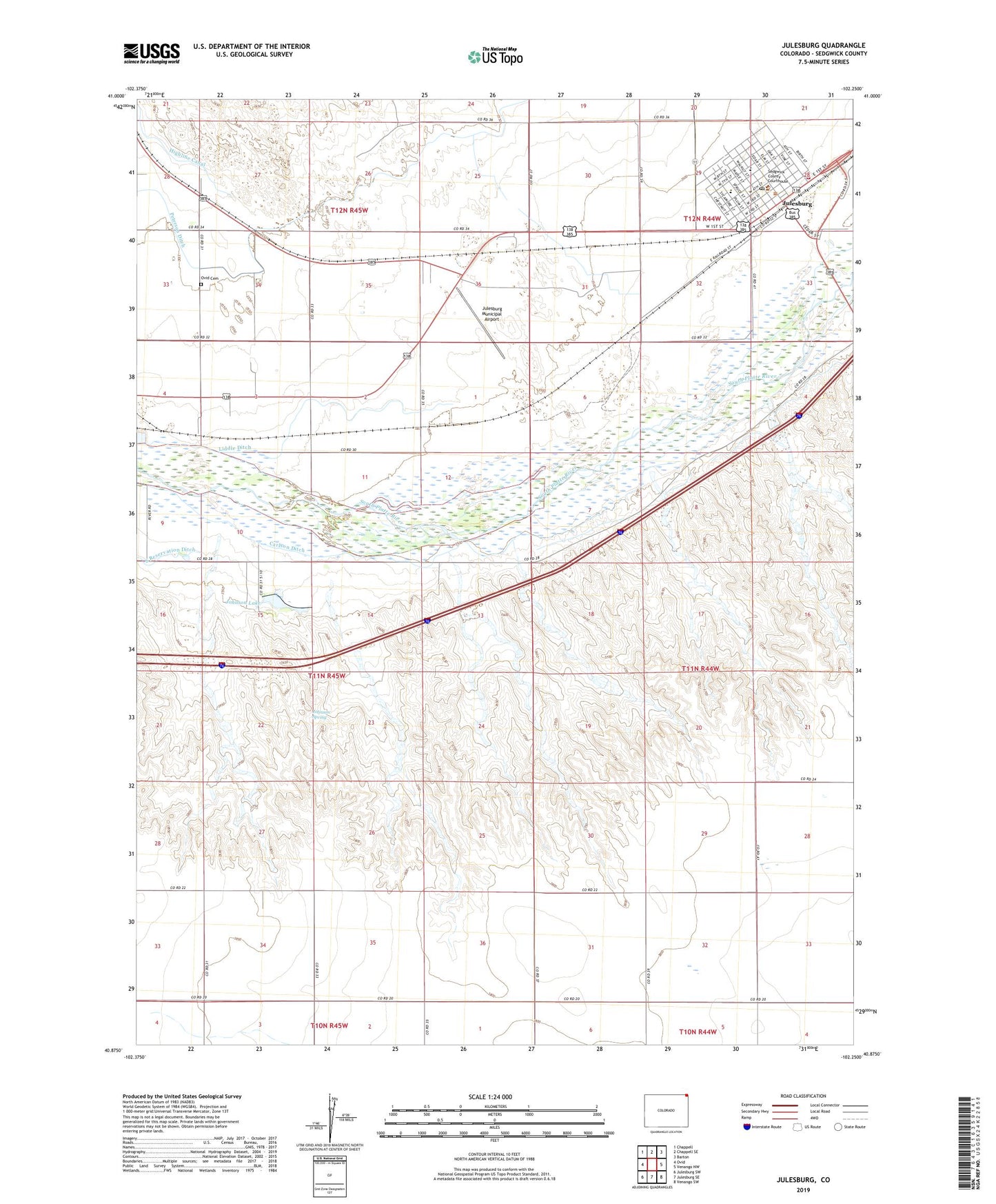
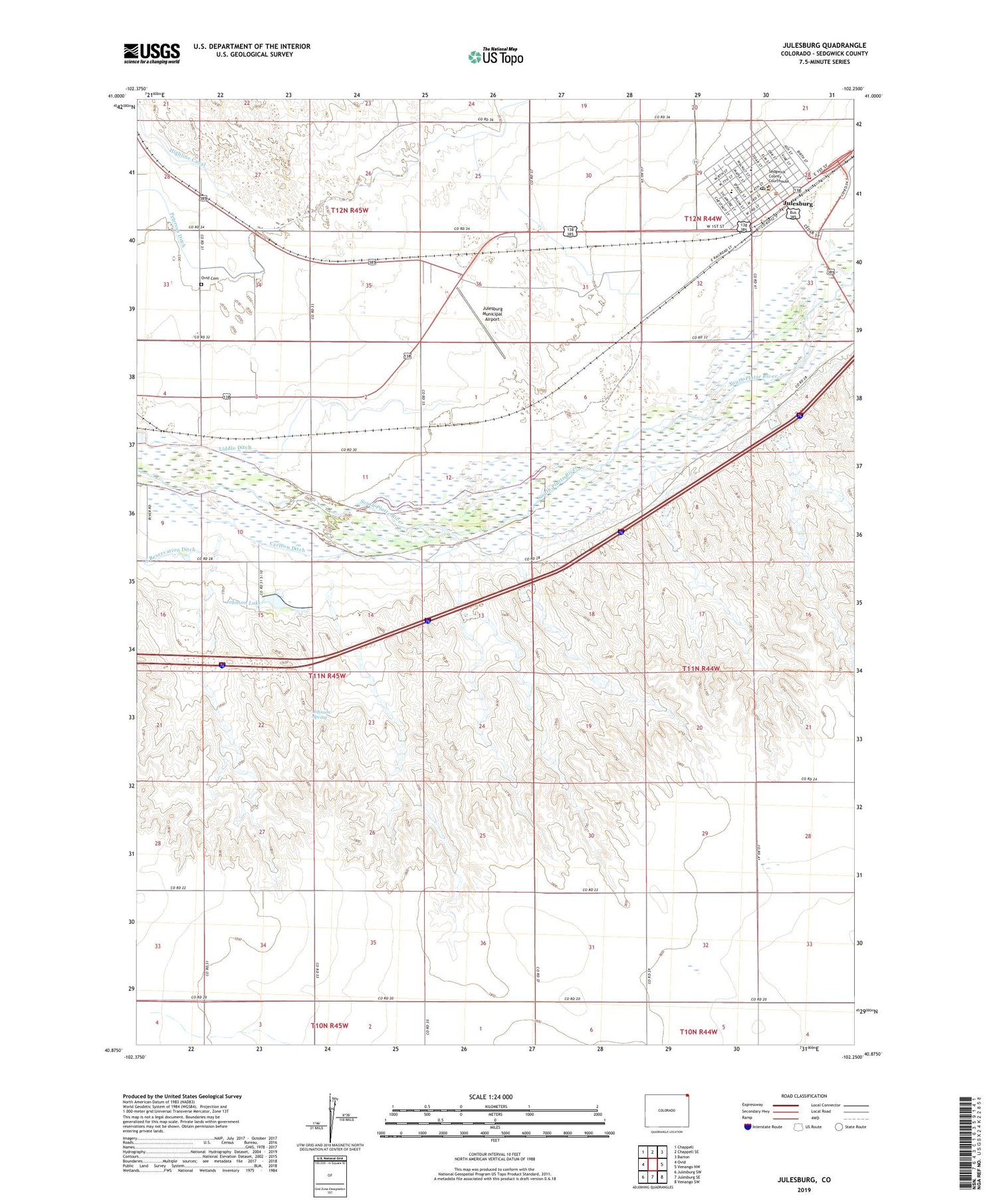
2022 topographic map quadrangle Julesburg in the state of Colorado. Scale: 1:24000. Based on the newly updated USGS 7.5' US Topo map series, this map is in the following counties: Sedgwick. The map contains contour data, water features, and other items you are used to seeing on USGS maps, but also has updated roads and other features. This is the next generation of topographic maps. Printed on high-quality waterproof paper with UV fade-resistant inks.
Quads adjacent to this one:
West: Ovid
Northwest: Chappell
North: Chappell SE
Northeast: Barton
East: Venango NW
Southeast: Venango SW
South: Julesburg SE
Southwest: Julesburg SW
This map covers the same area as the classic USGS quad with code o40102h3.
Contains the following named places: Carlson Ditch, Fort Julesburg, Italian Caves, Johnson Lake, Johnson Spring, Julesburg, Julesburg Municipal Airport, Julesburg Post Office, Julesburg Volunteer Fire Department, Julesburg Water Works, Liddle Ditch, Ovid Cemetery, Riverside School, Sedgwick County, Sedgwick County Ambulance Service, Sedgwick County Health Center, Sedgwick County Sheriff's Office, Town of Julesburg, Weir