MyTopo
Coumbe Bluff Nebraska US Topo Map
Couldn't load pickup availability
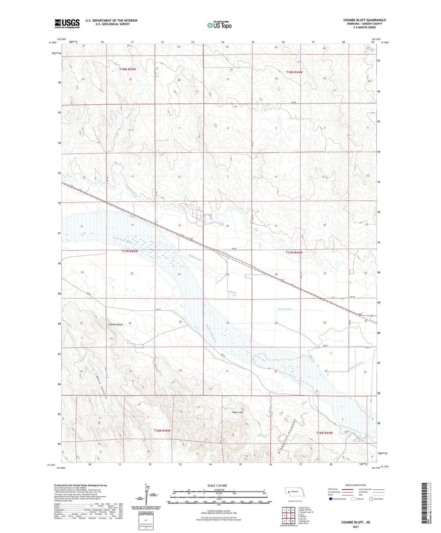
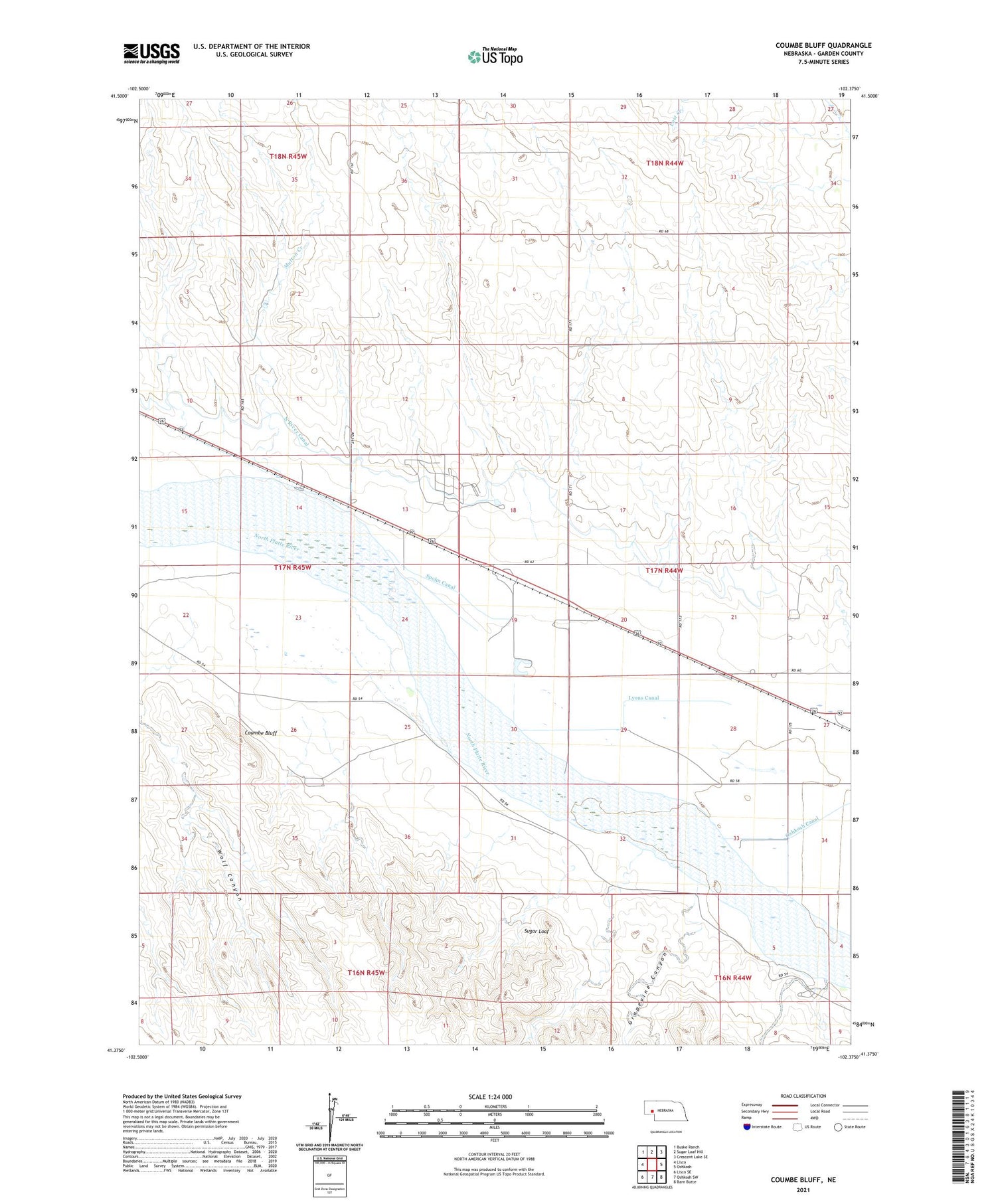
2021 topographic map quadrangle Coumbe Bluff in the state of Nebraska. Scale: 1:24000. Based on the newly updated USGS 7.5' US Topo map series, this map is in the following counties: Garden. The map contains contour data, water features, and other items you are used to seeing on USGS maps, but also has updated roads and other features. This is the next generation of topographic maps. Printed on high-quality waterproof paper with UV fade-resistant inks.
Quads adjacent to this one:
West: Lisco
Northwest: Buske Ranch
North: Sugar Loaf Hill
Northeast: Crescent Lake SE
East: Oshkosh
Southeast: Barn Butte
South: Oshkosh SW
Southwest: Lisco SE
Contains the following named places: Coumbe Bluff, Grapevine Canyon, Lyons Canal, Mutton Creek, North River Canal, Oshkosh Canal, Penn, Penn School, Spohn Canal, Sugar Loaf, Wolf Canyon