MyTopo
Oshkosh Nebraska US Topo Map
Couldn't load pickup availability
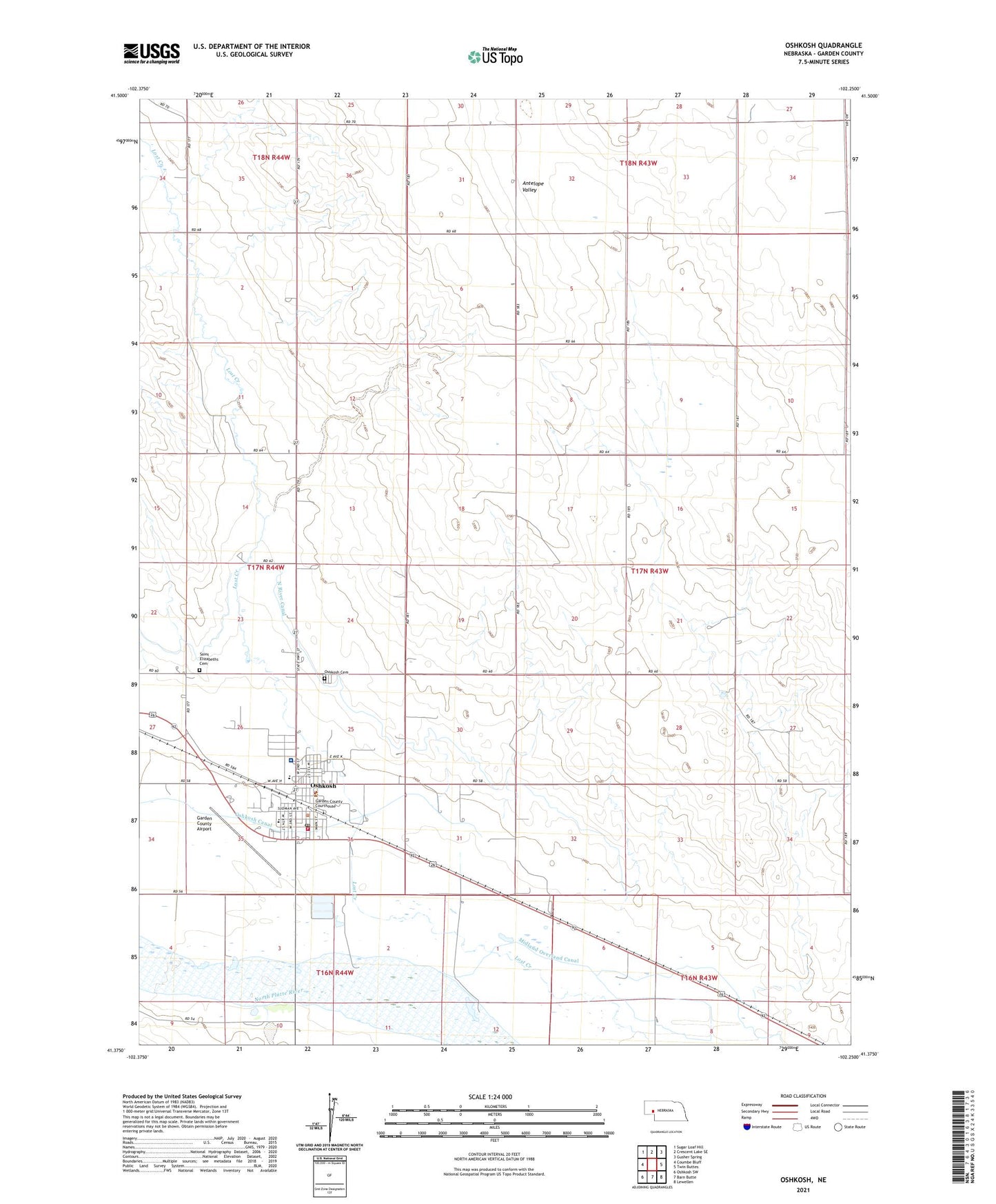
2021 topographic map quadrangle Oshkosh in the state of Nebraska. Scale: 1:24000. Based on the newly updated USGS 7.5' US Topo map series, this map is in the following counties: Garden. The map contains contour data, water features, and other items you are used to seeing on USGS maps, but also has updated roads and other features. This is the next generation of topographic maps. Printed on high-quality waterproof paper with UV fade-resistant inks.
Quads adjacent to this one:
West: Coumbe Bluff
Northwest: Sugar Loaf Hill
North: Crescent Lake SE
Northeast: Gusher Spring
East: Twin Buttes
Southeast: Lewellen
South: Barn Butte
Southwest: Oshkosh SW
This map covers the same area as the classic USGS quad with code o41102d3.
Contains the following named places: Antelope Valley, Antelope Valley Church, Assembly of God Church, City of Oshkosh, Dorman Dam, Dorman Reservoir, Dougs Texaco Campground, Emigrant Trail, Garden County Airport, Garden County Church of Christ, Garden County Courthouse, Garden County Fire Department, Garden County Health Services, Garden County High School, Garden County Museum, Garden County Sheriff's Office, Midland Overland Canal, New Oshkosh, Oshkosh, Oshkosh Canal, Oshkosh Cemetery, Oshkosh Country Club, Oshkosh Elementary School, Oshkosh Grain Incorporated Elevator, Oshkosh Medical Clinic, Oshkosh Police Department, Oshkosh Post Office, Oshkosh Public Library, Oshkosh Volunteer Fire Department, Retes Camper Park, Saint Elizabeths Cemetery, Saint Elizabeths Church, Saint Marks Lutheran Church, United Methodist Church, ZIP Code: 69154